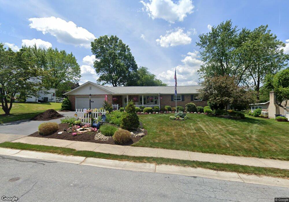
1010 N 7th St Emmaus, PA 18049
Estimated Value: $374,000 - $436,000
3
Beds
2
Baths
1,646
Sq Ft
$246/Sq Ft
Est. Value
About This Home
This home is located at 1010 N 7th St, Emmaus, PA 18049 and is currently estimated at $404,708, approximately $245 per square foot. 1010 N 7th St is a home located in Lehigh County with nearby schools including Jefferson Elementary School, Lower Macungie Middle School, and Emmaus High School.
Ownership History
Date
Name
Owned For
Owner Type
Purchase Details
Closed on
Aug 29, 2002
Sold by
Gerlach Donald J and Gerlach Vivian C
Bought by
Reid Robert G and Reid Joanne D
Current Estimated Value
Home Financials for this Owner
Home Financials are based on the most recent Mortgage that was taken out on this home.
Original Mortgage
$150,000
Outstanding Balance
$64,076
Interest Rate
6.55%
Mortgage Type
Purchase Money Mortgage
Estimated Equity
$340,632
Purchase Details
Closed on
May 11, 1979
Bought by
Gerlach Donald J and Gerlach Vivian C
Create a Home Valuation Report for This Property
The Home Valuation Report is an in-depth analysis detailing your home's value as well as a comparison with similar homes in the area
Home Values in the Area
Average Home Value in this Area
Purchase History
| Date | Buyer | Sale Price | Title Company |
|---|---|---|---|
| Reid Robert G | $190,000 | First American Title Ins Co | |
| Gerlach Donald J | $74,500 | -- |
Source: Public Records
Mortgage History
| Date | Status | Borrower | Loan Amount |
|---|---|---|---|
| Open | Reid Robert G | $150,000 |
Source: Public Records
Tax History Compared to Growth
Tax History
| Year | Tax Paid | Tax Assessment Tax Assessment Total Assessment is a certain percentage of the fair market value that is determined by local assessors to be the total taxable value of land and additions on the property. | Land | Improvement |
|---|---|---|---|---|
| 2025 | $7,168 | $203,500 | $42,500 | $161,000 |
| 2024 | $6,566 | $203,500 | $42,500 | $161,000 |
| 2023 | $6,438 | $203,500 | $42,500 | $161,000 |
| 2022 | $6,226 | $203,500 | $161,000 | $42,500 |
| 2021 | $6,070 | $203,500 | $42,500 | $161,000 |
| 2020 | $6,018 | $203,500 | $42,500 | $161,000 |
| 2019 | $5,857 | $203,500 | $42,500 | $161,000 |
| 2018 | $5,636 | $203,500 | $42,500 | $161,000 |
| 2017 | $5,463 | $203,500 | $42,500 | $161,000 |
| 2016 | -- | $203,500 | $42,500 | $161,000 |
| 2015 | -- | $203,500 | $42,500 | $161,000 |
| 2014 | -- | $203,500 | $42,500 | $161,000 |
Source: Public Records
Map
Nearby Homes
- 943 N 6th St
- 507 Iroquois St
- 657 Walnut St
- 543 Long St
- 3430 Gentlewind Way Unit IC 109
- 4109 Eveningstar Rd
- 3420 Gentlewind Way Unit IC 110
- 569 Chestnut St Unit 571
- 4088 Eveningstar Rd
- 1 E Pine St
- 659 Broad St
- 3514 Daylily Dr
- 120 N 2nd St
- 118 N 2nd St
- 3623 Daylily Dr
- 3601 Country Club Rd
- 2300 S Cedar Crest Blvd
- 137 E Harrison St
- 101 E George St
- 3149 Sheffield Dr
- 1014 N 7th St
- 1006 N 7th St
- 984 N 7th Street Cir
- 1003 Laura St
- 1020 N 7th St
- 1015 N 7th St
- 976 N 7th Street Cir
- 1005 Laura St
- 660 Iroquois St
- 1019 N 7th St
- 945 Franklin St
- 997 N 7th Street Cir
- 970 N 7th Street Cir
- 730 Frank Dr
- 948 Franklin St
- 647 Iroquois St
- 1013 Laura St
- 989 N 7th Street Cir
- 981 N 7th Street Cir
- 642 Iroquois St