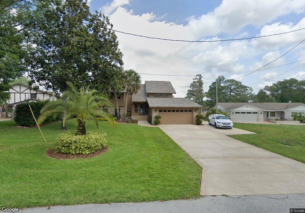
1010 Rosetta Dr Deltona, FL 32725
Estimated Value: $343,000 - $408,000
4
Beds
3
Baths
2,137
Sq Ft
$179/Sq Ft
Est. Value
About This Home
This home is located at 1010 Rosetta Dr, Deltona, FL 32725 and is currently estimated at $381,756, approximately $178 per square foot. 1010 Rosetta Dr is a home located in Volusia County with nearby schools including Spirit Elementary School, Deltona Middle School, and Deltona High School.
Ownership History
Date
Name
Owned For
Owner Type
Purchase Details
Closed on
May 9, 2017
Sold by
Parham Kathleen S and Parham David H
Bought by
Parham David H and Parham Kathleen S
Current Estimated Value
Purchase Details
Closed on
Aug 28, 1998
Sold by
Braun Charles M and Braun Kathleen S
Bought by
Braun Kathleen S
Purchase Details
Closed on
Dec 15, 1981
Bought by
Parham Kathleen S
Purchase Details
Closed on
Jan 15, 1979
Bought by
Parham Kathleen S
Purchase Details
Closed on
Jan 15, 1974
Bought by
Parham Kathleen S
Create a Home Valuation Report for This Property
The Home Valuation Report is an in-depth analysis detailing your home's value as well as a comparison with similar homes in the area
Home Values in the Area
Average Home Value in this Area
Purchase History
| Date | Buyer | Sale Price | Title Company |
|---|---|---|---|
| Parham David H | -- | Attorney | |
| Braun Kathleen S | -- | -- | |
| Parham Kathleen S | $100 | -- | |
| Parham Kathleen S | $12,000 | -- | |
| Parham Kathleen S | $9,500 | -- |
Source: Public Records
Tax History
| Year | Tax Paid | Tax Assessment Tax Assessment Total Assessment is a certain percentage of the fair market value that is determined by local assessors to be the total taxable value of land and additions on the property. | Land | Improvement |
|---|---|---|---|---|
| 2026 | $2,649 | $160,895 | -- | -- |
| 2025 | $2,649 | $156,666 | -- | -- |
| 2024 | $2,505 | $152,251 | -- | -- |
| 2023 | $2,505 | $147,817 | $0 | $0 |
| 2022 | $2,428 | $143,512 | $0 | $0 |
| 2021 | $2,583 | $139,332 | $0 | $0 |
| 2020 | $2,550 | $137,408 | $0 | $0 |
| 2019 | $2,570 | $134,319 | $0 | $0 |
| 2018 | $2,636 | $131,815 | $0 | $0 |
| 2017 | $2,883 | $129,104 | $0 | $0 |
| 2016 | $2,311 | $126,449 | $0 | $0 |
| 2015 | $2,354 | $125,570 | $0 | $0 |
| 2014 | $2,330 | $124,573 | $0 | $0 |
Source: Public Records
Map
Nearby Homes
- 1891 Marysville Dr
- 1009 Fort Smith Blvd
- 1668 W Waycross Cir
- 1179 Snowden Ave
- 889 W Village Dr
- 1148 Briarwood Ave
- 1792 Paco Ct
- 1961 Paragon St
- 0 Hastings Dr Unit MFRA4571860
- 2050 Swanson Dr
- 868 Saxon Blvd
- 1788 E Normandy Blvd
- 1778 E Normandy Blvd
- 1768 E Normandy Blvd
- 1901 Odham Dr
- 968 Fort Smith Blvd
- 962 Saxon Blvd
- 897 Picasso Ave
- 1596 N Page Dr
- 2046 Galahad Dr
- 1002 Rosetta Dr
- 1018 Rosetta Dr
- 1026 Rosetta Dr
- 1003 Rosetta Dr
- 1009 Rosetta Dr
- 998 Rosetta Dr
- 1034 Rosetta Dr
- 1015 Rosetta Dr
- 1021 Rosetta Dr
- 1001 Rosetta Dr
- 1042 Rosetta Dr
- 1810 Marysville Dr
- 1818 Marysville Dr
- 978 Rosetta Dr
- 1826 Marysville Dr
- 1027 Rosetta Dr
- 1834 Marysville Dr
- 1092 Monterey Dr
- 1050 Rosetta Dr
- 968 Rosetta Ct
Your Personal Tour Guide
Ask me questions while you tour the home.