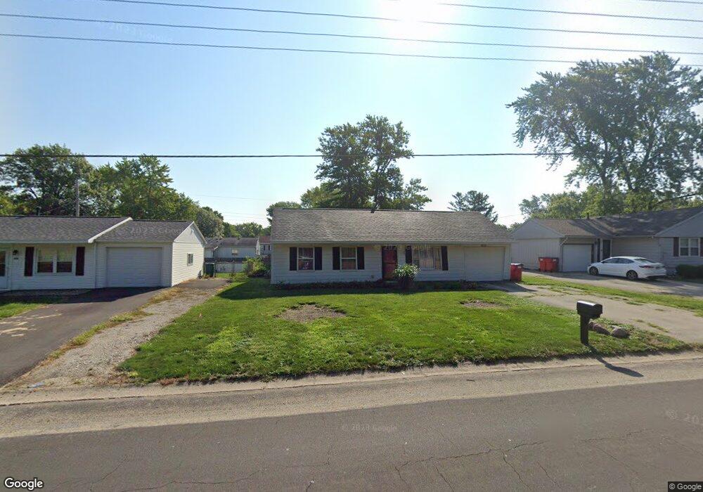
1010 S Duncan Rd Champaign, IL 61821
Estimated Value: $143,000 - $171,801
--
Bed
1
Bath
925
Sq Ft
$173/Sq Ft
Est. Value
About This Home
This home is located at 1010 S Duncan Rd, Champaign, IL 61821 and is currently estimated at $160,200, approximately $173 per square foot. 1010 S Duncan Rd is a home located in Champaign County with nearby schools including Centennial High School, St. John Lutheran School, and Swann Special Care Center-Elem/Secondary School.
Ownership History
Date
Name
Owned For
Owner Type
Purchase Details
Closed on
Nov 5, 2004
Sold by
Riley Marjorie W
Bought by
Jamison Penny
Current Estimated Value
Home Financials for this Owner
Home Financials are based on the most recent Mortgage that was taken out on this home.
Original Mortgage
$89,594
Outstanding Balance
$44,800
Interest Rate
5.81%
Mortgage Type
FHA
Estimated Equity
$115,400
Create a Home Valuation Report for This Property
The Home Valuation Report is an in-depth analysis detailing your home's value as well as a comparison with similar homes in the area
Home Values in the Area
Average Home Value in this Area
Purchase History
| Date | Buyer | Sale Price | Title Company |
|---|---|---|---|
| Jamison Penny | $88,000 | -- |
Source: Public Records
Mortgage History
| Date | Status | Borrower | Loan Amount |
|---|---|---|---|
| Open | Jamison Penny | $89,594 |
Source: Public Records
Tax History Compared to Growth
Tax History
| Year | Tax Paid | Tax Assessment Tax Assessment Total Assessment is a certain percentage of the fair market value that is determined by local assessors to be the total taxable value of land and additions on the property. | Land | Improvement |
|---|---|---|---|---|
| 2024 | $2,647 | $38,810 | $9,860 | $28,950 |
| 2023 | $2,647 | $35,350 | $8,980 | $26,370 |
| 2022 | $2,447 | $32,610 | $8,280 | $24,330 |
| 2021 | $2,377 | $31,970 | $8,120 | $23,850 |
| 2020 | $2,323 | $31,340 | $7,960 | $23,380 |
| 2019 | $2,238 | $30,700 | $7,800 | $22,900 |
| 2018 | $2,179 | $30,220 | $7,680 | $22,540 |
| 2017 | $2,189 | $30,220 | $7,680 | $22,540 |
| 2016 | $1,952 | $29,600 | $7,520 | $22,080 |
| 2015 | $1,958 | $29,080 | $7,390 | $21,690 |
| 2014 | $1,942 | $29,080 | $7,390 | $21,690 |
| 2013 | $1,924 | $29,080 | $7,390 | $21,690 |
Source: Public Records
Map
Nearby Homes
- 1309 Maplepark Dr
- 2808 Carrelton Dr
- 901 Dogwood Dr
- 2908 W John St Unit B
- 610 S Duncan Rd Unit A
- 3311 Brentwood Dr
- 806 Scottsdale Dr
- 2501 Sheridan Dr
- 1402 Scottsdale Dr
- 2612 W Kirby Ave
- 2605 Trafalgar Square
- 1407 Kenwood Rd
- 1012 Waters Edge Rd
- 3804 Balmoral Dr
- 1601 Carolyn Dr
- 3334 Ridgewood Dr
- 1818 Tahoe Ct
- 3761 Thornhill Cir Unit 3761
- 2203 W Kirby Ave
- 3907 Aberdeen Dr
- 1012 S Duncan Rd
- 1008 S Duncan Rd
- 1009 Maplepark Dr
- 1009 Maplepark Dr Unit 1
- 1011 Maplepark Dr
- 1007 Maplepark Dr
- 1014 S Duncan Rd
- 1006 S Duncan Rd
- 1013 Maplepark Dr
- 1005 Maplepark Dr
- 1016 S Duncan Rd
- 1002 S Duncan Rd
- 1015 Maplepark Dr
- 2911 W William St
- 1001 Maplepark Dr
- 1008 Maplepark Dr
- 1010 Maplepark Dr
- 1102 S Duncan Rd
- 1006 Maplepark Dr
- 1012 Maplepark Dr