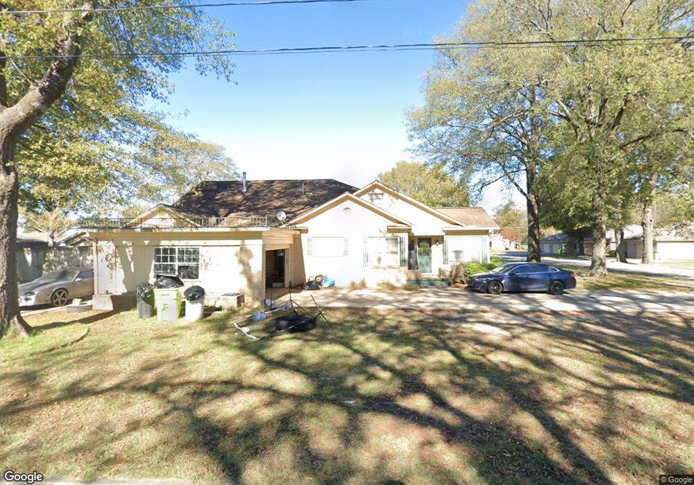
1010 S Lowe St Stuttgart, AR 72160
Estimated Value: $304,017 - $310,000
--
Bed
4
Baths
3,938
Sq Ft
$78/Sq Ft
Est. Value
About This Home
This home is located at 1010 S Lowe St, Stuttgart, AR 72160 and is currently estimated at $307,254, approximately $78 per square foot. 1010 S Lowe St is a home located in Arkansas County with nearby schools including Park Avenue Elementary School, Stuttgart Junior High School, and Meekins Middle School.
Ownership History
Date
Name
Owned For
Owner Type
Purchase Details
Closed on
Jun 10, 2015
Sold by
Mack Andrew and Mack Brooke
Bought by
Scaife Clinton and Scaife April
Current Estimated Value
Home Financials for this Owner
Home Financials are based on the most recent Mortgage that was taken out on this home.
Original Mortgage
$201,286
Outstanding Balance
$155,623
Interest Rate
3.7%
Mortgage Type
FHA
Estimated Equity
$151,631
Purchase Details
Closed on
Dec 2, 2013
Sold by
Helms Ronnie S and Helms Margaret L
Bought by
Mack Andrew and Mack Brooke
Home Financials for this Owner
Home Financials are based on the most recent Mortgage that was taken out on this home.
Original Mortgage
$182,450
Interest Rate
4.14%
Mortgage Type
Future Advance Clause Open End Mortgage
Create a Home Valuation Report for This Property
The Home Valuation Report is an in-depth analysis detailing your home's value as well as a comparison with similar homes in the area
Home Values in the Area
Average Home Value in this Area
Purchase History
| Date | Buyer | Sale Price | Title Company |
|---|---|---|---|
| Scaife Clinton | $205,000 | None Available | |
| Mack Andrew | $205,000 | None Available |
Source: Public Records
Mortgage History
| Date | Status | Borrower | Loan Amount |
|---|---|---|---|
| Open | Scaife Clinton | $201,286 | |
| Previous Owner | Mack Andrew | $182,450 |
Source: Public Records
Tax History Compared to Growth
Tax History
| Year | Tax Paid | Tax Assessment Tax Assessment Total Assessment is a certain percentage of the fair market value that is determined by local assessors to be the total taxable value of land and additions on the property. | Land | Improvement |
|---|---|---|---|---|
| 2025 | $3,067 | $68,334 | $4,000 | $64,334 |
| 2024 | $3,067 | $68,334 | $4,000 | $64,334 |
| 2023 | $2,981 | $68,334 | $4,000 | $64,334 |
| 2022 | $2,469 | $57,880 | $4,000 | $53,880 |
| 2021 | $2,469 | $57,880 | $4,000 | $53,880 |
| 2020 | $2,469 | $57,880 | $4,000 | $53,880 |
| 2019 | $2,456 | $57,880 | $4,000 | $53,880 |
| 2018 | $2,352 | $57,880 | $4,000 | $53,880 |
| 2017 | $2,571 | $52,370 | $4,500 | $47,870 |
| 2016 | $2,224 | $52,370 | $4,500 | $47,870 |
| 2015 | -- | $52,370 | $4,500 | $47,870 |
| 2014 | -- | $52,370 | $4,500 | $47,870 |
| 2013 | -- | $52,370 | $4,500 | $47,870 |
Source: Public Records
Map
Nearby Homes
- 1101 S Lowe St
- 602 Circle Ln
- 1408 S Porter St
- 1308 S Main St
- 1010 S Columbus St
- 1112 S College St
- 1105 S Prairie St
- 1410 Granvue Dr
- 606 S College St
- 1012 S Leslie St
- 1412 S Grand Ave
- 1212 S Leslie St
- 1605 Coker Hampton Dr
- 406 E 10th St
- 0 Buerkle St Unit 23033391
- 1816 S Buerkle St
- 408 E 6th St
- 1905 S Spring St
- 417/419 W 2nd St
- 213 S Main St