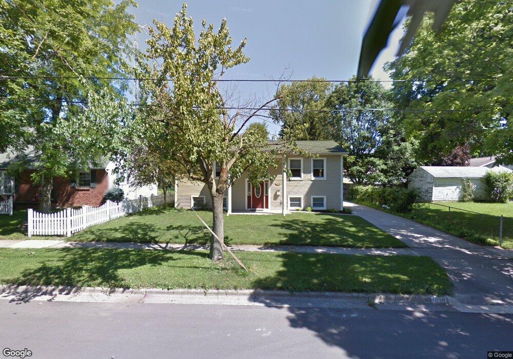
1010 Scottdale Dr Unit 1010 Scottdale Dr Adrian, MI 49221
Estimated Value: $233,891 - $250,000
4
Beds
2
Baths
1,940
Sq Ft
$124/Sq Ft
Est. Value
About This Home
This home is located at 1010 Scottdale Dr Unit 1010 Scottdale Dr, Adrian, MI 49221 and is currently estimated at $239,630, approximately $123 per square foot. 1010 Scottdale Dr Unit 1010 Scottdale Dr is a home located in Lenawee County with nearby schools including Adrian High School, Berean Baptist Academy, and St. Stephen Lutheran School.
Ownership History
Date
Name
Owned For
Owner Type
Purchase Details
Closed on
Aug 15, 2013
Sold by
Bacon Teresa J and Mcvay Teresa J
Bought by
Boxer Gregory S and Boxer Christie M Fitzgerald
Current Estimated Value
Home Financials for this Owner
Home Financials are based on the most recent Mortgage that was taken out on this home.
Original Mortgage
$105,450
Outstanding Balance
$77,979
Interest Rate
4.25%
Mortgage Type
New Conventional
Estimated Equity
$161,651
Purchase Details
Closed on
Aug 27, 2008
Sold by
Bacon Teresa J
Bought by
Grodhaus D Michael
Create a Home Valuation Report for This Property
The Home Valuation Report is an in-depth analysis detailing your home's value as well as a comparison with similar homes in the area
Home Values in the Area
Average Home Value in this Area
Purchase History
| Date | Buyer | Sale Price | Title Company |
|---|---|---|---|
| Boxer Gregory S | $111,000 | None Available | |
| Grodhaus D Michael | -- | None Available |
Source: Public Records
Mortgage History
| Date | Status | Borrower | Loan Amount |
|---|---|---|---|
| Open | Boxer Gregory S | $105,450 |
Source: Public Records
Tax History Compared to Growth
Tax History
| Year | Tax Paid | Tax Assessment Tax Assessment Total Assessment is a certain percentage of the fair market value that is determined by local assessors to be the total taxable value of land and additions on the property. | Land | Improvement |
|---|---|---|---|---|
| 2025 | $2,797 | $99,300 | $0 | $0 |
| 2024 | $2,360 | $93,000 | $0 | $0 |
| 2023 | $2,686 | $85,800 | $0 | $0 |
| 2022 | $2,351 | $79,700 | $0 | $0 |
| 2021 | $2,308 | $73,300 | $0 | $0 |
| 2020 | $2,303 | $68,300 | $0 | $0 |
| 2019 | $148,450 | $64,900 | $0 | $0 |
| 2018 | $2,223 | $76,206 | $0 | $0 |
| 2017 | $2,153 | $60,803 | $0 | $0 |
| 2016 | $2,136 | $58,687 | $0 | $0 |
| 2014 | -- | $50,200 | $0 | $0 |
Source: Public Records
Map
Nearby Homes
- 1035 Scottdale Dr
- 1062 Oram Dr
- 962 Vine St
- 217 Red River Dr
- 301 Ohio River Dr Unit LOT 52
- 301 Hidden River Dr
- 3520 Crestone Way
- 313 Rice St
- 637 W Beecher St
- 705 College Ave
- 521 Rio Grande Dr
- 914 W Maumee St
- 2000 W Beecher St
- 2004 Green Acres Dr
- 416 Allis St
- 2008 Green Acres Dr
- 415 W Beecher St
- 143 Park St
- 1144 W Maumee St
- 2026 Green Acres Dr
- 1010 Scottdale Dr
- 1020 Scottdale Dr
- 518 S Scott St
- 1030 Scottdale Dr
- 1015 Scottdale Dr
- 1025 Scottdale Dr
- 514 S Scott St
- 1017 Vine St
- 1005 Scottdale Dr
- 1019 Vine St
- 510 S Scott St
- 1015 Vine St
- 1027 Vine St
- 1040 Scottdale Dr
- 511 S Scott St
- 1033 Vine St
- 1050 Scottdale Dr
- 525 S Scott St
- 535 S Scott St
- 505 S Scott St