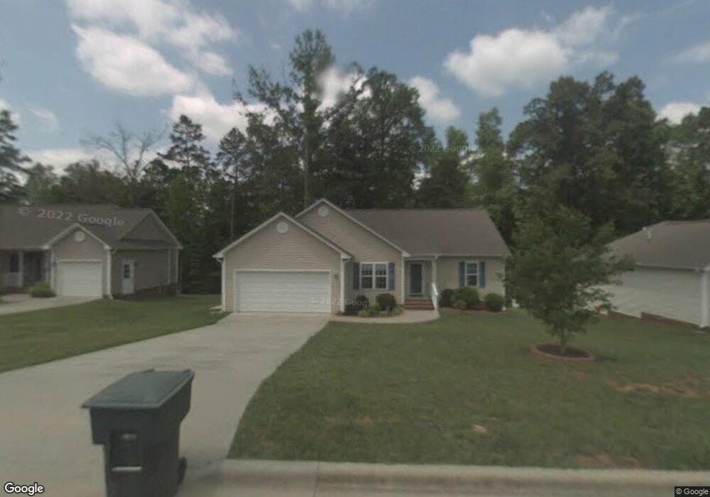
1010 Thompson Rd Graham, NC 27253
Estimated Value: $279,000 - $305,000
3
Beds
2
Baths
1,370
Sq Ft
$213/Sq Ft
Est. Value
About This Home
This home is located at 1010 Thompson Rd, Graham, NC 27253 and is currently estimated at $291,627, approximately $212 per square foot. 1010 Thompson Rd is a home located in Alamance County with nearby schools including South Graham Elementary School, Southern Alamance Middle School, and Southern Alamance High School.
Ownership History
Date
Name
Owned For
Owner Type
Purchase Details
Closed on
Sep 9, 2015
Sold by
Cosgrove Pers Rep Michele Bower and The Estate Of Mary Katherine E
Bought by
Daye Marcus O
Current Estimated Value
Home Financials for this Owner
Home Financials are based on the most recent Mortgage that was taken out on this home.
Original Mortgage
$139,906
Outstanding Balance
$109,283
Interest Rate
3.75%
Mortgage Type
FHA
Estimated Equity
$182,344
Purchase Details
Closed on
Jul 18, 2007
Sold by
Hollingsworth Joel K
Bought by
Easley Mary K
Purchase Details
Closed on
May 20, 2002
Sold by
Concept Builders Inc
Bought by
Hollingsworth Joel K
Home Financials for this Owner
Home Financials are based on the most recent Mortgage that was taken out on this home.
Original Mortgage
$122,850
Interest Rate
6.98%
Mortgage Type
New Conventional
Create a Home Valuation Report for This Property
The Home Valuation Report is an in-depth analysis detailing your home's value as well as a comparison with similar homes in the area
Home Values in the Area
Average Home Value in this Area
Purchase History
| Date | Buyer | Sale Price | Title Company |
|---|---|---|---|
| Daye Marcus O | $143,000 | None Available | |
| Easley Mary K | $135,000 | -- | |
| Hollingsworth Joel K | $136,500 | -- |
Source: Public Records
Mortgage History
| Date | Status | Borrower | Loan Amount |
|---|---|---|---|
| Open | Daye Marcus O | $139,906 | |
| Previous Owner | Hollingsworth Joel K | $122,850 |
Source: Public Records
Tax History
| Year | Tax Paid | Tax Assessment Tax Assessment Total Assessment is a certain percentage of the fair market value that is determined by local assessors to be the total taxable value of land and additions on the property. | Land | Improvement |
|---|---|---|---|---|
| 2025 | $1,376 | $278,471 | $38,000 | $240,471 |
| 2024 | $1,306 | $278,471 | $38,000 | $240,471 |
| 2023 | $1,197 | $278,471 | $38,000 | $240,471 |
| 2022 | $1,497 | $135,919 | $25,000 | $110,919 |
| 2021 | $1,511 | $135,919 | $25,000 | $110,919 |
| 2020 | $1,525 | $135,919 | $25,000 | $110,919 |
| 2019 | $1,529 | $135,919 | $25,000 | $110,919 |
| 2018 | $0 | $135,919 | $25,000 | $110,919 |
| 2017 | $1,407 | $135,919 | $25,000 | $110,919 |
| 2016 | $1,386 | $133,911 | $25,000 | $108,911 |
| 2015 | $773 | $133,911 | $25,000 | $108,911 |
| 2014 | $706 | $133,911 | $25,000 | $108,911 |
Source: Public Records
Map
Nearby Homes
- 512 Monroe Holt Rd
- 758 Aspenwood Dr
- 751 Kernodle Ln Unit 10
- 751 Kernodle Ln Unit 100
- 751 Kernodle Ln Unit 81
- 751 Kernodle Ln Unit 97
- 751 Kernodle Ln Unit 119
- 751 Kernodle Ln Unit 42
- 751 Kernodle Ln Unit 52
- 751 Kernodle Ln Unit 73
- 751 Kernodle Ln Unit 114
- 719 Williamsdale Rd
- 216 Canopy Dr
- 212 Canopy Dr
- 209 Moyer Dr
- 189 Moyer Dr
- 215 Moyer Dr
- 171 Moyer Dr
- 205 Moyer Dr
- 219 Moyer Dr
Your Personal Tour Guide
Ask me questions while you tour the home.