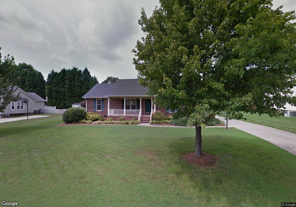
1010 Wentworth Dr Kannapolis, NC 28081
Estimated Value: $271,342 - $291,000
3
Beds
2
Baths
1,323
Sq Ft
$209/Sq Ft
Est. Value
About This Home
This home is located at 1010 Wentworth Dr, Kannapolis, NC 28081 and is currently estimated at $277,086, approximately $209 per square foot. 1010 Wentworth Dr is a home located in Cabarrus County with nearby schools including Shady Brook Elementary School, Kannapolis Middle, and A.L. Brown High School.
Ownership History
Date
Name
Owned For
Owner Type
Purchase Details
Closed on
Oct 28, 2002
Sold by
Walker Jamie Scott and Walker April Mullis
Bought by
Blackmon Sherry R
Current Estimated Value
Home Financials for this Owner
Home Financials are based on the most recent Mortgage that was taken out on this home.
Original Mortgage
$112,100
Outstanding Balance
$47,610
Interest Rate
6.21%
Estimated Equity
$229,476
Purchase Details
Closed on
Aug 1, 1992
Bought by
Walker Jamie Scott
Purchase Details
Closed on
May 1, 1991
Purchase Details
Closed on
Mar 1, 1991
Create a Home Valuation Report for This Property
The Home Valuation Report is an in-depth analysis detailing your home's value as well as a comparison with similar homes in the area
Home Values in the Area
Average Home Value in this Area
Purchase History
| Date | Buyer | Sale Price | Title Company |
|---|---|---|---|
| Blackmon Sherry R | $118,000 | -- | |
| Walker Jamie Scott | $92,000 | -- | |
| -- | $85,000 | -- | |
| -- | $80,000 | -- |
Source: Public Records
Mortgage History
| Date | Status | Borrower | Loan Amount |
|---|---|---|---|
| Open | Blackmon Sherry R | $112,100 |
Source: Public Records
Tax History Compared to Growth
Tax History
| Year | Tax Paid | Tax Assessment Tax Assessment Total Assessment is a certain percentage of the fair market value that is determined by local assessors to be the total taxable value of land and additions on the property. | Land | Improvement |
|---|---|---|---|---|
| 2025 | $1,465 | $258,080 | $65,000 | $193,080 |
| 2024 | $1,465 | $258,080 | $65,000 | $193,080 |
| 2023 | $1,081 | $157,830 | $46,000 | $111,830 |
| 2022 | $1,081 | $157,830 | $46,000 | $111,830 |
| 2021 | $2,162 | $157,830 | $46,000 | $111,830 |
| 2020 | $1,081 | $157,830 | $46,000 | $111,830 |
| 2019 | $897 | $130,920 | $32,000 | $98,920 |
| 2018 | $884 | $130,920 | $32,000 | $98,920 |
| 2017 | $871 | $130,920 | $32,000 | $98,920 |
| 2016 | $1,741 | $127,790 | $32,000 | $95,790 |
| 2015 | $1,610 | $127,790 | $32,000 | $95,790 |
| 2014 | $1,610 | $127,790 | $32,000 | $95,790 |
Source: Public Records
Map
Nearby Homes
- 808 Walker St
- 806 Walker St
- 1010 Sprucewood St
- 804 Evergreen Ave
- 825 Margate Ave
- 00 Sapp Rd
- 915 Sprucewood St
- 0000 Bethpage Rd
- 807 Klondale Ave
- 828 Richard Ave
- 1110 Rogers Lake Rd
- 709 Robin Ave
- 1209 Derbyshire Rd
- 1208 Berkshire Dr
- 621 Pleasant Ave
- 1201 Berkshire Dr
- 1003 Robinhood Ln
- 1200 Berkshire Dr
- 1309 Red Birch Place
- 1220 Lombardi St
- 1014 Wentworth Dr
- 1006 Wentworth Dr
- 941 Gilling Ct
- 1011 Wentworth Dr
- 1015 Wentworth Dr
- 945 Gilling Ct
- 1002 Wentworth Dr
- 1018 Wentworth Dr
- 932 Romsey Ct
- 1019 Wentworth Dr
- 937 Gilling Ct
- 1003 Wentworth Dr
- 928 Romsey Ct
- 932 Gilling Ct
- 1185 Daybrook Dr
- 1023 Wentworth Dr
- 1216 Woodacres Cir
- 938 Gilling Ct
- 1004 Romsey Ct
- 914 Wentworth Dr