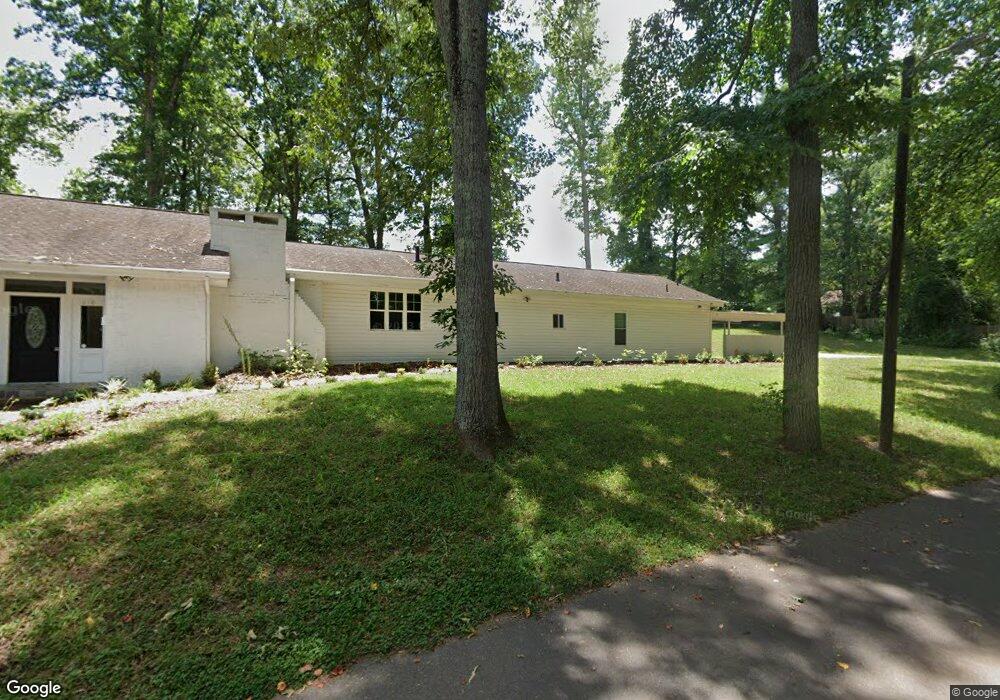
1010 Wesley St Shelby, NC 28150
Estimated Value: $333,000 - $483,000
3
Beds
3
Baths
2,363
Sq Ft
$168/Sq Ft
Est. Value
About This Home
This home is located at 1010 Wesley St, Shelby, NC 28150 and is currently estimated at $396,828, approximately $167 per square foot. 1010 Wesley St is a home located in Cleveland County with nearby schools including Jefferson Elementary School, Shelby Middle School, and Shelby High School.
Ownership History
Date
Name
Owned For
Owner Type
Purchase Details
Closed on
Oct 5, 2022
Sold by
Sallah Momodou and Sallah Leslie V
Bought by
Sallah Global Llc
Current Estimated Value
Home Financials for this Owner
Home Financials are based on the most recent Mortgage that was taken out on this home.
Original Mortgage
$214,500
Interest Rate
5.89%
Mortgage Type
Construction
Purchase Details
Closed on
Jul 20, 2020
Sold by
Sallah Global Inc
Bought by
Sallah Momodou
Purchase Details
Closed on
Sep 12, 2018
Sold by
Sallah Global Inc
Bought by
Sallah Global Inc
Create a Home Valuation Report for This Property
The Home Valuation Report is an in-depth analysis detailing your home's value as well as a comparison with similar homes in the area
Home Values in the Area
Average Home Value in this Area
Purchase History
| Date | Buyer | Sale Price | Title Company |
|---|---|---|---|
| Sallah Global Llc | -- | -- | |
| Sallah Momodou | $40,000 | None Available | |
| Sallah Global Inc | -- | None Available |
Source: Public Records
Mortgage History
| Date | Status | Borrower | Loan Amount |
|---|---|---|---|
| Closed | Sallah Global Llc | $214,500 |
Source: Public Records
Tax History Compared to Growth
Tax History
| Year | Tax Paid | Tax Assessment Tax Assessment Total Assessment is a certain percentage of the fair market value that is determined by local assessors to be the total taxable value of land and additions on the property. | Land | Improvement |
|---|---|---|---|---|
| 2025 | $3,822 | $384,134 | $23,800 | $360,334 |
| 2024 | $4,108 | $338,813 | $14,049 | $324,764 |
| 2023 | $4,087 | $338,813 | $14,049 | $324,764 |
| 2022 | $4,087 | $338,813 | $14,049 | $324,764 |
| 2021 | $1,359 | $110,684 | $14,049 | $96,635 |
| 2020 | $2,516 | $200,715 | $14,049 | $186,666 |
| 2019 | $2,516 | $200,715 | $14,049 | $186,666 |
| 2018 | $2,515 | $200,715 | $14,049 | $186,666 |
| 2017 | $2,452 | $200,715 | $14,049 | $186,666 |
| 2016 | $2,462 | $200,715 | $14,049 | $186,666 |
| 2015 | $1,873 | $160,560 | $12,175 | $148,385 |
| 2014 | $1,873 | $160,560 | $12,175 | $148,385 |
Source: Public Records
Map
Nearby Homes
- 930 Elizabeth Rd
- 310 S Poston St
- 911 Earl St
- 115 Sunrise Cir
- 319 Black St
- 8 Bolt Dr
- 213 Knott St
- 207 Knott St
- 953 Hardin Dr
- 951 Hardin Dr
- 214 Belvedere Ave
- 304 Belvedere Ave
- 515 Suttle St
- 409 Forest Hill Dr
- 335 Sunrise Cir
- 424 Airline Extension
- 823 Frederick St
- 1 Peach St
- 324 Beaumonde Ave
- 921 Logan St
- 1012 Wesley St
- 208 N Poston St
- 206 N Poston St
- 0 Gilliatt St
- 202 Gilliatt St
- 127 N Poston St
- 121 N Poston St
- 1021 E Marion St
- 119 N Poston St
- 115 N Poston St
- 110 Gilliatt St Unit 2
- 108 Gilliatt St Unit 3
- 113 N Poston St
- 206 Gilliatt St
- 1008 E Marion St
- 923 E Marion St
- 923 E Marion St
- 1026 E Marion St Unit 1
- 414 Claxton Dr
- 414 Claxton Dr