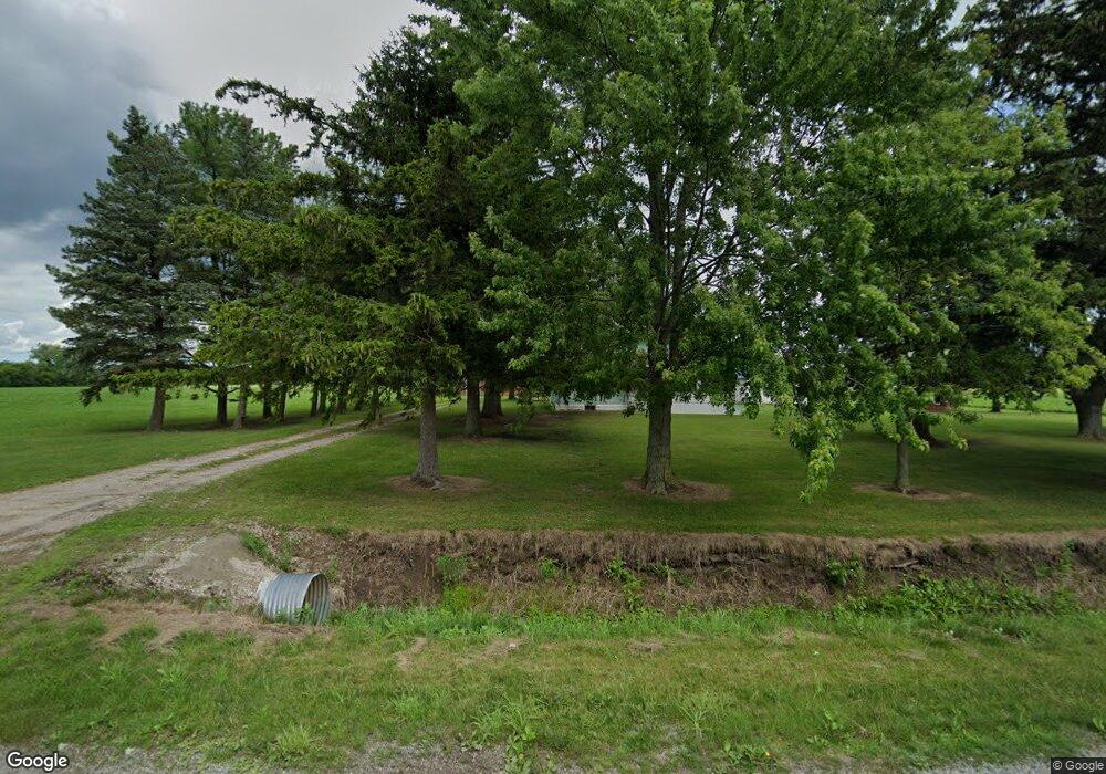
10100 Carter Rd Freeland, MI 48623
Estimated Value: $202,000 - $293,000
3
Beds
1
Bath
1,866
Sq Ft
$133/Sq Ft
Est. Value
About This Home
This home is located at 10100 Carter Rd, Freeland, MI 48623 and is currently estimated at $247,879, approximately $132 per square foot. 10100 Carter Rd is a home located in Saginaw County with nearby schools including Freeland Learning Center, Freeland Elementary School, and Freeland Middle/High School.
Ownership History
Date
Name
Owned For
Owner Type
Purchase Details
Closed on
Dec 9, 2014
Sold by
Schiesswohl Donald A
Bought by
Souden Edward G and Souden Shari L
Current Estimated Value
Purchase Details
Closed on
May 21, 1999
Sold by
Welborn Laura M and Estate Of Laura M Leuenberger
Bought by
Schiesswohl Donald A
Home Financials for this Owner
Home Financials are based on the most recent Mortgage that was taken out on this home.
Original Mortgage
$100,000
Interest Rate
6.94%
Purchase Details
Closed on
May 12, 1999
Sold by
Welborn Laura M and Estate Of Laura M Leuenberger
Bought by
Jennings Brian
Home Financials for this Owner
Home Financials are based on the most recent Mortgage that was taken out on this home.
Original Mortgage
$100,000
Interest Rate
6.94%
Create a Home Valuation Report for This Property
The Home Valuation Report is an in-depth analysis detailing your home's value as well as a comparison with similar homes in the area
Home Values in the Area
Average Home Value in this Area
Purchase History
| Date | Buyer | Sale Price | Title Company |
|---|---|---|---|
| Souden Edward G | $83,500 | Ppr Title Agency | |
| Schiesswohl Donald A | $135,000 | -- | |
| -- | $135,000 | -- | |
| Jennings Brian | $45,781 | -- |
Source: Public Records
Mortgage History
| Date | Status | Borrower | Loan Amount |
|---|---|---|---|
| Previous Owner | -- | $100,000 | |
| Previous Owner | Jennings Brian | $29,871 |
Source: Public Records
Tax History Compared to Growth
Tax History
| Year | Tax Paid | Tax Assessment Tax Assessment Total Assessment is a certain percentage of the fair market value that is determined by local assessors to be the total taxable value of land and additions on the property. | Land | Improvement |
|---|---|---|---|---|
| 2025 | $4,244 | $103,800 | $0 | $0 |
| 2024 | $812 | $96,100 | $0 | $0 |
| 2023 | $774 | $98,200 | $0 | $0 |
| 2022 | $3,608 | $92,800 | $0 | $0 |
| 2021 | $3,357 | $87,100 | $0 | $0 |
| 2020 | $3,272 | $71,200 | $0 | $0 |
| 2019 | $2,038 | $63,000 | $0 | $0 |
| 2018 | $710 | $65,600 | $0 | $0 |
| 2017 | $1,910 | $63,400 | $0 | $0 |
| 2016 | $1,924 | $63,900 | $0 | $0 |
| 2014 | -- | $65,600 | $0 | $46,100 |
| 2013 | -- | $64,700 | $0 | $0 |
Source: Public Records
Map
Nearby Homes
- 10832 Carter Rd
- 10399 Webster Rd
- 8981 Highland Dr
- 10585 Prairie View Ct
- 8884 Copper Ct
- 0 Foxtail Trail Unit 50182332
- 8657 Foxtail Trail
- 8630 Foxtail Trail
- 8483 N River Rock River Rock Unit 8487
- 8599 Ashland Place
- 5749 11 Mile Rd
- 8535 Summer Ridge Dr
- 9924 Garner Ln
- 5 Willow Point Dr
- 8442 Cottonwood Dr
- 8421 Waxwing Dr
- 12422 Northway Pkwy
- 12449 Northway Pkwy
- 8183 N River Rd
- 8611 Winding Brook Cir
- 10100 Carter Rd
- 10145 Carter Rd
- 10145 Carter Rd
- 10085 Carter Rd
- 10016 Carter Rd
- 10345 Carter Rd
- 10735 Buck Rd
- 10390 Carter Rd
- 10414 Carter Rd
- 9785 Carter Rd
- 10410 Carter Rd
- 10643 Buck Rd
- 10570 Buck Rd
- 10460 Carter Rd
- 10465 Carter Rd
- 10515 Buck Rd
- 10535 Buck Rd
- 10000 Buck Rd
- 10000 Buck Rd
- 10000 Buck Rd