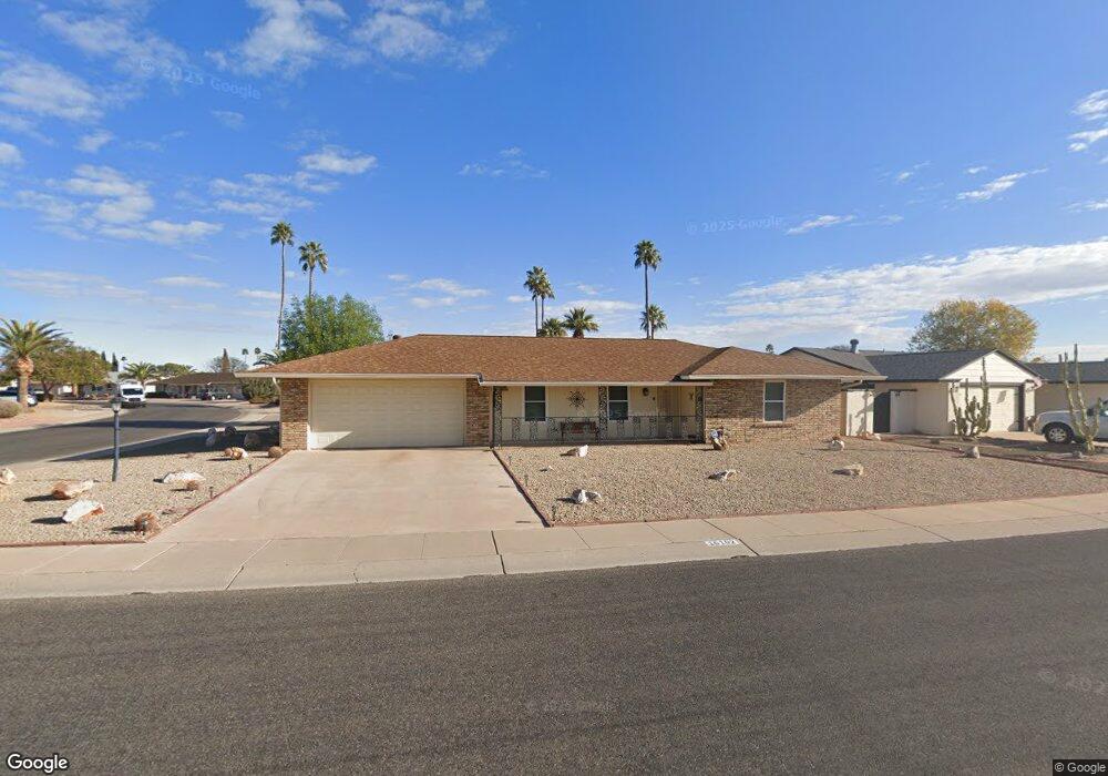
10102 W Desert Rock Dr Sun City, AZ 85351
Estimated Value: $314,463 - $348,000
2
Beds
2
Baths
1,597
Sq Ft
$209/Sq Ft
Est. Value
About This Home
This home is located at 10102 W Desert Rock Dr, Sun City, AZ 85351 and is currently estimated at $333,866, approximately $209 per square foot. 10102 W Desert Rock Dr is a home located in Maricopa County with nearby schools including Sonoran Science Academy-Peoria, Desert Mirage Elementary School, and Black Mountain Science Academy Montessori.
Ownership History
Date
Name
Owned For
Owner Type
Purchase Details
Closed on
Sep 20, 2019
Sold by
Arrington Dextur E and Arrington Janet M
Bought by
Arrington Dextur E and Arrington Janet M
Current Estimated Value
Purchase Details
Closed on
Aug 6, 2018
Sold by
Campbell Larry R
Bought by
Arrington Dexter E and Arrington Janet M
Home Financials for this Owner
Home Financials are based on the most recent Mortgage that was taken out on this home.
Original Mortgage
$107,000
Outstanding Balance
$92,925
Interest Rate
4.5%
Mortgage Type
New Conventional
Estimated Equity
$240,941
Purchase Details
Closed on
Jul 20, 2005
Sold by
Sutcliffe Patricia M
Bought by
Campbell Larry Richard
Home Financials for this Owner
Home Financials are based on the most recent Mortgage that was taken out on this home.
Original Mortgage
$170,000
Interest Rate
6%
Mortgage Type
Purchase Money Mortgage
Create a Home Valuation Report for This Property
The Home Valuation Report is an in-depth analysis detailing your home's value as well as a comparison with similar homes in the area
Home Values in the Area
Average Home Value in this Area
Purchase History
| Date | Buyer | Sale Price | Title Company |
|---|---|---|---|
| Arrington Dextur E | -- | None Available | |
| Arrington Dexter E | $235,000 | American Title Service Agenc | |
| Campbell Larry Richard | $182,000 | First American Title Ins Co |
Source: Public Records
Mortgage History
| Date | Status | Borrower | Loan Amount |
|---|---|---|---|
| Open | Arrington Dexter E | $107,000 | |
| Previous Owner | Campbell Larry Richard | $170,000 |
Source: Public Records
Tax History Compared to Growth
Tax History
| Year | Tax Paid | Tax Assessment Tax Assessment Total Assessment is a certain percentage of the fair market value that is determined by local assessors to be the total taxable value of land and additions on the property. | Land | Improvement |
|---|---|---|---|---|
| 2025 | $1,155 | $14,299 | -- | -- |
| 2024 | $1,043 | $13,618 | -- | -- |
| 2023 | $1,043 | $23,660 | $4,730 | $18,930 |
| 2022 | $975 | $18,610 | $3,720 | $14,890 |
| 2021 | $1,007 | $17,460 | $3,490 | $13,970 |
| 2020 | $981 | $15,410 | $3,080 | $12,330 |
| 2019 | $968 | $14,520 | $2,900 | $11,620 |
| 2018 | $931 | $13,110 | $2,620 | $10,490 |
| 2017 | $897 | $11,760 | $2,350 | $9,410 |
| 2016 | $842 | $10,930 | $2,180 | $8,750 |
| 2015 | $803 | $9,970 | $1,990 | $7,980 |
Source: Public Records
Map
Nearby Homes
- 10018 W Burns Dr
- 10134 W Desert Rock Dr
- 10009 W Pleasant Valley Rd
- 10202 W Edgewood Dr
- 10313 W Desert Rock Dr
- 10019 W Shasta Dr
- 10228 W Twin Oaks Dr
- 10025 W Shasta Dr
- 9921 W Hutton Dr
- 10313 W Burns Dr
- 15406 N Boswell Blvd
- 9915 W Sandstone Dr
- 10251 W Twin Oaks Dr
- 9814 W Gulf Hills Dr
- 9805 W Burns Dr
- 10210 W Charter Oak Dr
- 10329 W Gulf Hills Dr
- 15602 N Lakeforest Dr
- 10319 W Twin Oaks Dr
- 10336 W Kingswood Cir
- 10102 W Desert Rock Dr
- 10102 W Desert Rock Dr Unit 1
- 10030 W Desert Rock Dr
- 10106 W Sutters Gold Ln
- 10101 W Sutters Gold Ln
- 10026 W Desert Rock Dr
- 10105 W Desert Rock Dr
- 10109 W Sutters Gold Ln
- 10110 W Sutters Gold Ln
- 10021 W Brookside Dr
- 10109 W Desert Rock Dr
- 10025 W Brookside Dr
- 10022 W Desert Rock Dr Unit 3
- 10029 W Desert Rock Dr
- 10114 W Desert Rock Dr
- 10113 W Desert Rock Dr
- 10029 W Brookside Dr
- 10114 W Sutters Gold Ln
- 10117 W Sutters Gold Ln
- 10025 W Desert Rock Dr