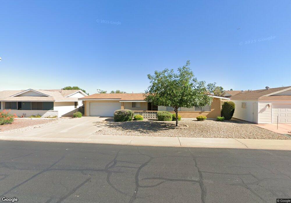
10102 W Mission Ln Unit 8 Sun City, AZ 85351
Estimated Value: $291,000 - $311,000
3
Beds
2
Baths
1,448
Sq Ft
$208/Sq Ft
Est. Value
About This Home
This home is located at 10102 W Mission Ln Unit 8, Sun City, AZ 85351 and is currently estimated at $301,762, approximately $208 per square foot. 10102 W Mission Ln Unit 8 is a home located in Maricopa County with nearby schools including Ombudsman - Northwest Charter and Peoria Accelerated High School.
Ownership History
Date
Name
Owned For
Owner Type
Purchase Details
Closed on
Jul 7, 2011
Sold by
Stecker Larry B and Stecker Marka A
Bought by
Haney Debra S and Lauer Mark J
Current Estimated Value
Home Financials for this Owner
Home Financials are based on the most recent Mortgage that was taken out on this home.
Original Mortgage
$70,000
Outstanding Balance
$48,135
Interest Rate
4.5%
Mortgage Type
New Conventional
Estimated Equity
$253,627
Purchase Details
Closed on
May 18, 2005
Sold by
Horvath Gay and Tober Janrose E
Bought by
Stecker Larry B and Stecker Marka A
Home Financials for this Owner
Home Financials are based on the most recent Mortgage that was taken out on this home.
Original Mortgage
$166,250
Interest Rate
5.74%
Mortgage Type
New Conventional
Create a Home Valuation Report for This Property
The Home Valuation Report is an in-depth analysis detailing your home's value as well as a comparison with similar homes in the area
Home Values in the Area
Average Home Value in this Area
Purchase History
| Date | Buyer | Sale Price | Title Company |
|---|---|---|---|
| Haney Debra S | $90,000 | Pioneer Title Agency Inc | |
| Stecker Larry B | $175,000 | First American Title Ins Co |
Source: Public Records
Mortgage History
| Date | Status | Borrower | Loan Amount |
|---|---|---|---|
| Open | Haney Debra S | $70,000 | |
| Previous Owner | Stecker Larry B | $166,250 |
Source: Public Records
Tax History Compared to Growth
Tax History
| Year | Tax Paid | Tax Assessment Tax Assessment Total Assessment is a certain percentage of the fair market value that is determined by local assessors to be the total taxable value of land and additions on the property. | Land | Improvement |
|---|---|---|---|---|
| 2025 | $1,056 | $11,853 | -- | -- |
| 2024 | $957 | $11,288 | -- | -- |
| 2023 | $957 | $21,320 | $4,260 | $17,060 |
| 2022 | $896 | $16,720 | $3,340 | $13,380 |
| 2021 | $916 | $15,620 | $3,120 | $12,500 |
| 2020 | $892 | $13,530 | $2,700 | $10,830 |
| 2019 | $888 | $12,480 | $2,490 | $9,990 |
| 2018 | $860 | $11,300 | $2,260 | $9,040 |
| 2017 | $828 | $10,000 | $2,000 | $8,000 |
| 2016 | $777 | $9,400 | $1,880 | $7,520 |
| 2015 | $741 | $8,380 | $1,670 | $6,710 |
Source: Public Records
Map
Nearby Homes
- 10014 W Mission Ln
- 10030 W Denham Dr
- 10109 W Mountain View Rd
- 10022 W Mountain View Rd
- 10001 W Caron Dr Unit 8
- 9925 W Mountain View Rd Unit 27
- 9915 W Mountain View Rd
- 10222 W Mountain View Rd Unit 2
- 10201 W Caron Dr
- 10001 W Deanita Ln
- 10301 W Salem Dr Unit 6D
- 9834 N Balboa Dr
- 10221 W Puget Ave
- 10326 W Caron Dr
- 10166 W Cinnebar Ave
- 10302 W Cheryl Dr Unit D
- 9939 W Ironwood Dr Unit 6D
- 9158 N 98th Dr
- 9891 N Balboa Dr
- 10448 W Caron Dr
- 10110 W Mission Ln
- 10020 W Mission Ln
- 10107 W Denham Dr
- 10111 W Denham Dr
- 10101 W Denham Dr
- 10116 W Mission Ln
- 10119 W Denham Dr
- 10101 W Mission Ln
- 10105 W Mission Ln
- 10029 W Denham Dr
- 10019 W Mission Ln
- 10113 W Mission Ln
- 10010 W Mission Ln Unit 8
- 10122 W Mission Ln
- 10127 W Denham Dr
- 10013 W Mission Ln
- 10023 W Denham Dr
- 10123 W Mission Ln
- 10108 W Denham Dr
- 10102 W Denham Dr