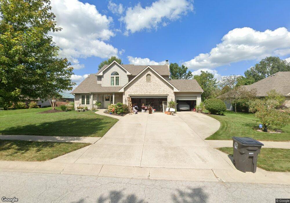
10102 White Cedar Rd Fort Wayne, IN 46804
Estimated Value: $383,000 - $419,000
4
Beds
3
Baths
2,341
Sq Ft
$169/Sq Ft
Est. Value
About This Home
This home is located at 10102 White Cedar Rd, Fort Wayne, IN 46804 and is currently estimated at $394,743, approximately $168 per square foot. 10102 White Cedar Rd is a home located in Allen County with nearby schools including Deer Ridge Elementary School, Woodside Middle School, and Homestead Senior High School.
Ownership History
Date
Name
Owned For
Owner Type
Purchase Details
Closed on
Jul 31, 2012
Sold by
Wakeel Ossama Ali and Adbul Heba Atef
Bought by
Pilsner Leory J and Pilsner Paula R
Current Estimated Value
Home Financials for this Owner
Home Financials are based on the most recent Mortgage that was taken out on this home.
Original Mortgage
$110,000
Outstanding Balance
$72,921
Interest Rate
3%
Mortgage Type
Adjustable Rate Mortgage/ARM
Estimated Equity
$321,822
Purchase Details
Closed on
Nov 19, 2004
Sold by
Cook James E and Cook Ruth N
Bought by
Elwakeil Ossama A and Elwakeil Heba A
Home Financials for this Owner
Home Financials are based on the most recent Mortgage that was taken out on this home.
Original Mortgage
$173,600
Interest Rate
4.62%
Mortgage Type
Purchase Money Mortgage
Create a Home Valuation Report for This Property
The Home Valuation Report is an in-depth analysis detailing your home's value as well as a comparison with similar homes in the area
Home Values in the Area
Average Home Value in this Area
Purchase History
| Date | Buyer | Sale Price | Title Company |
|---|---|---|---|
| Pilsner Leory J | -- | None Available | |
| Elwakeil Ossama A | -- | Century Title Services |
Source: Public Records
Mortgage History
| Date | Status | Borrower | Loan Amount |
|---|---|---|---|
| Open | Pilsner Leory J | $110,000 | |
| Previous Owner | Elwakeil Ossama A | $173,600 |
Source: Public Records
Tax History
| Year | Tax Paid | Tax Assessment Tax Assessment Total Assessment is a certain percentage of the fair market value that is determined by local assessors to be the total taxable value of land and additions on the property. | Land | Improvement |
|---|---|---|---|---|
| 2025 | $4,233 | $389,500 | $68,200 | $321,300 |
| 2024 | $3,925 | $393,000 | $68,200 | $324,800 |
| 2023 | $3,925 | $365,300 | $35,900 | $329,400 |
| 2022 | $3,715 | $342,900 | $35,900 | $307,000 |
| 2021 | $3,090 | $294,200 | $35,900 | $258,300 |
| 2020 | $2,971 | $282,100 | $35,900 | $246,200 |
| 2019 | $2,861 | $270,900 | $35,900 | $235,000 |
| 2018 | $2,829 | $267,400 | $35,900 | $231,500 |
| 2017 | $2,725 | $256,800 | $35,900 | $220,900 |
| 2016 | $2,602 | $244,200 | $35,900 | $208,300 |
| 2014 | $2,283 | $216,200 | $35,900 | $180,300 |
| 2013 | $2,270 | $213,800 | $35,900 | $177,900 |
Source: Public Records
Map
Nearby Homes
- TBD S Scott Rd Unit 303
- 10528 Foxtrot Ct
- 10238 Chestnut Plaza Dr Unit 2
- 10215 Chestnut Plaza Dr Unit 69
- 10576 Chestnut Plaza Dr Unit 15
- 10216 Chestnut Plaza Dr Unit 1
- 2707 Grenadier Ct
- 2227 Blue Harbor Dr
- 10928 Birkdale Ct
- 10528 Indian Ridge Dr
- 2306 Bluewater Trail
- 2805 Little River Run
- 11011 Shiregreen Ln
- 2820 Wind Pump Rd
- 606 Diamond Point Place
- 11136 Creekwood Ct
- 11117 Monte Vista Ct
- 1614 Marietta Dr
- 10642 Chestnut Creek Blvd
- 11231 Creekwood Dr
- 10034 White Cedar Rd
- 10108 White Cedar Rd
- 10022 White Cedar Rd
- 10114 White Cedar Rd
- 10104 Mesa Glen Ct
- 10110 Mesa Glen Ct
- 10120 White Cedar Rd
- 10116 Mesa Glen Ct
- 1713 Red Oak Run
- 1624 Silver Linden Ct
- 1630 Silver Linden Ct
- 1702 Silver Linden Ct
- 10126 White Cedar Rd
- 1616 Silver Linden Ct
- 10122 Mesa Glen Ct
- 1710 Silver Linden Ct
- 10109 Mesa Glen Ct
- 1625 Silver Linden Ct
- 1612 Silver Linden Ct
- 10115 Mesa Glen Ct
Your Personal Tour Guide
Ask me questions while you tour the home.