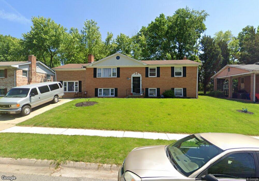
10104 White Ave Clinton, MD 20735
Estimated Value: $390,872 - $504,000
--
Bed
3
Baths
1,620
Sq Ft
$287/Sq Ft
Est. Value
About This Home
This home is located at 10104 White Ave, Clinton, MD 20735 and is currently estimated at $464,468, approximately $286 per square foot. 10104 White Ave is a home located in Prince George's County with nearby schools including Waldon Woods Elementary School, Stephen Decatur Middle School, and Surrattsville High School.
Ownership History
Date
Name
Owned For
Owner Type
Purchase Details
Closed on
Feb 27, 1996
Sold by
Mimms Ellis
Bought by
Mimms Ellis and Mimms Gennette S
Current Estimated Value
Purchase Details
Closed on
Sep 27, 1995
Sold by
Travers Charles L
Bought by
Mimms Ellis
Home Financials for this Owner
Home Financials are based on the most recent Mortgage that was taken out on this home.
Original Mortgage
$166,500
Interest Rate
7.89%
Purchase Details
Closed on
Jun 4, 1971
Sold by
Robert L Welch Inc
Bought by
Travers Charles L and Travers Nancy R
Create a Home Valuation Report for This Property
The Home Valuation Report is an in-depth analysis detailing your home's value as well as a comparison with similar homes in the area
Home Values in the Area
Average Home Value in this Area
Purchase History
| Date | Buyer | Sale Price | Title Company |
|---|---|---|---|
| Mimms Ellis | -- | -- | |
| Mimms Ellis | $166,500 | -- | |
| Travers Charles L | $36,000 | -- |
Source: Public Records
Mortgage History
| Date | Status | Borrower | Loan Amount |
|---|---|---|---|
| Previous Owner | Mimms Ellis | $166,500 |
Source: Public Records
Tax History Compared to Growth
Tax History
| Year | Tax Paid | Tax Assessment Tax Assessment Total Assessment is a certain percentage of the fair market value that is determined by local assessors to be the total taxable value of land and additions on the property. | Land | Improvement |
|---|---|---|---|---|
| 2025 | $6,361 | $423,600 | $101,200 | $322,400 |
| 2024 | $6,361 | $401,200 | $0 | $0 |
| 2023 | $6,027 | $378,800 | $0 | $0 |
| 2022 | $7,769 | $356,400 | $101,200 | $255,200 |
| 2021 | $7,577 | $343,467 | $0 | $0 |
| 2020 | $4,150 | $330,533 | $0 | $0 |
| 2019 | $4,045 | $317,600 | $100,600 | $217,000 |
| 2018 | $3,877 | $295,467 | $0 | $0 |
| 2017 | $3,729 | $273,333 | $0 | $0 |
| 2016 | -- | $251,200 | $0 | $0 |
| 2015 | $3,262 | $251,200 | $0 | $0 |
| 2014 | $3,262 | $251,200 | $0 | $0 |
Source: Public Records
Map
Nearby Homes
- 5904 Spell Rd
- 6100 Hellen Lee Dr
- 10309 Brandywine Rd
- 6204 Armor Dr
- 10203 Deep Creek Ct
- 9513 Juliette Dr
- F Gwynndale Dr
- 9410 Small Dr
- 9502 Brandywine Rd
- 7006 Chain Fern Ct
- 10802 Slippery Elm Ct
- 11106 Teaberry Way Ct
- 9500 Baymar Ct
- 9917 Raintree Way
- 6608 Horseshoe Rd
- 9605 Beverly Ave
- 11218 Keystone Ave
- 6205 Brooke Jane Dr
- 11313 Marlee Ave
- 6704 Crafton Ln