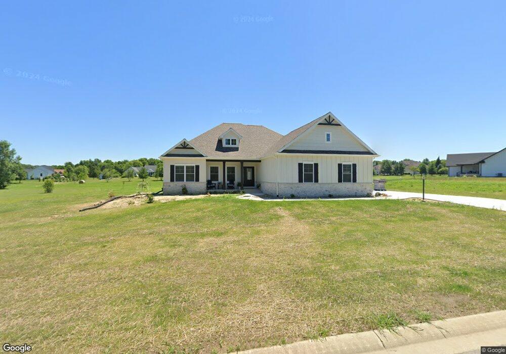
10107 N Halstead Dr La Porte, IN 46350
Estimated Value: $547,811 - $694,000
3
Beds
3
Baths
2,203
Sq Ft
$284/Sq Ft
Est. Value
About This Home
This home is located at 10107 N Halstead Dr, La Porte, IN 46350 and is currently estimated at $625,203, approximately $283 per square foot. 10107 N Halstead Dr is a home with nearby schools including New Prairie High School.
Ownership History
Date
Name
Owned For
Owner Type
Purchase Details
Closed on
Feb 24, 2021
Sold by
Freese Michael
Bought by
Bauer Lynn J and Bauer Amy C
Current Estimated Value
Purchase Details
Closed on
Feb 17, 2020
Sold by
Hometown Finance Llc
Bought by
Freese Michael
Purchase Details
Closed on
May 30, 2007
Sold by
Prascak Michael Stephen
Bought by
Hometown Finance Llc
Home Financials for this Owner
Home Financials are based on the most recent Mortgage that was taken out on this home.
Original Mortgage
$100,000
Interest Rate
6.22%
Mortgage Type
Unknown
Create a Home Valuation Report for This Property
The Home Valuation Report is an in-depth analysis detailing your home's value as well as a comparison with similar homes in the area
Home Values in the Area
Average Home Value in this Area
Purchase History
| Date | Buyer | Sale Price | Title Company |
|---|---|---|---|
| Bauer Lynn J | $30,000 | Acuity Title | |
| Freese Michael | $20,000 | Hometown Finance Llc | |
| Hometown Finance Llc | -- | Meridian Title Corp |
Source: Public Records
Mortgage History
| Date | Status | Borrower | Loan Amount |
|---|---|---|---|
| Previous Owner | Hometown Finance Llc | $100,000 |
Source: Public Records
Tax History Compared to Growth
Tax History
| Year | Tax Paid | Tax Assessment Tax Assessment Total Assessment is a certain percentage of the fair market value that is determined by local assessors to be the total taxable value of land and additions on the property. | Land | Improvement |
|---|---|---|---|---|
| 2024 | $1,122 | $456,900 | $50,200 | $406,700 |
| 2023 | $22 | $50,200 | $50,200 | -- |
| 2022 | $25 | $1,200 | $1,200 | -- |
| 2021 | $21 | $1,000 | $1,000 | $0 |
| 2020 | $22 | $1,000 | $1,000 | $0 |
| 2019 | $135 | $6,100 | $6,100 | $0 |
| 2018 | $126 | $6,100 | $6,100 | $0 |
| 2017 | $136 | $5,100 | $5,100 | $0 |
| 2016 | $145 | $5,100 | $5,100 | $0 |
| 2014 | $80 | $4,100 | $4,100 | $0 |
Source: Public Records
Map
Nearby Homes
- 10078 N Halstead Dr
- 9936 Wilson Rd
- 19785 S Lakeside Rd
- 19745 S Lakeside Rd
- 112 E 900 N
- 9656 N 200 E
- 135 W 900 N
- 19818 Michigan 239
- 0 Wilson Rd Unit B
- 13212 Wilson Rd
- 11412 Wilson Rd
- 8674 N 200 E
- The Badin Plan at Wagner Estates
- The Kelley Plan at Wagner Estates
- The Leahy Plan at Wagner Estates
- The Gipper Plan at Wagner Estates
- The Ara Plan at Wagner Estates
- The Rockne Plan at Wagner Estates
- The Sorin Plan at Wagner Estates
- 11509 Wilson Rd
- 10152 N Halstead Dr
- 10174 N Halstead Dr
- 10153 N Halstead Dr
- Lot 11 N Halstead Dr
- Lot 8 N Halstead Dr
- lot 18 N Halstead Dr
- 0 N Halstead Dr
- 0-lot 18 N Halstead Dr
- 0-Lot 8 N Halstead Dr
- 17 N Halstead Dr
- 451 E 1000 N
- 10085 N Halstead Dr
- 10152 N Beverly Ln
- 10128 N Beverly Ln
- 10168 N Beverly Ln
- 10171 N Beverly Ln
- 10104 N Beverly Ln
- 10068 N Halstead Dr
- 10127 N Beverly Ln
- lot 22 N Beverly Ln