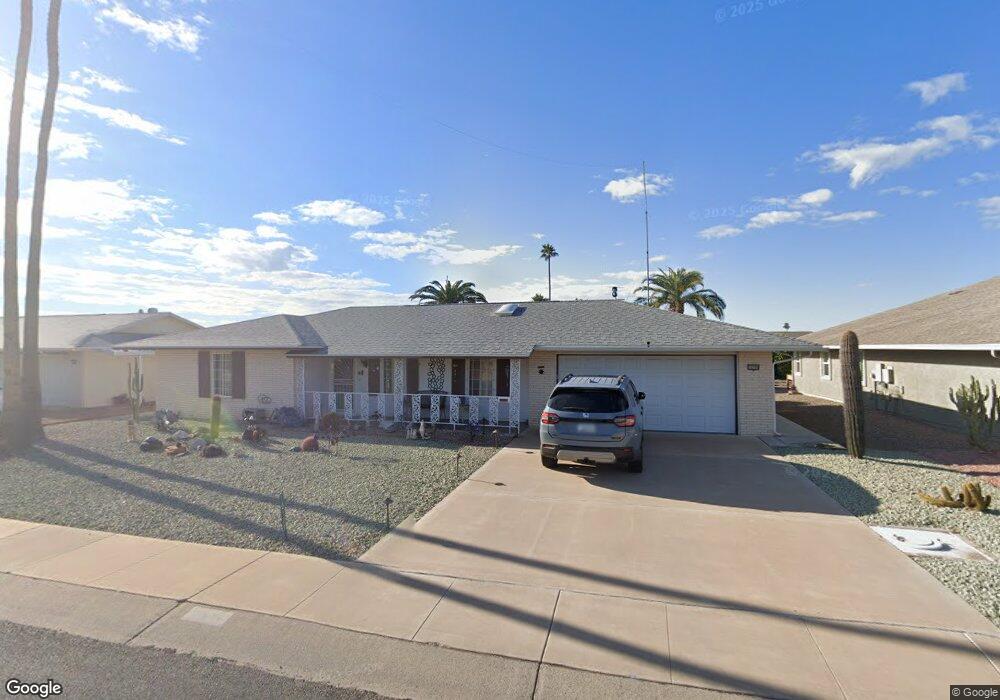
10109 W Desert Rock Dr Sun City, AZ 85351
Estimated Value: $288,000 - $337,000
--
Bed
2
Baths
1,438
Sq Ft
$214/Sq Ft
Est. Value
About This Home
This home is located at 10109 W Desert Rock Dr, Sun City, AZ 85351 and is currently estimated at $308,382, approximately $214 per square foot. 10109 W Desert Rock Dr is a home located in Maricopa County with nearby schools including Sonoran Science Academy-Peoria, Desert Mirage Elementary School, and Black Mountain Science Academy Montessori.
Ownership History
Date
Name
Owned For
Owner Type
Purchase Details
Closed on
Apr 10, 2016
Sold by
Day Muriel
Bought by
Brannock Rosemary and Howes Timothy
Current Estimated Value
Purchase Details
Closed on
Apr 3, 2007
Sold by
Herrboldt Robert A and Herrboldt Helen D
Bought by
Brannock Rosemary
Purchase Details
Closed on
Jun 29, 2000
Sold by
Herrboldt Robert A and Herrboldt Helen D
Bought by
Herrboldt Robert A and Herrboldt Helen D
Purchase Details
Closed on
Jan 8, 1998
Sold by
Ranck Thomas C and Ranck Lorena M
Bought by
Herrboldt Robert A and Herrboldt Helen D
Home Financials for this Owner
Home Financials are based on the most recent Mortgage that was taken out on this home.
Original Mortgage
$63,000
Interest Rate
7.14%
Mortgage Type
New Conventional
Create a Home Valuation Report for This Property
The Home Valuation Report is an in-depth analysis detailing your home's value as well as a comparison with similar homes in the area
Home Values in the Area
Average Home Value in this Area
Purchase History
| Date | Buyer | Sale Price | Title Company |
|---|---|---|---|
| Brannock Rosemary | $135,000 | Equity Title Agency Inc | |
| Brannock Rosemary | $190,000 | Capital Title Agency Inc | |
| Herrboldt Robert A | -- | -- | |
| Herrboldt Robert A | $79,000 | Ati Title Agency |
Source: Public Records
Mortgage History
| Date | Status | Borrower | Loan Amount |
|---|---|---|---|
| Previous Owner | Herrboldt Robert A | $63,000 |
Source: Public Records
Tax History Compared to Growth
Tax History
| Year | Tax Paid | Tax Assessment Tax Assessment Total Assessment is a certain percentage of the fair market value that is determined by local assessors to be the total taxable value of land and additions on the property. | Land | Improvement |
|---|---|---|---|---|
| 2025 | $1,268 | $14,316 | -- | -- |
| 2024 | $1,152 | $13,634 | -- | -- |
| 2023 | $1,152 | $22,900 | $4,580 | $18,320 |
| 2022 | $1,082 | $17,960 | $3,590 | $14,370 |
| 2021 | $1,107 | $16,870 | $3,370 | $13,500 |
| 2020 | $1,079 | $14,960 | $2,990 | $11,970 |
| 2019 | $1,065 | $14,020 | $2,800 | $11,220 |
| 2018 | $1,027 | $12,820 | $2,560 | $10,260 |
| 2017 | $991 | $11,410 | $2,280 | $9,130 |
| 2016 | $934 | $10,760 | $2,150 | $8,610 |
| 2015 | $887 | $9,980 | $1,990 | $7,990 |
Source: Public Records
Map
Nearby Homes
- 10018 W Burns Dr
- 10134 W Desert Rock Dr
- 10009 W Pleasant Valley Rd
- 10202 W Edgewood Dr
- 10019 W Shasta Dr
- 10025 W Shasta Dr
- 10228 W Twin Oaks Dr
- 10313 W Desert Rock Dr
- 15406 N Boswell Blvd
- 9915 W Sandstone Dr
- 9921 W Hutton Dr
- 10313 W Burns Dr
- 10251 W Twin Oaks Dr
- 10210 W Charter Oak Dr
- 9814 W Gulf Hills Dr
- 9805 W Burns Dr
- 10329 W Gulf Hills Dr
- 15602 N Lakeforest Dr
- 10336 W Kingswood Cir
- 15205 N Desert Rose Dr
- 10113 W Desert Rock Dr
- 10105 W Desert Rock Dr
- 10114 W Burns Dr Unit 33
- 10118 W Burns Dr
- 10110 W Burns Dr
- 10117 W Desert Rock Dr
- 10101 W Sutters Gold Ln
- 10122 W Burns Dr Unit 33
- 10106 W Burns Dr
- 10102 W Desert Rock Dr
- 10102 W Desert Rock Dr
- 10102 W Desert Rock Dr Unit 1
- 10114 W Desert Rock Dr
- 10121 W Desert Rock Dr
- 10126 W Burns Dr
- 10102 W Burns Dr
- 10109 W Sutters Gold Ln
- 10118 W Desert Rock Dr
- 10030 W Desert Rock Dr
- 10125 W Desert Rock Dr