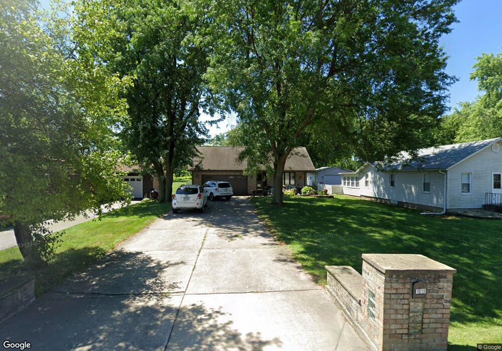
1011 174th St Hazel Crest, IL 60429
Estimated Value: $244,000 - $343,000
3
Beds
2
Baths
1,494
Sq Ft
$188/Sq Ft
Est. Value
About This Home
This home is located at 1011 174th St, Hazel Crest, IL 60429 and is currently estimated at $280,340, approximately $187 per square foot. 1011 174th St is a home located in Cook County with nearby schools including Thornwood High School and Glenwood Academy.
Ownership History
Date
Name
Owned For
Owner Type
Purchase Details
Closed on
Mar 12, 1999
Sold by
Pratscher Martin A and Pratscher Shari
Bought by
Beard Michael D and Beard Sharon L
Current Estimated Value
Home Financials for this Owner
Home Financials are based on the most recent Mortgage that was taken out on this home.
Original Mortgage
$145,350
Interest Rate
7.04%
Purchase Details
Closed on
Jul 11, 1995
Sold by
Pratscher Martin A
Bought by
Pratscher Martin and Pratscher Shari
Home Financials for this Owner
Home Financials are based on the most recent Mortgage that was taken out on this home.
Original Mortgage
$86,000
Interest Rate
7.79%
Create a Home Valuation Report for This Property
The Home Valuation Report is an in-depth analysis detailing your home's value as well as a comparison with similar homes in the area
Home Values in the Area
Average Home Value in this Area
Purchase History
| Date | Buyer | Sale Price | Title Company |
|---|---|---|---|
| Beard Michael D | $153,000 | Professional National Title | |
| Pratscher Martin | -- | -- |
Source: Public Records
Mortgage History
| Date | Status | Borrower | Loan Amount |
|---|---|---|---|
| Previous Owner | Beard Michael D | $145,350 | |
| Previous Owner | Pratscher Martin | $86,000 |
Source: Public Records
Tax History
| Year | Tax Paid | Tax Assessment Tax Assessment Total Assessment is a certain percentage of the fair market value that is determined by local assessors to be the total taxable value of land and additions on the property. | Land | Improvement |
|---|---|---|---|---|
| 2025 | $9,547 | $25,001 | $4,010 | $20,991 |
| 2024 | $9,547 | $25,001 | $4,010 | $20,991 |
| 2023 | $5,284 | $25,001 | $4,010 | $20,991 |
| 2022 | $5,284 | $14,961 | $3,564 | $11,397 |
| 2021 | $5,302 | $14,961 | $3,564 | $11,397 |
| 2020 | $5,365 | $14,961 | $3,564 | $11,397 |
| 2019 | $3,171 | $12,161 | $3,118 | $9,043 |
| 2018 | $3,129 | $12,161 | $3,118 | $9,043 |
| 2017 | $3,216 | $12,161 | $3,118 | $9,043 |
| 2016 | $3,702 | $11,592 | $2,673 | $8,919 |
| 2015 | $3,443 | $11,592 | $2,673 | $8,919 |
| 2014 | $5,514 | $12,927 | $2,673 | $10,254 |
| 2013 | $5,715 | $14,264 | $2,673 | $11,591 |
Source: Public Records
Map
Nearby Homes
- 17406 Lathrop Ave
- 1021 173rd St
- 1307 173rd St
- 1113 171st St
- 1409 172nd St
- 1411 172nd St
- 1514 173rd St
- 18000 Armitage Ct
- 18110 Center Ave
- 18205 Hart Dr Unit 2B
- 1321 Ridge Rd
- 840 Elder Rd Unit A405
- 18144 Aberdeen St
- 17917 Ashland Ave
- 17866 Ashland Ave
- 1624 Burr Oak Rd
- 830 Elder Rd Unit B403
- 830 Elder Rd Unit B303
- 830 Elder Rd Unit B111
- 16627 Carse Ave
- 1005 174th St
- 1013 174th St
- 1015 174th St
- 1021 174th St
- 1017 174th St
- 17410 Lathrop Ave
- 17416 Lathrop Ave
- 1010 174th St
- 1016 174th St
- 1025 174th St
- 1016 175th St
- 923 Garden Ln Unit 923
- 17328 Lathrop Ave
- 17415 Fisk St
- 17424 Lathrop Ave
- 1020 175th St
- 913 Garden Ln Unit 913
- 1029 174th St
- 1022 174th St
- 1006 175th St
Your Personal Tour Guide
Ask me questions while you tour the home.