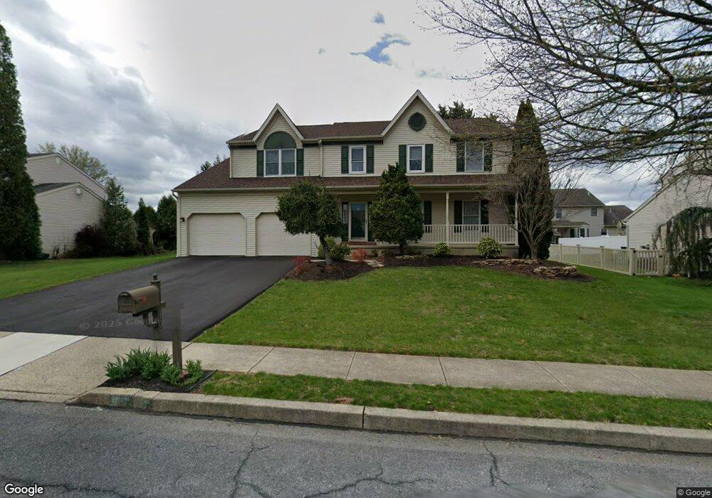
1011 Boeshore Cir Reading, PA 19605
Riverview Park NeighborhoodEstimated Value: $372,000 - $443,000
4
Beds
3
Baths
2,264
Sq Ft
$178/Sq Ft
Est. Value
About This Home
This home is located at 1011 Boeshore Cir, Reading, PA 19605 and is currently estimated at $402,308, approximately $177 per square foot. 1011 Boeshore Cir is a home located in Berks County with nearby schools including C E Cole Intermediate School, Muhlenberg Elementary Center, and Muhlenberg Junior High School.
Ownership History
Date
Name
Owned For
Owner Type
Purchase Details
Closed on
Aug 26, 1994
Bought by
Greb Martin and Greb Karen A
Current Estimated Value
Create a Home Valuation Report for This Property
The Home Valuation Report is an in-depth analysis detailing your home's value as well as a comparison with similar homes in the area
Home Values in the Area
Average Home Value in this Area
Purchase History
| Date | Buyer | Sale Price | Title Company |
|---|---|---|---|
| Greb Martin | $152,600 | -- |
Source: Public Records
Tax History Compared to Growth
Tax History
| Year | Tax Paid | Tax Assessment Tax Assessment Total Assessment is a certain percentage of the fair market value that is determined by local assessors to be the total taxable value of land and additions on the property. | Land | Improvement |
|---|---|---|---|---|
| 2025 | $2,210 | $147,200 | $34,400 | $112,800 |
| 2024 | $7,087 | $147,200 | $34,400 | $112,800 |
| 2023 | $6,652 | $147,200 | $34,400 | $112,800 |
| 2022 | $6,541 | $147,200 | $34,400 | $112,800 |
| 2021 | $6,387 | $147,200 | $34,400 | $112,800 |
| 2020 | $6,387 | $147,200 | $34,400 | $112,800 |
| 2019 | $6,251 | $147,200 | $34,400 | $112,800 |
| 2018 | $6,141 | $147,200 | $34,400 | $112,800 |
| 2017 | $6,025 | $147,200 | $34,400 | $112,800 |
| 2016 | $1,785 | $147,200 | $34,400 | $112,800 |
| 2015 | $1,785 | $147,200 | $34,400 | $112,800 |
| 2014 | $1,785 | $147,200 | $34,400 | $112,800 |
Source: Public Records
Map
Nearby Homes
- 1012 Dallas Rd
- 1052 Boeshore Cir
- 1282 Fredrick Blvd Unit 15F
- 914 Suellen Dr
- 1019 Heath Ave
- 1002 Heath Ave
- 1033 Barberry Ave
- 1021 Barberry Ave Unit T67
- 1047 Sage Ave
- 3810 Willow Grove Ave
- 833 Pine Heights Rd
- 3706 Rosewood Rd
- 1105 Showers Ln
- 1025 River Crest Dr
- 1033 Whitford Dr
- 1072 Grandell Ave
- 5213 Stoudts Ferry Bridge Rd
- 1129 Whitner Rd
- 3500 Eisenbrown Rd
- 1125 Ashbourne Dr
- 1013 Boeshore Cir
- 1009 Boeshore Cir
- 1016 Dallas Rd
- 1020 Dallas Rd
- 1012 Boeshore Cir
- 1010 Boeshore Cir
- 1007 Boeshore Cir
- 1015 Boeshore Cir
- 1014 Boeshore Cir
- 1024 Dallas Rd
- 1008 Boeshore Cir
- 1016 Boeshore Cir
- 1017 Dallas Rd
- 1017 Boeshore Cir
- 1005 Boeshore Cir
- 1013 Dallas Rd
- 1021 Dallas Rd
- 1004 Dallas Rd
- 1028 Dallas Rd
- 1006 Boeshore Cir