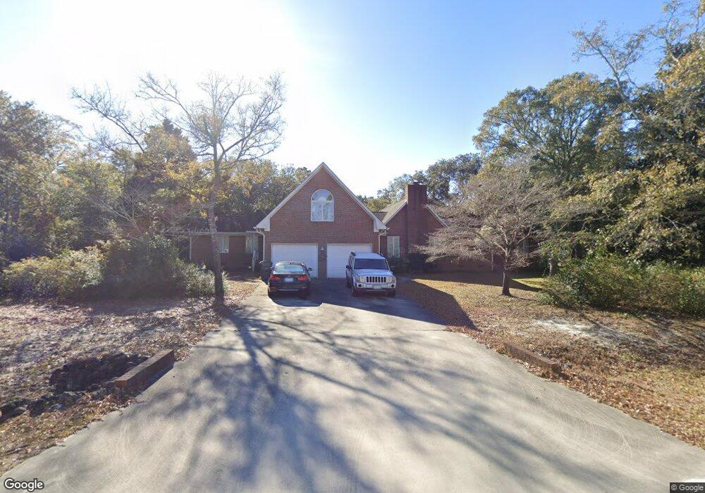
1011 Bonner Bussells Dr Southport, NC 28461
Estimated Value: $566,000 - $666,000
4
Beds
3
Baths
2,710
Sq Ft
$226/Sq Ft
Est. Value
About This Home
This home is located at 1011 Bonner Bussells Dr, Southport, NC 28461 and is currently estimated at $613,683, approximately $226 per square foot. 1011 Bonner Bussells Dr is a home located in Brunswick County with nearby schools including Southport Elementary School, South Brunswick Middle School, and South Brunswick High School.
Ownership History
Date
Name
Owned For
Owner Type
Purchase Details
Closed on
Oct 15, 2013
Sold by
Buchanan Annette
Bought by
Litten Frederick L and Litten Katherine C
Current Estimated Value
Home Financials for this Owner
Home Financials are based on the most recent Mortgage that was taken out on this home.
Original Mortgage
$294,500
Outstanding Balance
$221,980
Interest Rate
4.58%
Mortgage Type
New Conventional
Estimated Equity
$391,703
Purchase Details
Closed on
Jul 13, 2005
Sold by
Mcentire Thomas Hatcher and Cary Mcentire P
Bought by
Mcentire P Cary
Home Financials for this Owner
Home Financials are based on the most recent Mortgage that was taken out on this home.
Original Mortgage
$78,000
Interest Rate
5.59%
Mortgage Type
Purchase Money Mortgage
Create a Home Valuation Report for This Property
The Home Valuation Report is an in-depth analysis detailing your home's value as well as a comparison with similar homes in the area
Home Values in the Area
Average Home Value in this Area
Purchase History
| Date | Buyer | Sale Price | Title Company |
|---|---|---|---|
| Litten Frederick L | $310,000 | None Available | |
| Mcentire P Cary | $96,500 | None Available |
Source: Public Records
Mortgage History
| Date | Status | Borrower | Loan Amount |
|---|---|---|---|
| Open | Litten Frederick L | $294,500 | |
| Previous Owner | Mcentire P Cary | $78,000 |
Source: Public Records
Tax History Compared to Growth
Tax History
| Year | Tax Paid | Tax Assessment Tax Assessment Total Assessment is a certain percentage of the fair market value that is determined by local assessors to be the total taxable value of land and additions on the property. | Land | Improvement |
|---|---|---|---|---|
| 2025 | $2,101 | $445,230 | $84,000 | $361,230 |
| 2024 | $2,101 | $445,230 | $84,000 | $361,230 |
| 2023 | $2,169 | $445,230 | $84,000 | $361,230 |
| 2022 | $2,169 | $336,900 | $60,000 | $276,900 |
| 2021 | $2,044 | $336,900 | $60,000 | $276,900 |
| 2020 | $2,044 | $336,900 | $60,000 | $276,900 |
| 2019 | $2,044 | $60,770 | $60,000 | $770 |
| 2018 | $1,908 | $61,190 | $60,000 | $1,190 |
| 2017 | $1,883 | $61,190 | $60,000 | $1,190 |
| 2016 | $1,833 | $61,190 | $60,000 | $1,190 |
| 2015 | $1,833 | $311,080 | $60,000 | $251,080 |
| 2014 | $1,836 | $339,015 | $80,500 | $258,515 |
Source: Public Records
Map
Nearby Homes
- 2000 Bonner Bussells Dr
- 2002 Petes Camp Dr
- 5003 Robert Ruark Dr
- 2343 Crescent Bay Dr
- 2339 Crescent Bay Dr
- 1121 Mallard Pointe Ln
- 3006 Robert Ruark Dr
- 2293 Crescent Bay Dr
- 2499 Lake Ridge Dr
- Marshall Plan at Osprey Landing - Signature
- Kauai Plan at Osprey Landing - Signature
- Helmsley Plan at Osprey Landing - Signature
- McKenzie Plan at Osprey Landing - Signature
- Shoreline Plan at Osprey Landing - Bungalow
- Hadley Plan at Osprey Landing - Village
- Seagrass Plan at Osprey Landing - Bungalow
- Ashton Plan at Osprey Landing - Signature
- Essex Plan at Osprey Landing - Village
- McKinley Plan at Osprey Landing - Signature
- Bedford Plan at Osprey Landing - Signature
- 1011 Bonner Bussels Dr
- 1008 Newton Dr
- 1009 Bonner Bussells Dr
- 1024 Bonner Bussells Dr
- 1028 Bonner Bussells Dr
- 1111 Newton Dr
- 1022 Bonner Bussells Dr
- 2001 Bonner Bussells Dr
- 1006 Newton Dr SE
- 1006 Newton Dr
- 1020 Bonner Bussells Dr
- 1107 Newton Dr
- 1007 Bonner Bussells Dr
- 1018 Bonner Bussells Dr SE
- 1018 Bonner Bussells Dr
- 2002 Bonner Bussells Dr
- 1016 Bonner Bussells Dr
- 1004 Petes Camp Dr
- 4016 Robert Ruark Dr
- 1005 Bonner Bussells Dr