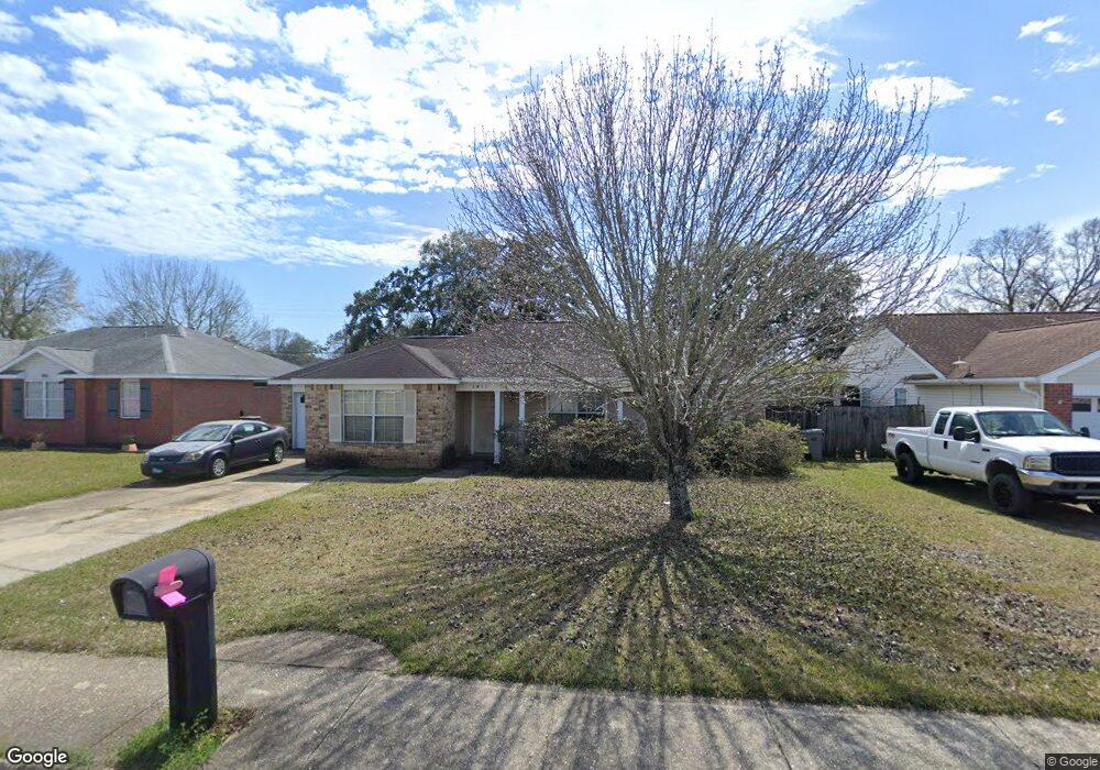
1011 Brownfield Rd Pensacola, FL 32526
Estimated Value: $213,994 - $249,000
--
Bed
2
Baths
1,336
Sq Ft
$174/Sq Ft
Est. Value
About This Home
This home is located at 1011 Brownfield Rd, Pensacola, FL 32526 and is currently estimated at $232,999, approximately $174 per square foot. 1011 Brownfield Rd is a home located in Escambia County with nearby schools including Beulah Elementary School, Bellview Middle School, and Pine Forest High School.
Ownership History
Date
Name
Owned For
Owner Type
Purchase Details
Closed on
Mar 4, 2011
Sold by
Voighte Terry and Clark Palti E
Bought by
Voight Terry
Current Estimated Value
Purchase Details
Closed on
Nov 16, 1997
Sold by
Mitchell Co Inc
Bought by
Clark Patti R and Voight Terry
Home Financials for this Owner
Home Financials are based on the most recent Mortgage that was taken out on this home.
Original Mortgage
$88,900
Interest Rate
7.38%
Create a Home Valuation Report for This Property
The Home Valuation Report is an in-depth analysis detailing your home's value as well as a comparison with similar homes in the area
Home Values in the Area
Average Home Value in this Area
Purchase History
| Date | Buyer | Sale Price | Title Company |
|---|---|---|---|
| Voight Terry | -- | Attorney | |
| Clark Patti R | $89,900 | -- |
Source: Public Records
Mortgage History
| Date | Status | Borrower | Loan Amount |
|---|---|---|---|
| Previous Owner | Clark Patti R | $88,900 |
Source: Public Records
Tax History Compared to Growth
Tax History
| Year | Tax Paid | Tax Assessment Tax Assessment Total Assessment is a certain percentage of the fair market value that is determined by local assessors to be the total taxable value of land and additions on the property. | Land | Improvement |
|---|---|---|---|---|
| 2024 | $1,105 | $101,815 | -- | -- |
| 2023 | $1,105 | $98,850 | $0 | $0 |
| 2022 | $1,076 | $95,971 | $0 | $0 |
| 2021 | $1,069 | $93,176 | $0 | $0 |
| 2020 | $1,036 | $91,890 | $0 | $0 |
| 2019 | $1,016 | $89,825 | $0 | $0 |
| 2018 | $1,011 | $88,151 | $0 | $0 |
| 2017 | $1,004 | $86,338 | $0 | $0 |
| 2016 | $993 | $84,563 | $0 | $0 |
| 2015 | $974 | $83,976 | $0 | $0 |
| 2014 | $961 | $83,310 | $0 | $0 |
Source: Public Records
Map
Nearby Homes
- 4032 Glenway Dr
- 1039 Brownfield Rd
- 6437 Sarasota St
- 321 Loveland Cir
- 5196 Zachary Blvd
- 3076 Flintlock Dr
- 3086 Flintlock Dr
- 6265 N Blue Angel Pkwy
- 5127 Cocoa Dr
- 5314 Othell Way
- 6320 Clegg Rd
- 6368 Footprint Dr
- 5130 Bankhead Dr
- 5205 Bankhead Dr
- 6032 Brylex Ln Unit 18A
- 3280 Wasatch Range Loop
- 5142 Stevendale Rd
- 6290 Footprint Dr
- 5920 Pawnee Dr
- 5502 Lexlee Blvd Unit 1A
- 1009 Brownfield Rd
- 1013 Brownfield Rd
- 1007 Brownfield Rd
- 1014 Brownfield Rd
- 4001 Glenway Dr
- 1015 Brownfield Rd
- 3579 Godwin Ln
- 6324 Embers Ridge Dr
- 1005 Brownfield Rd
- 4003 Glenway Dr
- 1018 Brownfield Rd
- 1017 Brownfield Rd
- 3569 Godwin Ln
- 4005 Glenway Dr
- 1003 Brownfield Rd
- 4007 Glenway Dr
- 1019 Brownfield Rd
- 6320 Embers Ridge Dr
- 6325 Embers Ridge Dr
- 1020 Brownfield Rd