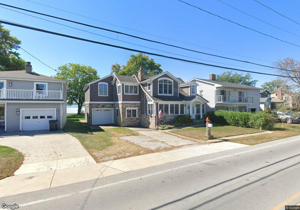
1011 Cedar Point Rd Sandusky, OH 44870
Estimated Value: $618,997 - $874,000
3
Beds
2
Baths
2,172
Sq Ft
$335/Sq Ft
Est. Value
About This Home
This home is located at 1011 Cedar Point Rd, Sandusky, OH 44870 and is currently estimated at $728,666, approximately $335 per square foot. 1011 Cedar Point Rd is a home located in Erie County with nearby schools including Sandusky High School.
Ownership History
Date
Name
Owned For
Owner Type
Purchase Details
Closed on
Jan 8, 2019
Sold by
Mitchell Terrence and Mitchell Kathleen A
Bought by
Mitchell Kathleen A and Kathleen A Mitchell Trust
Current Estimated Value
Purchase Details
Closed on
Oct 14, 1994
Sold by
Delonais Laurence C
Bought by
Mitchell Terrence and Mitchell Kathleen A
Home Financials for this Owner
Home Financials are based on the most recent Mortgage that was taken out on this home.
Original Mortgage
$109,000
Interest Rate
8.55%
Mortgage Type
New Conventional
Create a Home Valuation Report for This Property
The Home Valuation Report is an in-depth analysis detailing your home's value as well as a comparison with similar homes in the area
Home Values in the Area
Average Home Value in this Area
Purchase History
| Date | Buyer | Sale Price | Title Company |
|---|---|---|---|
| Mitchell Kathleen A | -- | None Available | |
| Mitchell Terrence | $209,000 | -- |
Source: Public Records
Mortgage History
| Date | Status | Borrower | Loan Amount |
|---|---|---|---|
| Closed | Mitchell Terrence | $109,000 |
Source: Public Records
Tax History Compared to Growth
Tax History
| Year | Tax Paid | Tax Assessment Tax Assessment Total Assessment is a certain percentage of the fair market value that is determined by local assessors to be the total taxable value of land and additions on the property. | Land | Improvement |
|---|---|---|---|---|
| 2024 | $7,773 | $197,358 | $114,240 | $83,118 |
| 2023 | $7,773 | $160,265 | $100,800 | $59,465 |
| 2022 | $8,124 | $160,268 | $100,800 | $59,468 |
| 2021 | $8,199 | $160,270 | $100,800 | $59,470 |
| 2020 | $8,499 | $152,680 | $100,800 | $51,880 |
| 2019 | $8,737 | $152,680 | $100,800 | $51,880 |
| 2018 | $8,747 | $152,680 | $100,800 | $51,880 |
| 2017 | $9,285 | $161,550 | $104,160 | $57,390 |
| 2016 | $9,280 | $161,550 | $104,160 | $57,390 |
| 2015 | $8,406 | $161,550 | $104,160 | $57,390 |
| 2014 | $7,598 | $146,880 | $94,080 | $52,800 |
| 2013 | $7,522 | $146,880 | $94,080 | $52,800 |
Source: Public Records
Map
Nearby Homes
- 939 Cedar Point Rd
- 1602 Willow Dr
- 1711 Willow Dr
- 0 Cleveland Rd W
- 1640 Cleveland Rd W
- 139 Cedar Point Rd
- 49 Marina Point Dr
- 32 Marina Point Dr
- 1708 Dietrick St
- 2820 Hinde Ave
- 607 Bimini Dr
- 2033 S Oldgate St
- 2501 E Perkins Ave
- 2156 S Oldgate St
- 2815 E Perkins Ave
- 1200 E Perkins Ave
- 0 E Perkins Ave
- 1910 E Perkins Ave
- 1417 E Strub Rd
- 2906 E Perkins Ave
- 1013 Cedar Point Rd
- 1007 Cedar Point Rd
- 1015 Cedar Point Rd
- 1005 Cedar Point Rd
- 1017 Cedar Point Rd
- 1021 Cedar Point Rd
- 935 Cedar Point Rd
- 1025 Cedar Point Rd
- 933 Cedar Point Rd
- 929 Cedar Point Rd
- 1031 Cedar Point Rd
- 925 Cedar Point Rd
- 1035 Cedar Point Rd
- 921 Cedar Point Rd
- 1101 Cedar Point Rd
- 117 Lurie Ln
- 917 Cedar Point Rd
- 915 Cedar Point Rd
- 1107 Cedar Point Rd
- 103 Lurie Ln