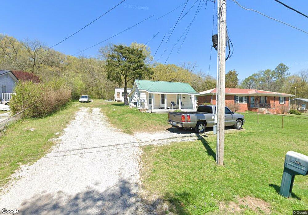
1011 E 1st St Russellville, KY 42276
Estimated Value: $47,000 - $63,157
1
Bed
1
Bath
598
Sq Ft
$95/Sq Ft
Est. Value
About This Home
This home is located at 1011 E 1st St, Russellville, KY 42276 and is currently estimated at $56,539, approximately $94 per square foot. 1011 E 1st St is a home located in Logan County with nearby schools including Russellville Primary Academy, R.E. Stevenson Elementary School, and Russellville Middle School.
Ownership History
Date
Name
Owned For
Owner Type
Purchase Details
Closed on
Dec 5, 2023
Sold by
Dossett Jonathan and Dossett Carol Ann
Bought by
Townview Properties Llc
Current Estimated Value
Purchase Details
Closed on
Apr 14, 2020
Sold by
Sweatt Lucille E
Bought by
T 6 Properties Llc
Home Financials for this Owner
Home Financials are based on the most recent Mortgage that was taken out on this home.
Original Mortgage
$13,236
Interest Rate
3.2%
Mortgage Type
Future Advance Clause Open End Mortgage
Create a Home Valuation Report for This Property
The Home Valuation Report is an in-depth analysis detailing your home's value as well as a comparison with similar homes in the area
Home Values in the Area
Average Home Value in this Area
Purchase History
| Date | Buyer | Sale Price | Title Company |
|---|---|---|---|
| Townview Properties Llc | -- | Clark Title | |
| T 6 Properties Llc | $14,500 | None Available |
Source: Public Records
Mortgage History
| Date | Status | Borrower | Loan Amount |
|---|---|---|---|
| Previous Owner | T 6 Properties Llc | $13,236 |
Source: Public Records
Tax History Compared to Growth
Tax History
| Year | Tax Paid | Tax Assessment Tax Assessment Total Assessment is a certain percentage of the fair market value that is determined by local assessors to be the total taxable value of land and additions on the property. | Land | Improvement |
|---|---|---|---|---|
| 2025 | $340 | $28,000 | $5,000 | $23,000 |
| 2024 | $315 | $25,000 | $5,000 | $20,000 |
| 2023 | $316 | $25,000 | $5,000 | $20,000 |
| 2022 | $315 | $25,000 | $5,000 | $20,000 |
| 2021 | $320 | $25,000 | $5,000 | $20,000 |
| 2020 | $0 | $26,000 | $5,000 | $21,000 |
| 2019 | $179 | $26,000 | $5,000 | $21,000 |
| 2018 | $0 | $26,000 | $5,000 | $21,000 |
| 2017 | -- | $26,000 | $5,000 | $21,000 |
| 2016 | -- | $15,000 | $0 | $0 |
| 2015 | $179 | $15,000 | $15,000 | $0 |
| 2012 | $179 | $15,000 | $0 | $0 |
Source: Public Records
Map
Nearby Homes
- 108 Lot E Bowden St
- 112 Lot D Bowden St
- 708 E 3rd St
- 587 E 7th St
- 125 N Spring St
- 0 Karis Dr Unit Lot 58 Stonewall Sub
- 604 E 8th St
- 500 Dockins St
- 35 Long Ave
- 105 Madeline Ct
- 121 Madeline Ct
- 113 Madeline Ct
- 117 Madeline Ct
- 137 Fairfield Dr
- 116 Madeline Ct
- 127 Madeline Ct
- 123 Madeline Ct
- 130 Madeline Ct
- 107 Madeline Ct
- 164 E 6th St
- 1013 Stevenson Mill Rd
- 1009 E 1st St
- 1101 E 1st St
- 101 Mcarthur St
- 100 Mcarthur St
- 1005 E 1st St
- 100 Lincoln St
- 101 Clinton St
- 103 Mcarthur St
- 102 Mcarthur St
- 1003 E 1st St
- 1502 Pin Oak Dr
- 1502 Pin Oak Dr Unit Pin Oak Dr
- 102 Lincoln St
- 101 Lincoln St
- 103 Clinton St
- 105 Mcarthur St
- 104 Mcarthur St
- 104 Lincoln St
- 1001 E 1st St