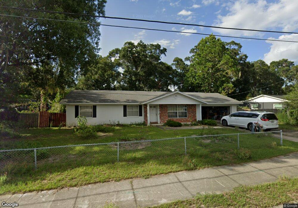
1011 E University Ave Deland, FL 32724
Estimated Value: $286,256 - $343,000
3
Beds
2
Baths
1,918
Sq Ft
$163/Sq Ft
Est. Value
About This Home
This home is located at 1011 E University Ave, Deland, FL 32724 and is currently estimated at $312,064, approximately $162 per square foot. 1011 E University Ave is a home located in Volusia County with nearby schools including Deland High School, Blue Lake Elementary School, and Deland Middle School.
Ownership History
Date
Name
Owned For
Owner Type
Purchase Details
Closed on
Jan 15, 2025
Sold by
David Allen Stock Trust and Stock David Allen
Bought by
David Allen Stock Trust and Stock
Current Estimated Value
Purchase Details
Closed on
Jun 13, 2013
Sold by
Stock David Allen
Bought by
Stock David Allen and The David Allen Stock Trust
Purchase Details
Closed on
Mar 17, 1997
Sold by
Gardner Joyce Ann and Stock Joyce A
Bought by
Stock David Allen
Purchase Details
Closed on
Apr 15, 1973
Bought by
Stock David Allen
Create a Home Valuation Report for This Property
The Home Valuation Report is an in-depth analysis detailing your home's value as well as a comparison with similar homes in the area
Home Values in the Area
Average Home Value in this Area
Purchase History
| Date | Buyer | Sale Price | Title Company |
|---|---|---|---|
| David Allen Stock Trust | $100 | None Listed On Document | |
| David Allen Stock Trust | $100 | None Listed On Document | |
| Stock David Allen | -- | Attorney | |
| Stock David Allen | $20,000 | -- | |
| Stock David Allen | $35,400 | -- |
Source: Public Records
Tax History Compared to Growth
Tax History
| Year | Tax Paid | Tax Assessment Tax Assessment Total Assessment is a certain percentage of the fair market value that is determined by local assessors to be the total taxable value of land and additions on the property. | Land | Improvement |
|---|---|---|---|---|
| 2025 | $825 | $91,983 | -- | -- |
| 2024 | $825 | $89,391 | -- | -- |
| 2023 | $825 | $86,788 | $0 | $0 |
| 2022 | $791 | $84,260 | $0 | $0 |
| 2021 | $798 | $81,806 | $0 | $0 |
| 2020 | $780 | $80,677 | $0 | $0 |
| 2019 | $775 | $78,863 | $0 | $0 |
| 2018 | $774 | $77,393 | $0 | $0 |
| 2017 | $765 | $75,801 | $0 | $0 |
| 2016 | $740 | $74,242 | $0 | $0 |
| 2015 | $764 | $73,726 | $0 | $0 |
| 2014 | $777 | $73,141 | $0 | $0 |
Source: Public Records
Map
Nearby Homes
- 1100 E University Ave
- 1007 Crescent Pkwy
- 1005 Crescent Pkwy
- 1235 E Minnesota Ave
- 527 Land O Lakes Ct
- 405 N McDonald Ave
- 401 N McDonald Ave
- 753 Mystic Oaks Ln
- 418 Berwick Cir
- 714 Astoria Dr
- 851 E Pennsylvania Ave
- 811 Grand Park Ct
- 907 Marlboro Dr
- 706 E Minnesota Ave Unit C
- 818 Eastover Cir
- 733 E Ohio Ave
- 915 Marlboro Dr
- 437 N Boston Ave Unit 437
- 241 N Hill Ave
- 183 N Hill Ave Unit 90
- 1015 E University Ave
- 1002 Crescent Pkwy
- 1004 Crescent Pkwy
- 1000 E University Ave
- 1030 E University Ave
- 1027 E University Ave
- 1000 Crescent Pkwy
- 939 E University Ave
- 1006 Crescent Pkwy
- 527 Camelia Ln
- 910 Crescent Pkwy
- 522 Holly Ln
- 532 Camelia Ln
- 1008 Crescent Pkwy
- 1033 E University Ave
- 933 E University Ave
- 521 Camelia Ln
- 1003 Crescent Pkwy
- 526 Camelia Ln