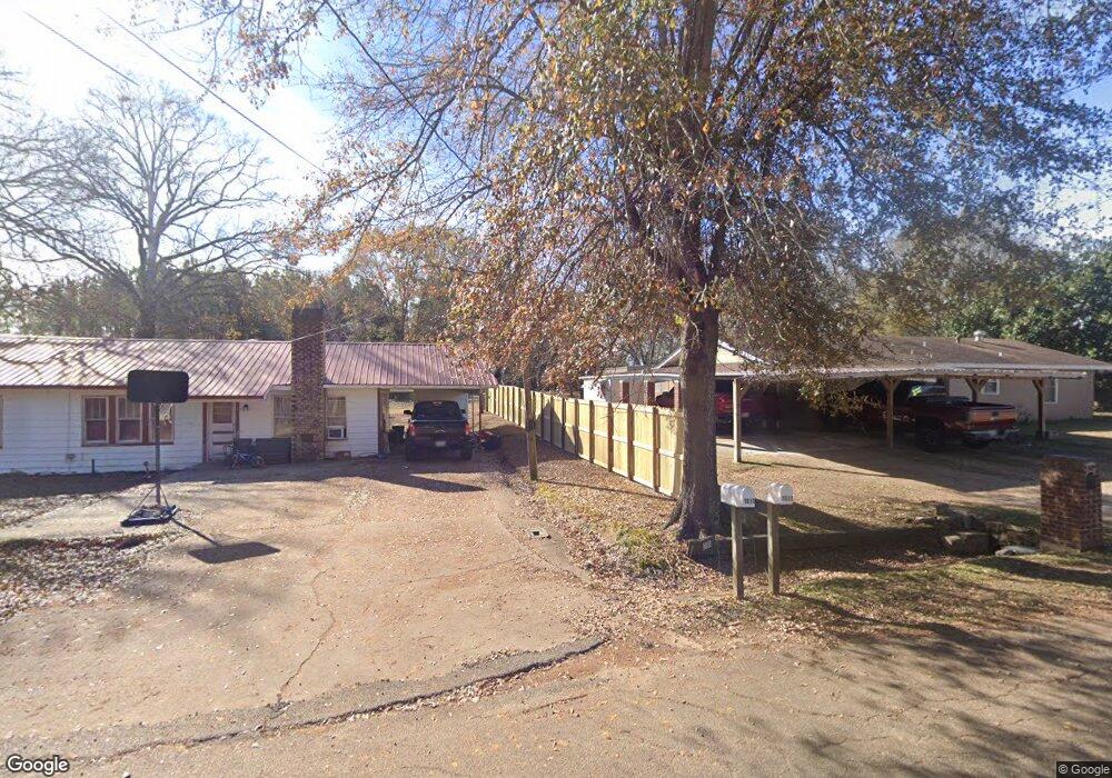
1011 Graves St Bernice, LA 71222
Estimated Value: $62,000 - $83,000
3
Beds
2
Baths
1,440
Sq Ft
$52/Sq Ft
Est. Value
About This Home
This home is located at 1011 Graves St, Bernice, LA 71222 and is currently estimated at $74,172, approximately $51 per square foot. 1011 Graves St is a home located in Union Parish with nearby schools including Union Parish 6th Grade Center.
Ownership History
Date
Name
Owned For
Owner Type
Purchase Details
Closed on
Apr 18, 2016
Sold by
Rodriguez Demetrio T and Rodriguez Sara Gutierrez
Bought by
Rodriguez Marcos and Zuniga Araceli
Current Estimated Value
Purchase Details
Closed on
Jun 30, 2008
Sold by
Wiltcher Doris Thomas and Thompson Charolette Wiltcher
Bought by
Rodriguez Demetrio T and Rodriguez Sara Gutierrez
Home Financials for this Owner
Home Financials are based on the most recent Mortgage that was taken out on this home.
Original Mortgage
$150,000
Interest Rate
6.11%
Mortgage Type
Credit Line Revolving
Create a Home Valuation Report for This Property
The Home Valuation Report is an in-depth analysis detailing your home's value as well as a comparison with similar homes in the area
Purchase History
| Date | Buyer | Sale Price | Title Company |
|---|---|---|---|
| Rodriguez Marcos | $33,245 | None Available | |
| Rodriguez Demetrio T | $54,000 | None Available |
Source: Public Records
Mortgage History
| Date | Status | Borrower | Loan Amount |
|---|---|---|---|
| Previous Owner | Rodriguez Demetrio T | $150,000 |
Source: Public Records
Tax History
| Year | Tax Paid | Tax Assessment Tax Assessment Total Assessment is a certain percentage of the fair market value that is determined by local assessors to be the total taxable value of land and additions on the property. | Land | Improvement |
|---|---|---|---|---|
| 2025 | $256 | $3,066 | $275 | $2,791 |
| 2024 | $17 | $3,067 | $275 | $2,792 |
| 2023 | $18 | $3,380 | $385 | $2,995 |
| 2022 | $63 | $3,380 | $385 | $2,995 |
| 2021 | $48 | $3,380 | $385 | $2,995 |
| 2020 | $48 | $3,380 | $385 | $2,995 |
| 2019 | $46 | $3,697 | $605 | $3,092 |
| 2018 | $46 | $3,697 | $605 | $3,092 |
| 2017 | $40 | $3,697 | $605 | $3,092 |
| 2016 | -- | $3,697 | $605 | $3,092 |
| 2015 | -- | $3,996 | $400 | $3,596 |
| 2014 | -- | $4,000 | $400 | $3,600 |
| 2013 | $282 | $4,000 | $400 | $3,600 |
Source: Public Records
Map
Nearby Homes
- 501 Elm St
- 0 lot 1 Elm St
- 118 Maple St
- 209 Cherry St
- 000 U S Highway 167 Unit South of Bernice
- Pisqoh Church Rd
- L Albritton Rd
- 000 Double Bridges Rd Unit 2.2
- 00 Jones Crossing Rd
- 999 Double Bridges Rd
- 16294 Highway 2
- 000 William Colvin Rd
- 000 Parish Line Rd Unit 2.2
- 000 Parish Line Rd Unit 4.4
- 0 Cook Unit 20968203
- 321 William Colvin Rd
- 0 Nick Creek
- 116 Tuff St
- Nick Creek Rd
- 00 Hico Loop Rd
- 1009 Graves St
- 1015 Graves St
- 1106 Louisiana Ave
- 1109 Louisiana Ave
- 303 Willis Reed St
- 408 Willis Reed St
- 114 Willis Reed St
- 1271 Robert Welch Rd
- 1004 Louisiana Ave
- 223 Oak St
- 206 Willis Reed St
- 207 Walnut St
- 210 Walnut St
- 206 Walnut St
- 1110 Graves St
- 1116 Graves St
- 1112 Graves St
- 1114 Graves St
- 1106 Graves St
- 209 Walnut St