Estimated Value: $117,833 - $129,000
3
Beds
1
Bath
1,472
Sq Ft
$84/Sq Ft
Est. Value
About This Home
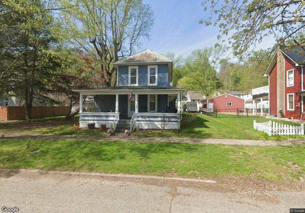
This home is located at 1011 High St N, Malta, OH 43758 and is currently estimated at $123,708, approximately $84 per square foot. 1011 High St N is a home with nearby schools including Morgan High School.
Ownership History
Date
Name
Owned For
Owner Type
Purchase Details
Closed on
May 29, 2024
Sold by
Rucker Alicia Rae and Collins Addy Marie
Bought by
Mccoy Thomas A and Mccoy Kelly B
Current Estimated Value
Purchase Details
Closed on
Jun 11, 2020
Sold by
Mccoy Thomas and Mccoy Kelly B
Bought by
Rucker Alicia Rae and Collins Addy Marie
Purchase Details
Closed on
Feb 24, 2012
Sold by
White Kevin L
Bought by
Mccoy Thomas A and Mccoy Kelly B
Home Financials for this Owner
Home Financials are based on the most recent Mortgage that was taken out on this home.
Original Mortgage
$42,910
Interest Rate
4.01%
Mortgage Type
Future Advance Clause Open End Mortgage
Purchase Details
Closed on
Sep 27, 2010
Bought by
White Kevin L
Purchase Details
Closed on
Feb 8, 2010
Bought by
White Virgil L
Purchase Details
Closed on
Feb 1, 1988
Purchase Details
Closed on
Feb 1, 1985
Create a Home Valuation Report for This Property
The Home Valuation Report is an in-depth analysis detailing your home's value as well as a comparison with similar homes in the area
Purchase History
We collect this data history from publicly available records. To have your information removed, we recommend requesting removal directly through your county’s website.
| Date | Buyer | Sale Price | Title Company |
|---|---|---|---|
| Mccoy Thomas A | -- | None Listed On Document | |
| Mccoy Thomas A | -- | None Listed On Document | |
| Rucker Alicia Rae | -- | None Available | |
| Mccoy Thomas A | $54,000 | None Available | |
| White Kevin L | -- | -- | |
| White Virgil L | -- | -- | |
| -- | $39,000 | -- | |
| -- | $23,500 | -- |
Source: Public Records
Mortgage History
We collect this data history from publicly available records. To have your information removed, we recommend requesting removal directly through your county’s website.
| Date | Status | Borrower | Loan Amount |
|---|---|---|---|
| Previous Owner | Mccoy Thomas A | $42,910 |
Source: Public Records
Tax History
| Year | Tax Paid | Tax Assessment Tax Assessment Total Assessment is a certain percentage of the fair market value that is determined by local assessors to be the total taxable value of land and additions on the property. | Land | Improvement |
|---|---|---|---|---|
| 2025 | $944 | $28,010 | $4,610 | $23,400 |
| 2024 | $944 | $28,010 | $4,610 | $23,400 |
| 2023 | $946 | $20,940 | $3,720 | $17,220 |
| 2022 | $715 | $20,940 | $3,720 | $17,220 |
| 2021 | $723 | $20,980 | $3,720 | $17,260 |
| 2019 | $681 | $19,280 | $3,380 | $15,900 |
| 2018 | $657 | $19,280 | $3,380 | $15,900 |
| 2017 | $634 | $18,124 | $2,986 | $15,138 |
| 2016 | $636 | $18,124 | $2,986 | $15,138 |
| 2015 | $636 | $18,159 | $2,986 | $15,173 |
| 2014 | $654 | $18,159 | $2,986 | $15,173 |
| 2013 | $649 | $18,159 | $2,986 | $15,173 |
Source: Public Records
Map
Nearby Homes
- 1111 Echo St N
- 102 8th St
- 0 Echo Hill Rd
- 95 Sunset Dr
- 4118 N State Route 669 NW
- 246 N 5th St
- 262 N 5th St
- 3940 Wedgewood Dr
- 160 S Main St
- 284 N Kennebec Ave
- Parcel 5 Ohio 376
- 456 N 8th St
- 274 N 8th St
- 437 N 8th St
- 4360 State Route 37
- 4360 Ohio 37
- 0 N Hill Ln NE
- 5980 Ohio 60
- 0 Upper Douda Rd Unit 225030416
- 6341 Ohio 669
Your Personal Tour Guide
Ask me questions while you tour the home.