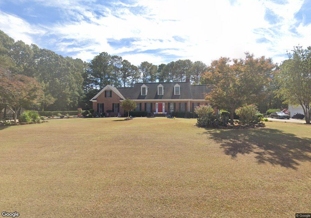
1011 Jimson Dr SE Conyers, GA 30013
Estimated Value: $322,000 - $578,000
4
Beds
4
Baths
3,784
Sq Ft
$114/Sq Ft
Est. Value
About This Home
This home is located at 1011 Jimson Dr SE, Conyers, GA 30013 and is currently estimated at $432,169, approximately $114 per square foot. 1011 Jimson Dr SE is a home located in Rockdale County with nearby schools including Flat Shoals Elementary School, Memorial Middle School, and Rockdale County High School.
Ownership History
Date
Name
Owned For
Owner Type
Purchase Details
Closed on
Jun 15, 2011
Sold by
Jones Cheryl E and Jones Thomas O
Bought by
Narchet Solange
Current Estimated Value
Home Financials for this Owner
Home Financials are based on the most recent Mortgage that was taken out on this home.
Original Mortgage
$151,500
Outstanding Balance
$103,157
Interest Rate
4.37%
Mortgage Type
FHA
Estimated Equity
$329,012
Create a Home Valuation Report for This Property
The Home Valuation Report is an in-depth analysis detailing your home's value as well as a comparison with similar homes in the area
Home Values in the Area
Average Home Value in this Area
Purchase History
| Date | Buyer | Sale Price | Title Company |
|---|---|---|---|
| Narchet Solange | $190,000 | -- |
Source: Public Records
Mortgage History
| Date | Status | Borrower | Loan Amount |
|---|---|---|---|
| Open | Narchet Solange | $151,500 |
Source: Public Records
Tax History Compared to Growth
Tax History
| Year | Tax Paid | Tax Assessment Tax Assessment Total Assessment is a certain percentage of the fair market value that is determined by local assessors to be the total taxable value of land and additions on the property. | Land | Improvement |
|---|---|---|---|---|
| 2024 | $3,417 | $164,200 | $39,400 | $124,800 |
| 2023 | $3,820 | $157,920 | $35,240 | $122,680 |
| 2022 | $3,650 | $151,280 | $35,240 | $116,040 |
| 2021 | $3,058 | $120,280 | $25,200 | $95,080 |
| 2020 | $2,862 | $109,160 | $24,560 | $84,600 |
| 2019 | $2,515 | $95,560 | $15,000 | $80,560 |
| 2018 | $2,531 | $95,560 | $15,000 | $80,560 |
| 2017 | $2,233 | $85,000 | $15,000 | $70,000 |
| 2016 | $1,785 | $75,360 | $15,880 | $59,480 |
| 2015 | $1,860 | $77,840 | $15,880 | $61,960 |
| 2014 | $3,507 | $75,360 | $13,400 | $61,960 |
| 2013 | -- | $76,000 | $18,974 | $57,025 |
Source: Public Records
Map
Nearby Homes
- 1019 Henna Ct SE
- 2474 Harvest Dr SE
- 1242 Saxony Dr SE
- 1402 Aramore Dr SE
- 2197 Boxwood Cir
- 1180 Azalea Cir SE
- Astrid Plan at Alder Park
- Harrison Plan at Alder Park
- Baker Plan at Alder Park
- Oliver Plan at Alder Park
- 2464 Lennox Rd SE
- Boston Plan at Millers Pointe
- Atlanta Plan at Millers Pointe
- Columbus Plan at Millers Pointe
- 2165 Old Salem Rd SE
- 2684 Harvest Dr SE
- 1260 Sweet Shrub Ln SE
- 2259 Old Salem Rd SE
- 2608 Downing Park Dr SE
- 2561 Old Salem Cir SE
- 1001 Jimson Dr SE
- 1021 Jimson Dr SE
- 0 Jimson Dr SE Unit 7203546
- 0 Jimson Dr SE
- 1040 Vineyard Dr SE
- 992 Jimson Dr SE Unit 5
- 1058 Vineyard Dr SE
- 991 Jimson Dr SE
- 1031 Jimson Dr SE Unit 5
- 1022 Vineyard Dr SE
- 1023 Henna Ct SE
- 982 Jimson Dr SE
- 1074 Vineyard Dr SE
- 1015 Henna Ct SE
- 1012 Jimson Dr SE Unit 5
- 1004 Vineyard Dr SE
- 1041 Jimson Dr SE
- 0 Vineyard Dr SE Unit 8684204
- 0 Vineyard Dr SE Unit 8440147
- 0 Vineyard Dr SE Unit 8569889