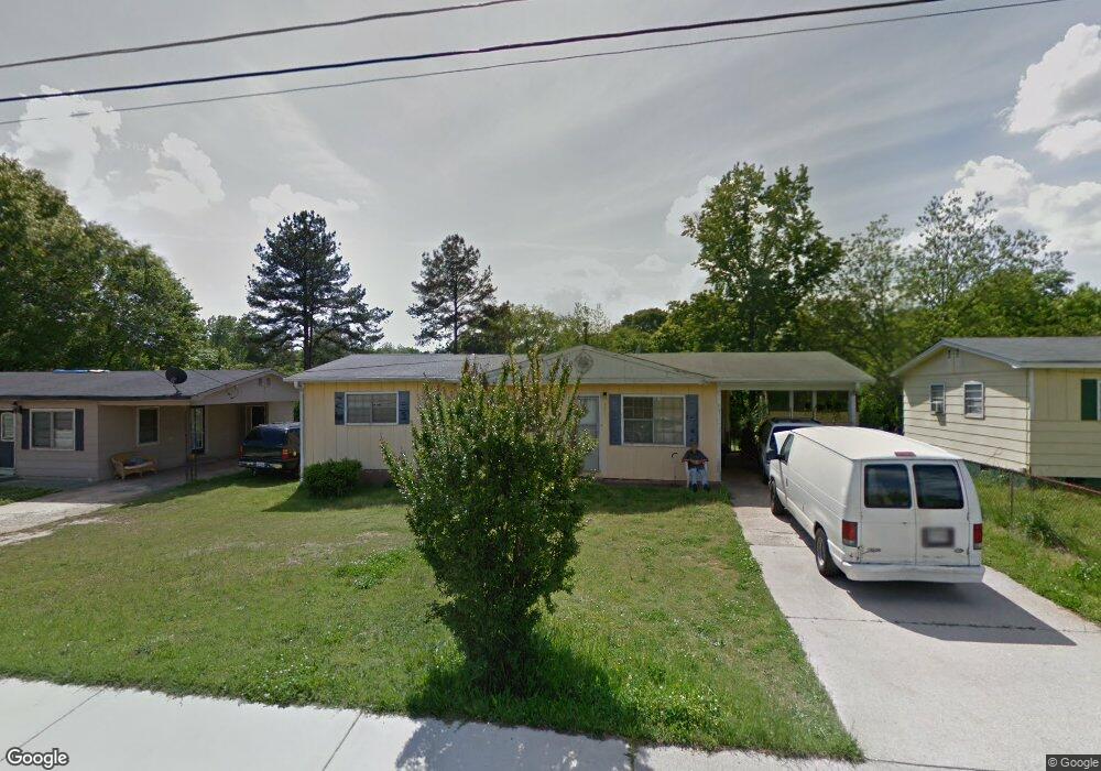
1011 Maxham Rd Austell, GA 30168
Estimated Value: $123,000 - $233,000
3
Beds
1
Bath
1,056
Sq Ft
$183/Sq Ft
Est. Value
About This Home
This home is located at 1011 Maxham Rd, Austell, GA 30168 and is currently estimated at $193,474, approximately $183 per square foot. 1011 Maxham Rd is a home located in Cobb County with nearby schools including Austell Elementary School, Garrett Middle School, and South Cobb High School.
Ownership History
Date
Name
Owned For
Owner Type
Purchase Details
Closed on
Jun 27, 2024
Sold by
Key Sara K and Key Roy G
Bought by
Lackey Jacqueline Paulette and Lackey Joseph Allen
Current Estimated Value
Purchase Details
Closed on
Jul 12, 2018
Sold by
Key Sara K
Bought by
Lackey Jacqueline Paulette
Purchase Details
Closed on
Jan 30, 2006
Sold by
Key Mary J
Bought by
Key Sara K and Key Roy G
Home Financials for this Owner
Home Financials are based on the most recent Mortgage that was taken out on this home.
Original Mortgage
$54,000
Interest Rate
10.5%
Mortgage Type
New Conventional
Create a Home Valuation Report for This Property
The Home Valuation Report is an in-depth analysis detailing your home's value as well as a comparison with similar homes in the area
Home Values in the Area
Average Home Value in this Area
Purchase History
| Date | Buyer | Sale Price | Title Company |
|---|---|---|---|
| Lackey Jacqueline Paulette | -- | None Listed On Document | |
| Lackey Jacqueline Paulette | $48,000 | -- | |
| Key Sara K | -- | -- | |
| Key Mary J | -- | -- |
Source: Public Records
Mortgage History
| Date | Status | Borrower | Loan Amount |
|---|---|---|---|
| Previous Owner | Key Mary J | $54,000 |
Source: Public Records
Tax History
| Year | Tax Paid | Tax Assessment Tax Assessment Total Assessment is a certain percentage of the fair market value that is determined by local assessors to be the total taxable value of land and additions on the property. | Land | Improvement |
|---|---|---|---|---|
| 2025 | $2,204 | $81,136 | $18,000 | $63,136 |
| 2024 | $2,204 | $81,136 | $18,000 | $63,136 |
| 2023 | $2,204 | $81,136 | $18,000 | $63,136 |
Source: Public Records
Map
Nearby Homes
- 2173 Apple Orchard Way
- 1138 Pontiac Cir Unit 23
- 6083 Oak Hill Dr
- 2090 Old Alabama Rd
- 1045 Elowen Dr
- 1155 Elowen Dr
- 3023 Creekside Overlook Way
- 2414 Old Alabama Rd
- 5790 Maxham Rd
- 110 Creekway Dr
- 2390 Ravencliff Dr Unit 140
- 2390 Ravencliff Dr
- 2370 Ravencliff Dr
- 2370 Ravencliff Dr Unit 138
- 2360 Ravencliff Dr Unit 137
- 2360 Ravencliff Dr
- 2310 Ravencliff Dr
- 6182 Grove Crest Way Unit 3
- 2115 Venesa Cir
- 1984 Brenda Dr
- 1009 Maxham Rd
- 1013 Maxham Rd
- 1007 Maxham Rd
- 6157 Glade Ct Unit 90
- 6157 Glade Ct
- 6163 Glade Ct Unit 91
- 6163 Glade Ct
- 1210 Hiawatha Ln
- 1208 Hiawatha Ln
- 1005 Maxham Rd
- 1212 Hiawatha Ln
- 1214 Hiawatha Ln
- 1017 Maxham Rd
- 1216 Hiawatha Ln
- 6151 Glade Ct Unit 89
- 6151 Glade Ct
- 1206 Hiawatha Ln
- 1003 Maxham Rd
- 1019 Maxham Rd
- 6145 Glade Ct Unit 88
Your Personal Tour Guide
Ask me questions while you tour the home.