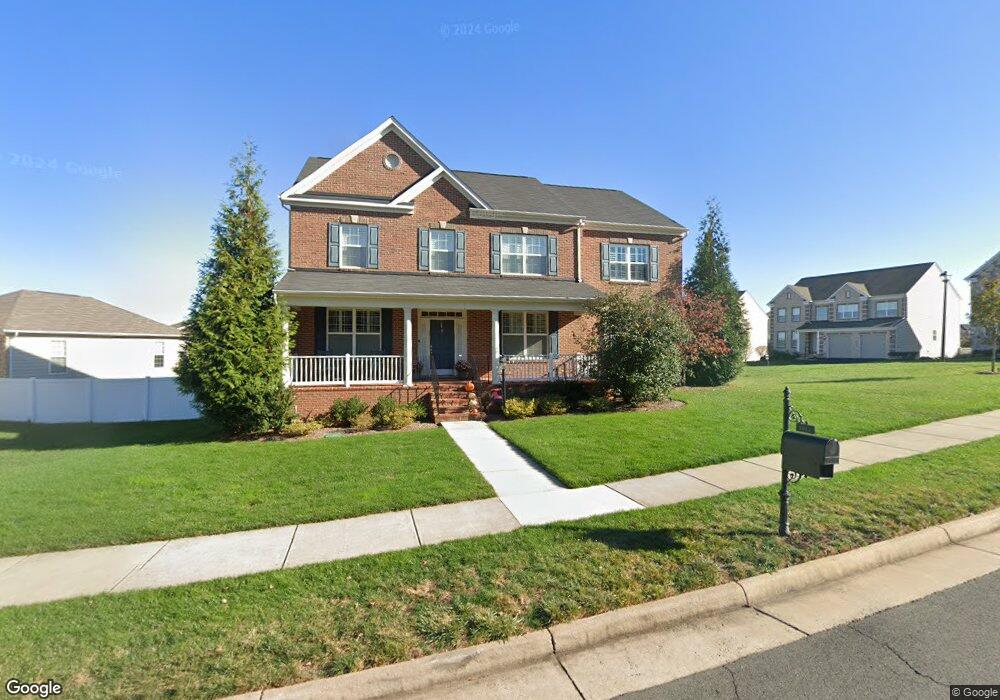
1011 Menlow Dr NE Leesburg, VA 20176
Estimated Value: $1,183,000 - $1,346,000
4
Beds
5
Baths
4,057
Sq Ft
$313/Sq Ft
Est. Value
About This Home
This home is located at 1011 Menlow Dr NE, Leesburg, VA 20176 and is currently estimated at $1,269,029, approximately $312 per square foot. 1011 Menlow Dr NE is a home located in Loudoun County with nearby schools including John W. Tolbert Jr. Elementary School, Harper Park Middle School, and Heritage High School.
Ownership History
Date
Name
Owned For
Owner Type
Purchase Details
Closed on
Sep 25, 2015
Sold by
Gtis & Hov Festival Lakes Llc
Bought by
Cowan Charles D and Cowan Donna M
Current Estimated Value
Home Financials for this Owner
Home Financials are based on the most recent Mortgage that was taken out on this home.
Original Mortgage
$553,050
Outstanding Balance
$436,459
Interest Rate
3.97%
Mortgage Type
New Conventional
Estimated Equity
$832,570
Create a Home Valuation Report for This Property
The Home Valuation Report is an in-depth analysis detailing your home's value as well as a comparison with similar homes in the area
Home Values in the Area
Average Home Value in this Area
Purchase History
| Date | Buyer | Sale Price | Title Company |
|---|---|---|---|
| Cowan Charles D | $691,365 | None Available |
Source: Public Records
Mortgage History
| Date | Status | Borrower | Loan Amount |
|---|---|---|---|
| Open | Cowan Charles D | $553,050 |
Source: Public Records
Tax History Compared to Growth
Tax History
| Year | Tax Paid | Tax Assessment Tax Assessment Total Assessment is a certain percentage of the fair market value that is determined by local assessors to be the total taxable value of land and additions on the property. | Land | Improvement |
|---|---|---|---|---|
| 2025 | $9,504 | $1,180,570 | $300,500 | $880,070 |
| 2024 | $9,570 | $1,106,370 | $300,500 | $805,870 |
| 2023 | $9,603 | $1,097,470 | $300,500 | $796,970 |
| 2022 | $8,473 | $951,990 | $230,500 | $721,490 |
| 2021 | $8,230 | $839,760 | $205,500 | $634,260 |
| 2020 | $8,305 | $802,370 | $180,500 | $621,870 |
| 2019 | $8,143 | $779,250 | $180,500 | $598,750 |
| 2018 | $7,733 | $712,720 | $180,500 | $532,220 |
| 2017 | $7,859 | $698,620 | $180,500 | $518,120 |
| 2016 | $7,937 | $693,170 | $0 | $0 |
| 2015 | $330 | $0 | $0 | $0 |
| 2014 | $358 | $0 | $0 | $0 |
Source: Public Records
Map
Nearby Homes
- 1740 Moultrie Terrace NE
- 1707 Taymount Terrace NE
- 706 Invermere Dr NE
- 1787 Moultrie Terrace NE
- 851 Valemount Terrace NE
- 1008 Galena Terrace NE
- 18483 Wide Meadow Square
- 750 Mount Airy Terrace NE Unit 304
- 750 Mount Airy Terrace NE Unit 403
- 750 Mount Airy Terrace NE Unit 206
- 750 Mount Airy Terrace NE Unit 205
- 750 Mount Airy Terrace NE Unit 402
- 750 Mount Airy Terrace NE Unit 104
- 700 Mount Airy Terrace NE Unit 405
- 700 Mount Airy Terrace NE Unit 403
- 700 Mount Airy Terrace NE Unit 104
- 700 Mount Airy Terrace NE Unit 302
- 817 Sawback Square NE
- 18415 Rim Rock Cir
- 18389 Sugar Snap Cir
- 1015 Menlow Dr NE
- 1308 Tenaya Way NE
- 1303 Tenaya Way NE
- 1301 Tenaya Way NE
- 1008 Menlow Dr NE
- 1019 Menlow Dr NE
- 1010 Menlow Dr NE
- 1305 Tenaya Way NE
- 1012 Menlow Dr NE
- 1006 Menlow Dr NE
- 1014 Menlow Dr NE
- 1310 Tenaya Way NE
- 1004 Menlow Dr NE
- 1016 Menlow Dr NE
- 1021 Menlow Dr NE Unit BASEMENT
- 1021 Menlow Dr NE
- 1309 Tenaya Way NE
- 1003 Menlow Dr NE
- 1018 Menlow Dr NE
- 1002 Menlow Dr NE