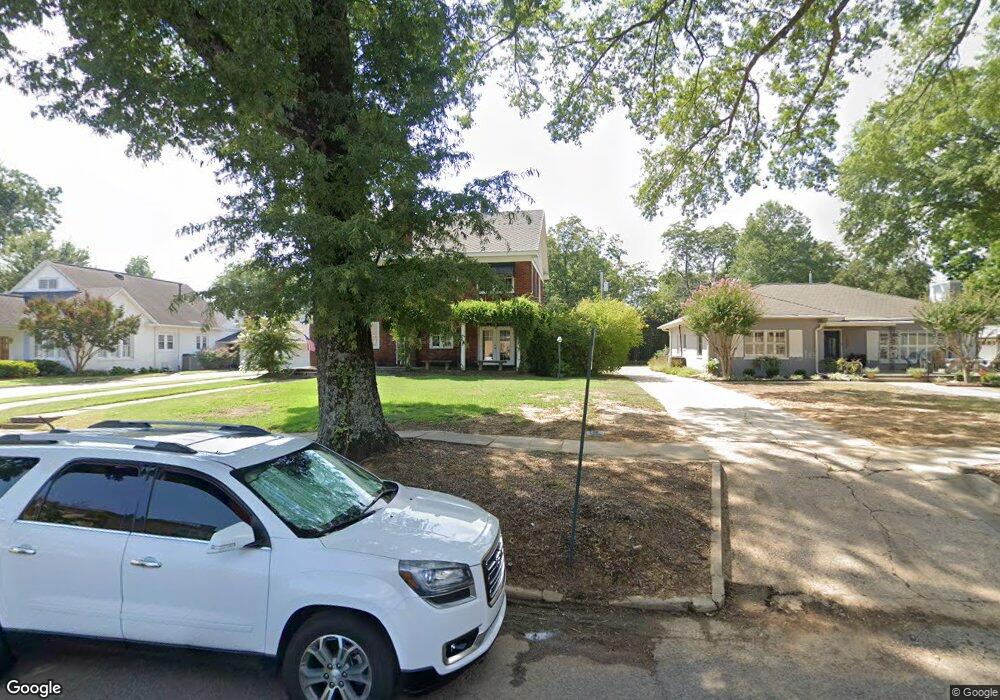
1011 Mitchell St Conway, AR 72034
Downtown Conway NeighborhoodEstimated Value: $365,381 - $497,000
5
Beds
3
Baths
3,077
Sq Ft
$142/Sq Ft
Est. Value
About This Home
This home is located at 1011 Mitchell St, Conway, AR 72034 and is currently estimated at $436,095, approximately $141 per square foot. 1011 Mitchell St is a home located in Faulkner County with nearby schools including Ida Burns Elementary School, Conway Junior High School, and Ruth Doyle Intermediate School.
Ownership History
Date
Name
Owned For
Owner Type
Purchase Details
Closed on
Mar 30, 2010
Sold by
Bmh Llc
Bought by
Irby Darren
Current Estimated Value
Home Financials for this Owner
Home Financials are based on the most recent Mortgage that was taken out on this home.
Original Mortgage
$260,200
Outstanding Balance
$170,462
Interest Rate
4.75%
Mortgage Type
FHA
Estimated Equity
$265,633
Purchase Details
Closed on
Jul 31, 2007
Bought by
Bmh, Llc
Purchase Details
Closed on
Jul 27, 2007
Bought by
Bmh, Llc
Purchase Details
Closed on
Apr 19, 2006
Bought by
Jumper
Purchase Details
Closed on
Apr 14, 2006
Bought by
Jumper
Purchase Details
Closed on
Jul 9, 2003
Bought by
Jumper
Purchase Details
Closed on
Jun 2, 2003
Bought by
Jumper
Create a Home Valuation Report for This Property
The Home Valuation Report is an in-depth analysis detailing your home's value as well as a comparison with similar homes in the area
Home Values in the Area
Average Home Value in this Area
Purchase History
| Date | Buyer | Sale Price | Title Company |
|---|---|---|---|
| Irby Darren | $265,000 | -- | |
| Bmh, Llc | $260,000 | -- | |
| Bmh, Llc | $260,000 | -- | |
| Jumper | -- | -- | |
| Jumper | -- | -- | |
| Jumper | -- | -- | |
| Jumper | -- | -- |
Source: Public Records
Mortgage History
| Date | Status | Borrower | Loan Amount |
|---|---|---|---|
| Open | Irby Darren | $260,200 |
Source: Public Records
Tax History
| Year | Tax Paid | Tax Assessment Tax Assessment Total Assessment is a certain percentage of the fair market value that is determined by local assessors to be the total taxable value of land and additions on the property. | Land | Improvement |
|---|---|---|---|---|
| 2025 | $2,651 | $78,150 | $5,000 | $73,150 |
| 2024 | $2,531 | $78,150 | $5,000 | $73,150 |
| 2023 | $2,411 | $50,670 | $5,000 | $45,670 |
| 2022 | $1,931 | $50,670 | $5,000 | $45,670 |
| 2021 | $1,826 | $50,670 | $5,000 | $45,670 |
| 2020 | $1,721 | $41,430 | $5,000 | $36,430 |
| 2019 | $1,721 | $41,430 | $5,000 | $36,430 |
| 2018 | $1,746 | $41,430 | $5,000 | $36,430 |
| 2017 | $1,746 | $41,430 | $5,000 | $36,430 |
| 2016 | $1,746 | $41,430 | $5,000 | $36,430 |
| 2015 | $2,341 | $46,270 | $5,000 | $41,270 |
| 2014 | $1,991 | $46,270 | $5,000 | $41,270 |
Source: Public Records
Map
Nearby Homes
- 2005 Weems St
- 839 Watkins St
- 1069 Donaghey Ave
- 1621 Prince St
- 846 Donaghey Ave
- 0 Lee Ave
- 1934 Lee Ave
- 1220 & 1221 Ash St
- 1130 Clifton St
- 819 & 821 Center St
- 1150 Clifton St
- 1916 Johnston Ave
- 1834 Johnston Ave
- 1815 Scott St
- 1415 Watkins St
- 2207 Independence Ave
- 1936 College Ave
- 2007 Arkansas Ave
- 1535 Clifton St
- 00 Third Ave
- 1003 Mitchell St
- 1019 Mitchell St
- 1916 Prince St
- 1025 Mitchell St
- 1926 Prince St
- 1033 Mitchell St
- 1041 Mitchell St
- 1913 Duncan St
- 1936 Prince St
- 1925 Prince St
- 1917 Duncan St
- 1921 Duncan St
- 1010 Watkins St
- 1925 Duncan St
- 1940 Prince St
- 1022 Watkins St
- 1927 Prince St
- 1931 Duncan St
- 1921 Prince St
- 1935 Duncan St
Your Personal Tour Guide
Ask me questions while you tour the home.