Estimated Value: $135,000 - $148,000
2
Beds
1
Bath
1,121
Sq Ft
$126/Sq Ft
Est. Value
About This Home
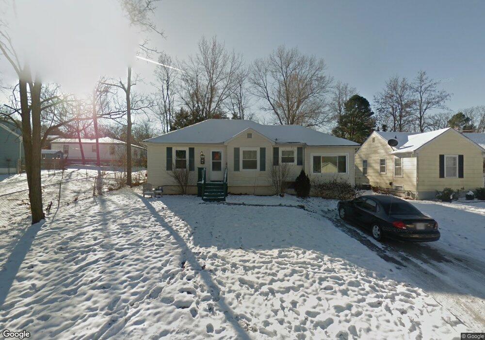
This home is located at 1011 Morrell Ave, Rolla, MO 65401 and is currently estimated at $141,202, approximately $125 per square foot. 1011 Morrell Ave is a home located in Phelps County with nearby schools including Rolla Junior High School, Rolla Senior High School, and Immanuel Lutheran School.
Ownership History
Date
Name
Owned For
Owner Type
Purchase Details
Closed on
Aug 29, 2025
Sold by
Reno & Ridge Burrell Rentals L
Bought by
Ratliff Development Llc
Current Estimated Value
Home Financials for this Owner
Home Financials are based on the most recent Mortgage that was taken out on this home.
Original Mortgage
$405,000
Outstanding Balance
$401,898
Interest Rate
0.56%
Mortgage Type
Construction
Estimated Equity
-$260,696
Purchase Details
Closed on
Jun 1, 2015
Purchase Details
Closed on
Jun 27, 2003
Purchase Details
Closed on
May 4, 2000
Purchase Details
Closed on
Dec 7, 1995
Purchase Details
Closed on
Jun 10, 1991
Purchase Details
Closed on
Oct 11, 1989
Purchase Details
Closed on
Dec 16, 1980
Create a Home Valuation Report for This Property
The Home Valuation Report is an in-depth analysis detailing your home's value as well as a comparison with similar homes in the area
Home Values in the Area
Average Home Value in this Area
Purchase History
| Date | Buyer | Sale Price | Title Company |
|---|---|---|---|
| Ratliff Development Llc | $506,250 | -- | |
| -- | $172,500 | -- | |
| -- | -- | -- | |
| -- | -- | -- | |
| -- | -- | -- | |
| -- | -- | -- | |
| -- | -- | -- | |
| -- | -- | -- |
Source: Public Records
Mortgage History
| Date | Status | Borrower | Loan Amount |
|---|---|---|---|
| Open | Ratliff Development Llc | $405,000 |
Source: Public Records
Tax History Compared to Growth
Tax History
| Year | Tax Paid | Tax Assessment Tax Assessment Total Assessment is a certain percentage of the fair market value that is determined by local assessors to be the total taxable value of land and additions on the property. | Land | Improvement |
|---|---|---|---|---|
| 2025 | $785 | $15,050 | $2,690 | $12,360 |
| 2024 | $701 | $13,040 | $1,810 | $11,230 |
| 2023 | $705 | $13,040 | $1,810 | $11,230 |
| 2022 | $599 | $13,040 | $1,810 | $11,230 |
| 2021 | $603 | $13,040 | $1,810 | $11,230 |
| 2020 | $549 | $11,580 | $1,810 | $9,770 |
| 2019 | $546 | $11,580 | $1,810 | $9,770 |
| 2018 | $541 | $11,580 | $1,810 | $9,770 |
| 2017 | $540 | $11,580 | $1,810 | $9,770 |
| 2016 | $504 | $11,170 | $1,810 | $9,360 |
| 2015 | -- | $11,170 | $1,810 | $9,360 |
| 2014 | -- | $11,170 | $1,810 | $9,360 |
| 2013 | -- | $11,170 | $0 | $0 |
Source: Public Records
Map
Nearby Homes
- 1022 Lynwood Dr
- 922 Oak Lane Dr Unit 926
- 403 Fort Wyman Rd
- 231 Sunny Dr
- 104 E 3rd St
- 400 N Oak St
- 305 Mossman Ln
- TBD Bluebird Ln
- 1000 N Pine St
- 100 N Walnut St
- 5 Rolla Gardens Dr
- 35 Green Acres Dr
- 303 E 7th St
- 0 Lanning Ln
- 213 Sunny Dr
- 205 Victoria Ln
- 229 Sunny Dr
- 14.25 acres Cedar Grove Rd
- 0 Yale Avenue Lot 45 Unit 18039534
- 0 Columbia Avenue Lot 21 Unit 18039514
- 1013 Morrell Ave
- 110 S Adrian Ave
- 1015 Morrell Ave
- 108 S Adrian Ave
- 108 S Adrian Ave Unit 1
- 902 Ridgeview Rd
- 1017 Morrell Ave
- 904 Ridgeview Rd
- 1012 Morrell Ave
- 906 Ridgeview Rd
- 109 S Adrian Ave
- 100 S Adrian Ave
- 1014 Morrell Ave
- 1019 Morrell Ave
- 900 Ridgeview Rd
- 111 S Adrian Ave
- 908 Ridgeview Rd
- 1016 Morrell Ave
- 107 S Adrian Ave
- 113 S Adrian Ave