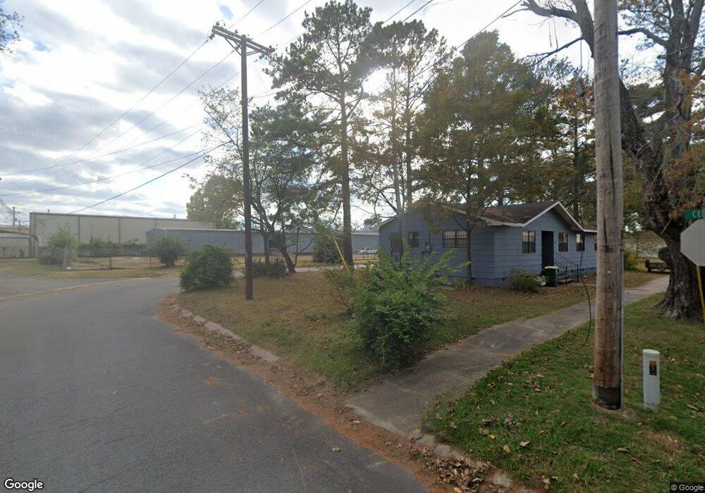
1011 N F St North Little Rock, AR 72114
Rose City NeighborhoodEstimated Value: $37,000 - $59,836
2
Beds
1
Bath
840
Sq Ft
$58/Sq Ft
Est. Value
About This Home
This home is located at 1011 N F St, North Little Rock, AR 72114 and is currently estimated at $48,945, approximately $58 per square foot. 1011 N F St is a home located in Pulaski County with nearby schools including Glenview Elementary School, North Little Rock Middle School 6th Grade Campus, and North Little Rock High School.
Ownership History
Date
Name
Owned For
Owner Type
Purchase Details
Closed on
Jan 29, 2016
Sold by
Fowler Derrick
Bought by
Rla Investments Llc
Current Estimated Value
Purchase Details
Closed on
Aug 31, 2015
Sold by
Bradford Dustin Eugene and Ratola Robert J
Bought by
Fowler Derrick
Purchase Details
Closed on
Jun 29, 2015
Sold by
U S Bank National Association
Bought by
Bradford Dustin Eugene and Ratola Robert J
Purchase Details
Closed on
Oct 27, 2014
Sold by
Bowers Donald L and White Tracee
Bought by
U S Bank National Association
Create a Home Valuation Report for This Property
The Home Valuation Report is an in-depth analysis detailing your home's value as well as a comparison with similar homes in the area
Home Values in the Area
Average Home Value in this Area
Purchase History
| Date | Buyer | Sale Price | Title Company |
|---|---|---|---|
| Rla Investments Llc | $11,500 | Commerce Title & Closing Svc | |
| Fowler Derrick | $5,000 | Waco Title Co Little Rock | |
| Bradford Dustin Eugene | $500 | Attorney | |
| U S Bank National Association | $13,684 | None Available |
Source: Public Records
Tax History Compared to Growth
Tax History
| Year | Tax Paid | Tax Assessment Tax Assessment Total Assessment is a certain percentage of the fair market value that is determined by local assessors to be the total taxable value of land and additions on the property. | Land | Improvement |
|---|---|---|---|---|
| 2025 | $240 | $3,638 | $540 | $3,098 |
| 2024 | $205 | $3,638 | $540 | $3,098 |
| 2023 | $205 | $3,638 | $540 | $3,098 |
| 2022 | $188 | $3,638 | $540 | $3,098 |
| 2021 | $170 | $2,550 | $200 | $2,350 |
| 2020 | $170 | $2,550 | $200 | $2,350 |
| 2019 | $170 | $2,550 | $200 | $2,350 |
| 2018 | $170 | $2,550 | $200 | $2,350 |
| 2017 | $170 | $2,550 | $200 | $2,350 |
| 2016 | $194 | $2,910 | $600 | $2,310 |
| 2015 | $194 | $2,910 | $600 | $2,310 |
| 2014 | $194 | $2,910 | $600 | $2,310 |
Source: Public Records
Map
Nearby Homes
- 915 N E St
- 2402 E Broadway St Unit 2410 E Broadway Stre
- 520 Dewayne Ave
- 716 Atkinson Rhodes St
- 2307 E 2nd St
- 4221 Rogers St
- 2614 Lincoln Ave
- 4511 Haywood St
- 120 N Buckeye St
- 4705 Goodwin Cir
- 412 Middle St
- 2704 Gribble St
- 4608 School St
- 115 Parkdale St
- 4712 Rogers St
- 506 Prothro St
- 301 Boggs St
- 0 Coral St
- 4821 Rogers St
- 4825 School St