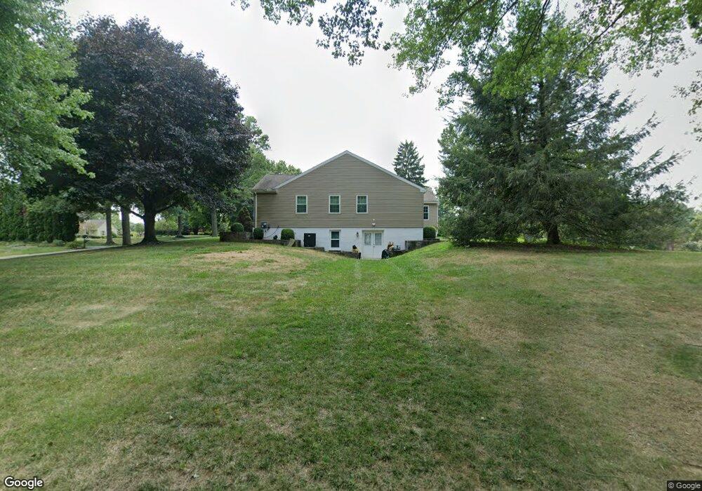
1011 Plumly Rd West Chester, PA 19382
Estimated Value: $724,000 - $778,000
3
Beds
3
Baths
2,360
Sq Ft
$319/Sq Ft
Est. Value
About This Home
This home is located at 1011 Plumly Rd, West Chester, PA 19382 and is currently estimated at $752,907, approximately $319 per square foot. 1011 Plumly Rd is a home located in Chester County with nearby schools including Westtown-Thornbury Elementary School, Stetson Middle School, and Bayard Rustin High School.
Ownership History
Date
Name
Owned For
Owner Type
Purchase Details
Closed on
Aug 18, 2008
Sold by
Joseph J Gardner Revocable Trust
Bought by
Earwood David B and Earwood Deborah L
Current Estimated Value
Home Financials for this Owner
Home Financials are based on the most recent Mortgage that was taken out on this home.
Original Mortgage
$320,000
Interest Rate
6.69%
Mortgage Type
Purchase Money Mortgage
Purchase Details
Closed on
Sep 10, 1999
Sold by
Gardner Joseph J and Gardner Lorraine M
Bought by
Gardner Joseph J
Create a Home Valuation Report for This Property
The Home Valuation Report is an in-depth analysis detailing your home's value as well as a comparison with similar homes in the area
Home Values in the Area
Average Home Value in this Area
Purchase History
| Date | Buyer | Sale Price | Title Company |
|---|---|---|---|
| Earwood David B | $375,000 | None Available | |
| Gardner Joseph J | -- | -- |
Source: Public Records
Mortgage History
| Date | Status | Borrower | Loan Amount |
|---|---|---|---|
| Closed | Earwood David B | $320,000 |
Source: Public Records
Tax History Compared to Growth
Tax History
| Year | Tax Paid | Tax Assessment Tax Assessment Total Assessment is a certain percentage of the fair market value that is determined by local assessors to be the total taxable value of land and additions on the property. | Land | Improvement |
|---|---|---|---|---|
| 2025 | $7,371 | $238,480 | $61,660 | $176,820 |
| 2024 | $7,371 | $238,480 | $61,660 | $176,820 |
| 2023 | $7,321 | $238,480 | $61,660 | $176,820 |
| 2022 | $7,181 | $238,480 | $61,660 | $176,820 |
| 2021 | $7,086 | $238,480 | $61,660 | $176,820 |
| 2020 | $7,043 | $238,480 | $61,660 | $176,820 |
| 2019 | $6,950 | $238,480 | $61,660 | $176,820 |
| 2018 | $6,809 | $238,480 | $61,660 | $176,820 |
| 2017 | $6,670 | $238,480 | $61,660 | $176,820 |
| 2016 | $5,185 | $238,480 | $61,660 | $176,820 |
| 2015 | $5,185 | $238,480 | $61,660 | $176,820 |
| 2014 | $5,185 | $238,480 | $61,660 | $176,820 |
Source: Public Records
Map
Nearby Homes
- 1018 Ashley Rd
- 45 Sawmill Ct
- 47 Sawmill Ct
- 16 Diamond Dr
- 222 Westtown Way
- 878 Empress Rd
- 859 Empress Rd
- 120 Freedom Rider Trail
- 103 Everest Cir
- 1252 Northgate Rd
- 301 Westtown Way
- 600 Oaklea Ln
- 924 Trellis Ln
- 207 Walnut Hill Rd Unit C5
- 712 Daisy Ln
- 602 Bowers Dr
- 1312 College Hill Dr
- 1343 Creek Rd
- 1376 College Hill Dr
- 1626 S Coventry Ln