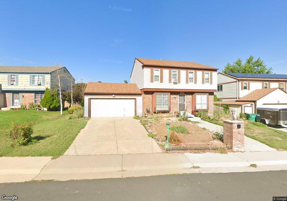
1011 S Memphis St Aurora, CO 80017
Centre Pointe NeighborhoodEstimated Value: $499,000 - $518,890
3
Beds
4
Baths
2,580
Sq Ft
$196/Sq Ft
Est. Value
About This Home
This home is located at 1011 S Memphis St, Aurora, CO 80017 and is currently estimated at $506,723, approximately $196 per square foot. 1011 S Memphis St is a home located in Arapahoe County with nearby schools including Tollgate Elementary School of Expeditionary Learning, Mrachek Middle School, and Gateway High School.
Ownership History
Date
Name
Owned For
Owner Type
Purchase Details
Closed on
Aug 24, 2017
Sold by
Vonhortenau Charles and Estate Of Jose Armesto
Bought by
Nguyen Tony and Ngo Dung Thi Kim
Current Estimated Value
Home Financials for this Owner
Home Financials are based on the most recent Mortgage that was taken out on this home.
Original Mortgage
$269,600
Outstanding Balance
$225,384
Interest Rate
4.03%
Mortgage Type
New Conventional
Estimated Equity
$281,339
Purchase Details
Closed on
Oct 1, 1977
Sold by
Conversion Arapco
Bought by
Conversion Arapco
Purchase Details
Closed on
Jul 4, 1776
Bought by
Conversion Arapco
Create a Home Valuation Report for This Property
The Home Valuation Report is an in-depth analysis detailing your home's value as well as a comparison with similar homes in the area
Home Values in the Area
Average Home Value in this Area
Purchase History
| Date | Buyer | Sale Price | Title Company |
|---|---|---|---|
| Nguyen Tony | $337,000 | None Available | |
| Conversion Arapco | -- | -- | |
| Conversion Arapco | -- | -- |
Source: Public Records
Mortgage History
| Date | Status | Borrower | Loan Amount |
|---|---|---|---|
| Open | Nguyen Tony | $269,600 |
Source: Public Records
Tax History Compared to Growth
Tax History
| Year | Tax Paid | Tax Assessment Tax Assessment Total Assessment is a certain percentage of the fair market value that is determined by local assessors to be the total taxable value of land and additions on the property. | Land | Improvement |
|---|---|---|---|---|
| 2024 | $3,277 | $35,262 | -- | -- |
| 2023 | $3,277 | $35,262 | $0 | $0 |
| 2022 | $2,769 | $27,578 | $0 | $0 |
| 2021 | $2,858 | $27,578 | $0 | $0 |
| 2020 | $2,871 | $27,571 | $0 | $0 |
| 2019 | $2,855 | $27,571 | $0 | $0 |
| 2018 | $2,341 | $22,140 | $0 | $0 |
| 2017 | $2,037 | $22,140 | $0 | $0 |
| 2016 | $1,648 | $17,544 | $0 | $0 |
| 2015 | $1,591 | $17,544 | $0 | $0 |
| 2014 | $593 | $12,593 | $0 | $0 |
| 2013 | -- | $14,570 | $0 | $0 |
Source: Public Records
Map
Nearby Homes
- 1024 S Mobile St
- 16405 E Kentucky Ave
- 1140 S Kittredge St
- 16094 E Exposition Dr
- 16136 E Exposition Dr
- 16506 E Arizona Dr
- 16135 E Exposition Dr
- 16233 E Louisiana Place
- 16651 E Arizona Place
- 611 S Laredo Cir
- 1305 S Laredo Ct
- 16325 E Alabama Dr
- 1262 S Olathe Way
- 17034 E Tennessee Dr Unit 105
- 16673 E Louisiana Dr
- 15875 E Custer Dr
- 17053 E Tennessee Dr Unit 104
- 17093 E Tennessee Dr Unit 212
- 15810 E Arkansas Dr
- 16634 E Louisiana Dr
- 1001 S Memphis St
- 1021 S Memphis St
- 16298 E Tennessee Ave
- 16299 E Tennessee Place
- 16279 E Tennessee Place
- 1031 S Memphis St
- 1012 S Memphis St
- 16278 E Tennessee Ave
- 1002 S Memphis St
- 1022 S Memphis St
- 1042 S Memphis St
- 994 S Memphis Way
- 16290 E Tennessee Place
- 16319 E Tennessee Ave
- 1032 S Memphis St
- 16259 E Tennessee Place
- 16258 E Tennessee Ave
- 1005 S Mobile St
- 16359 E Tennessee Ave
- 1053 S Memphis St