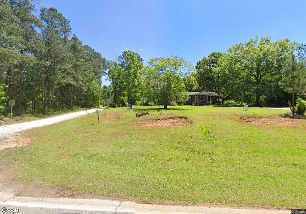
1011 Smith Andrews Dr Elberton, GA 30635
Estimated Value: $188,000 - $271,000
--
Bed
3
Baths
2,504
Sq Ft
$94/Sq Ft
Est. Value
About This Home
This home is located at 1011 Smith Andrews Dr, Elberton, GA 30635 and is currently estimated at $235,049, approximately $93 per square foot. 1011 Smith Andrews Dr is a home located in Elbert County with nearby schools including Elbert County Primary School, Elbert County Elementary School, and Elbert County Middle School.
Ownership History
Date
Name
Owned For
Owner Type
Purchase Details
Closed on
Apr 30, 2010
Sold by
Hunter James
Bought by
Evans Darrell Bernard and Evans Wanda Maxine
Current Estimated Value
Purchase Details
Closed on
Jan 3, 2008
Sold by
Tiller Robbi
Bought by
Hunter James
Purchase Details
Closed on
Jun 7, 2005
Sold by
Tiller Robert L
Bought by
Tiller Robbi
Home Financials for this Owner
Home Financials are based on the most recent Mortgage that was taken out on this home.
Original Mortgage
$54,881
Interest Rate
5.7%
Purchase Details
Closed on
Oct 1, 1987
Purchase Details
Closed on
Jul 1, 1978
Purchase Details
Closed on
Mar 1, 1963
Purchase Details
Closed on
Feb 1, 1962
Create a Home Valuation Report for This Property
The Home Valuation Report is an in-depth analysis detailing your home's value as well as a comparison with similar homes in the area
Home Values in the Area
Average Home Value in this Area
Purchase History
| Date | Buyer | Sale Price | Title Company |
|---|---|---|---|
| Evans Darrell Bernard | $87,000 | -- | |
| Hunter James | $54,066 | -- | |
| Tiller Robbi | $50,000 | -- | |
| Tiller Robert L | -- | -- | |
| -- | -- | -- | |
| -- | $1,000 | -- | |
| -- | -- | -- | |
| -- | -- | -- |
Source: Public Records
Mortgage History
| Date | Status | Borrower | Loan Amount |
|---|---|---|---|
| Previous Owner | Tiller Robert L | $54,881 |
Source: Public Records
Tax History Compared to Growth
Tax History
| Year | Tax Paid | Tax Assessment Tax Assessment Total Assessment is a certain percentage of the fair market value that is determined by local assessors to be the total taxable value of land and additions on the property. | Land | Improvement |
|---|---|---|---|---|
| 2024 | $1,212 | $50,530 | $3,158 | $47,372 |
| 2023 | $1,212 | $50,530 | $3,158 | $47,372 |
| 2022 | $825 | $34,407 | $1,880 | $32,527 |
| 2021 | $778 | $34,407 | $1,880 | $32,527 |
| 2020 | $694 | $27,528 | $1,504 | $26,024 |
| 2019 | $721 | $27,528 | $1,504 | $26,024 |
| 2018 | $743 | $27,528 | $1,504 | $26,024 |
| 2017 | $996 | $33,714 | $1,504 | $32,210 |
| 2016 | $931 | $33,714 | $1,504 | $32,210 |
| 2015 | -- | $33,714 | $1,504 | $32,210 |
| 2014 | -- | $33,714 | $1,504 | $32,210 |
| 2013 | -- | $33,714 | $1,504 | $32,210 |
Source: Public Records
Map
Nearby Homes
- 1448 Lexington Hwy
- 1628 Melody Ln
- 0 Fairway Dr Unit 10491731
- 1408 Grady Cleveland Rd
- 00 Lexington Hwy
- 518 Fambrough Dr
- 1709 Bullards Ferry Rd
- 1703 Bullards Ferry Rd
- 1987 Indian Hill Rd
- 844 Sherwood Dr
- 1 Calhoun Falls Hwy
- 4 Calhoun Falls Hwy
- 3 Calhoun Falls Hwy
- 2089 Jones Ferry Rd
- 141 Wildwood Dr
- 0 Jaudon Rd Unit 25452604
- 0 Jaudon Rd Unit 10657787
- 2211 Indian Hill Rd
- 1055 Country Manor Ln
- 0 Mineral Springs Rd Unit 10455464
- 1011 Smith-Andrews Dr
- 1021 Smith Andrews Dr
- 1542 Lexington Hwy
- 1534 Lexington Hwy
- 1023 Smith Andrews Dr
- 1552 Lexington Hwy
- 1558 Lexington Hwy
- 1562 Lexington Hwy
- 0 Grimes Cir Unit 3217248
- 0 Grimes Cir Unit CM911529
- 1578 Lexington Hwy
- 1505 Lexington Hwy
- 1506 Lexington Hwy
- 1567 Lexington Hwy
- 1503 Lexington Hwy
- 1587 Grimes Cir
- 1703 Grimes Cir
- 1590 Lexington Hwy
- 1610 Lexington Hwy
- 1490 Lexington Hwy