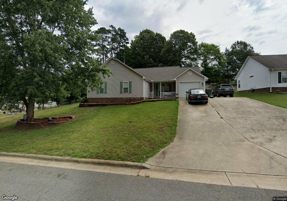
1011 Thompson Rd Graham, NC 27253
Estimated Value: $284,000 - $299,000
4
Beds
2
Baths
1,554
Sq Ft
$187/Sq Ft
Est. Value
About This Home
This home is located at 1011 Thompson Rd, Graham, NC 27253 and is currently estimated at $291,345, approximately $187 per square foot. 1011 Thompson Rd is a home located in Alamance County with nearby schools including South Graham Elementary School, Southern Alamance Middle School, and Southern Alamance High School.
Ownership History
Date
Name
Owned For
Owner Type
Purchase Details
Closed on
May 15, 2001
Sold by
Concept Builders Inc
Bought by
Harrington Christopher S
Current Estimated Value
Home Financials for this Owner
Home Financials are based on the most recent Mortgage that was taken out on this home.
Original Mortgage
$129,960
Outstanding Balance
$48,347
Interest Rate
6.98%
Estimated Equity
$242,998
Create a Home Valuation Report for This Property
The Home Valuation Report is an in-depth analysis detailing your home's value as well as a comparison with similar homes in the area
Home Values in the Area
Average Home Value in this Area
Purchase History
| Date | Buyer | Sale Price | Title Company |
|---|---|---|---|
| Harrington Christopher S | $132,000 | -- |
Source: Public Records
Mortgage History
| Date | Status | Borrower | Loan Amount |
|---|---|---|---|
| Open | Harrington Christopher S | $129,960 |
Source: Public Records
Tax History Compared to Growth
Tax History
| Year | Tax Paid | Tax Assessment Tax Assessment Total Assessment is a certain percentage of the fair market value that is determined by local assessors to be the total taxable value of land and additions on the property. | Land | Improvement |
|---|---|---|---|---|
| 2025 | $1,341 | $271,474 | $38,000 | $233,474 |
| 2024 | $1,273 | $271,474 | $38,000 | $233,474 |
| 2023 | $1,167 | $271,474 | $38,000 | $233,474 |
| 2022 | $1,475 | $133,854 | $25,000 | $108,854 |
| 2021 | $1,488 | $133,854 | $25,000 | $108,854 |
| 2020 | $1,501 | $133,854 | $25,000 | $108,854 |
| 2019 | $1,506 | $133,854 | $25,000 | $108,854 |
| 2018 | $0 | $133,854 | $25,000 | $108,854 |
| 2017 | $1,385 | $133,854 | $25,000 | $108,854 |
| 2016 | $1,327 | $128,170 | $25,000 | $103,170 |
| 2015 | $740 | $128,170 | $25,000 | $103,170 |
| 2014 | $676 | $128,170 | $25,000 | $103,170 |
Source: Public Records
Map
Nearby Homes
- 605 Sania Ct
- 5560 Henley Ridge Dr
- 162 Canopy Dr
- 174 Canopy Dr
- NEWTON Plan at Henley Ridge
- MAYWOOD Plan at Henley Ridge
- 700 Thompson Rd
- 5336 Henley Ridge Dr
- 244 Canopy Dr
- 240 Canopy Dr
- 236 Canopy Dr
- 212 Canopy Dr
- 215 Moyer Dr
- 223 Moyer Dr
- 219 Moyer Dr
- 209 Moyer Dr
- 205 Moyer Dr
- 200 Moyer Dr
- 212 Moyer Dr
- 204 Moyer Dr