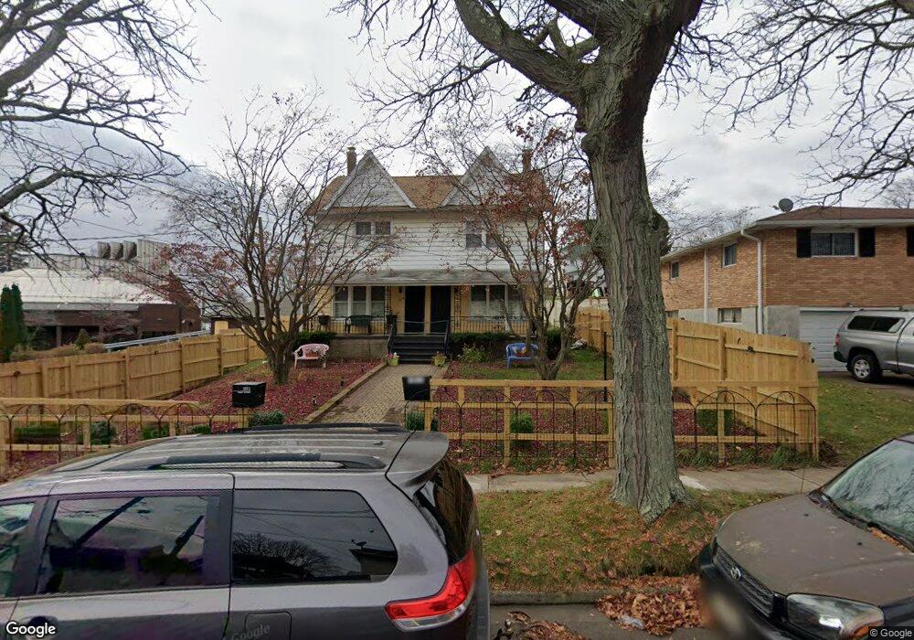
1011 Tripp St Scranton, PA 18508
Tripp's Park NeighborhoodEstimated Value: $113,434 - $185,000
About This Home
This home is located at 1011 Tripp St, Scranton, PA 18508 and is currently estimated at $159,859, approximately $78 per square foot. 1011 Tripp St is a home located in Lackawanna County with nearby schools including Isaac Tripp Elementary School, Northeast Scranton Intermediate School, and Scranton High School.
Ownership History
We collect this data history from publicly available records. To have your information removed, we recommend requesting removal directly through your county’s website.
Purchase Details
Home Financials for this Owner
Home Financials are based on the most recent Mortgage that was taken out on this home.Purchase Details
Home Values in the Area
Average Home Value in this Area
Purchase History
We collect this data history from publicly available records. To have your information removed, we recommend requesting removal directly through your county’s website.
| Date | Buyer | Sale Price | Title Company |
|---|---|---|---|
| $86,000 | Keystone Abstract Svcs Inc | ||
| $115,000 | None Available |
Mortgage History
We collect this data history from publicly available records. To have your information removed, we recommend requesting removal directly through your county’s website.
| Date | Status | Borrower | Loan Amount |
|---|---|---|---|
| Previous Owner | $73,100 |
Tax History
We collect this data history from publicly available records. To have your information removed, we recommend requesting removal directly through your county’s website.
| Year | Tax Paid | Tax Assessment Tax Assessment Total Assessment is a certain percentage of the fair market value that is determined by local assessors to be the total taxable value of land and additions on the property. | Land | Improvement |
|---|---|---|---|---|
| 2026 | $22,738 | $142,120 | $29,410 | $112,710 |
| 2025 | $3,844 | $11,000 | $3,300 | $7,700 |
| 2024 | $3,533 | $11,000 | $3,300 | $7,700 |
| 2023 | $3,533 | $11,000 | $3,300 | $7,700 |
| 2022 | $3,456 | $11,000 | $3,300 | $7,700 |
| 2021 | $3,456 | $11,000 | $3,300 | $7,700 |
| 2020 | $3,397 | $11,000 | $3,300 | $7,700 |
| 2019 | $3,201 | $11,000 | $3,300 | $7,700 |
| 2018 | $3,201 | $11,000 | $3,300 | $7,700 |
| 2017 | $3,150 | $11,000 | $3,300 | $7,700 |
| 2016 | $1,157 | $11,000 | $3,300 | $7,700 |
| 2015 | $2,419 | $11,000 | $3,300 | $7,700 |
| 2014 | -- | $11,000 | $3,300 | $7,700 |
Map
- 817 Court St
- 1229 Providence Rd
- 1132 Lloyd St
- 1248 Providence Rd
- 1016-1018 Diamond Ave
- 724 Court St
- 700 Philo St Unit 702
- 1057 Euclid Ave
- 1406 N Main Ave
- 1121 Albright Ave
- 1438 Hawthorne St
- 1429 Hawthorne St
- 1413 Bulwer St
- 1102 1104 Albright Ave
- 1108-1110 Albright Ave
- 1430 N Main Ave
- 942 Providence Rd
- 938 Providence Rd
- 1436 Church Ave
- 1438 Church Ave Unit 1440
- 1011 1013 Tripp St
- 1011 Tripp Place
- 1015 Tripp St Unit 1017
- 1012 Sterling St
- 1016 Sterling St
- 1018 Sterling St
- 1122 N Main Ave
- 1014 Sterling St Unit 1016
- 1116 N Main Ave
- 1012 Tripp St
- 1201 Providence Rd
- 1201 Providence Rd
- 1108 N Main Ave
- 1120 N Main Ave
- 1126 N Main Ave
- 1118 N Main Ave
- 1104 N Main Ave
- 1207 Providence Rd
- 1200 N Main Ave
- 1202 N Main Ave
Ask me questions while you tour the home.