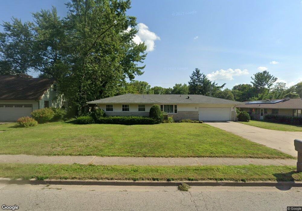
1011 W Kirby Ave Champaign, IL 61821
Bolten Field NeighborhoodEstimated Value: $233,679 - $301,000
--
Bed
2
Baths
1,410
Sq Ft
$194/Sq Ft
Est. Value
About This Home
This home is located at 1011 W Kirby Ave, Champaign, IL 61821 and is currently estimated at $273,420, approximately $193 per square foot. 1011 W Kirby Ave is a home located in Champaign County with nearby schools including Central High School, Montessori Habitat School, and Devonshire KinderCare.
Ownership History
Date
Name
Owned For
Owner Type
Purchase Details
Closed on
Jan 22, 2025
Sold by
Schroeder Patricia S and Ward Michael E
Bought by
Patricia S Schroeder Trust and Schroeder
Current Estimated Value
Purchase Details
Closed on
May 18, 2004
Sold by
Schroeder Evalyn I
Bought by
Schroeder Evalyn I and Schroeder Patricia S
Create a Home Valuation Report for This Property
The Home Valuation Report is an in-depth analysis detailing your home's value as well as a comparison with similar homes in the area
Home Values in the Area
Average Home Value in this Area
Purchase History
| Date | Buyer | Sale Price | Title Company |
|---|---|---|---|
| Patricia S Schroeder Trust | -- | None Listed On Document | |
| Schroeder Evalyn I | -- | -- |
Source: Public Records
Tax History Compared to Growth
Tax History
| Year | Tax Paid | Tax Assessment Tax Assessment Total Assessment is a certain percentage of the fair market value that is determined by local assessors to be the total taxable value of land and additions on the property. | Land | Improvement |
|---|---|---|---|---|
| 2024 | $4,400 | $60,160 | $16,910 | $43,250 |
| 2023 | $4,400 | $54,790 | $15,400 | $39,390 |
| 2022 | $4,097 | $50,550 | $14,210 | $36,340 |
| 2021 | $3,988 | $49,560 | $13,930 | $35,630 |
| 2020 | $3,819 | $47,650 | $13,390 | $34,260 |
| 2019 | $3,685 | $46,670 | $13,110 | $33,560 |
| 2018 | $3,593 | $45,930 | $12,900 | $33,030 |
| 2017 | $3,448 | $44,160 | $12,400 | $31,760 |
| 2016 | $3,081 | $43,250 | $12,140 | $31,110 |
| 2015 | $3,095 | $42,480 | $11,920 | $30,560 |
| 2014 | $3,069 | $42,480 | $11,920 | $30,560 |
| 2013 | $3,041 | $42,480 | $11,920 | $30,560 |
Source: Public Records
Map
Nearby Homes
- 1106 W Kirby Ave
- 1109 W Kirby Ave
- 32 Greencroft Dr
- 1202 Foothill Dr
- 1725 Lincoln Place
- 7 Greencroft Dr
- 21 Greencroft Dr
- 1217 Foothill Dr
- 811 Hamilton Dr
- 1205 Broadmoor Dr
- 812 Dodds Dr
- 1601 Coronado Dr
- 1318 Broadmoor Dr
- 7 McDonald Ct
- 807 Haines Blvd
- 1023 W Charles St
- 1420 S Western Ave
- 1208 W William St
- 508 Haines Blvd
- 1527 Devonshire Dr
- 1009 W Kirby Ave
- 1602 Ridge Rd
- 1018 Lincolnshire Dr
- 1016 Lincolnshire Dr
- 1606 Ridge Rd
- 1007 W Kirby Ave
- 1014 Lincolnshire Dr
- 46 Greencroft Dr
- 1601 Ridge Rd
- 45 Greencroft Dr
- 1005 W Kirby Ave
- 1012 Lincolnshire Dr
- 1102 Lincolnshire Dr
- 1015 Lincolnshire Dr
- 78 Greencroft Dr
- 1013 Lincolnshire Dr
- 1103 W Kirby Ave
- 1017 Lincolnshire Dr
- 923 W Kirby Ave
- 44 Greencroft Dr