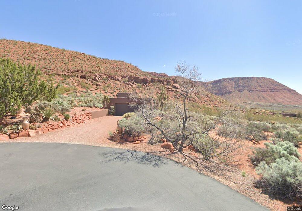
1011 W Kokopelli Way Ivins, UT 84738
Shonto Point NeighborhoodEstimated Value: $1,143,000 - $1,331,000
3
Beds
3
Baths
2,650
Sq Ft
$472/Sq Ft
Est. Value
About This Home
This home is located at 1011 W Kokopelli Way, Ivins, UT 84738 and is currently estimated at $1,250,108, approximately $471 per square foot. 1011 W Kokopelli Way is a home located in Washington County with nearby schools including Red Mountain School, Snow Canyon Middle School, and Lava Ridge Intermediate School.
Ownership History
Date
Name
Owned For
Owner Type
Purchase Details
Closed on
Oct 30, 2020
Sold by
Peterson Mark and Cook Gregory
Bought by
Peterson Mark B and Cook Gregory A
Current Estimated Value
Purchase Details
Closed on
Jun 20, 2016
Sold by
Peterson Mark B
Bought by
Peterson Mark B and Cook Gregory A
Purchase Details
Closed on
Jun 7, 2011
Sold by
Peterson Mark B and Cook Gregory A
Bought by
Peterson Mark B
Purchase Details
Closed on
Jun 13, 2007
Sold by
Peterson Mark B
Bought by
Peterson Mark B and Cook Gregory A
Purchase Details
Closed on
Apr 4, 2006
Sold by
Peterson Mark B
Bought by
Peterson Mark B and Cook Gregory A
Home Financials for this Owner
Home Financials are based on the most recent Mortgage that was taken out on this home.
Original Mortgage
$62,000
Outstanding Balance
$34,770
Interest Rate
6.04%
Mortgage Type
Credit Line Revolving
Estimated Equity
$1,215,338
Purchase Details
Closed on
Mar 4, 2006
Sold by
Peterson Mark B and Cook Gregory A
Bought by
Peterson Mark B
Home Financials for this Owner
Home Financials are based on the most recent Mortgage that was taken out on this home.
Original Mortgage
$62,000
Outstanding Balance
$34,770
Interest Rate
6.04%
Mortgage Type
Credit Line Revolving
Estimated Equity
$1,215,338
Purchase Details
Closed on
Feb 27, 2006
Sold by
Peterson Mark B
Bought by
Peterson Mark B and Cook Gregory A
Home Financials for this Owner
Home Financials are based on the most recent Mortgage that was taken out on this home.
Original Mortgage
$62,000
Outstanding Balance
$34,770
Interest Rate
6.04%
Mortgage Type
Credit Line Revolving
Estimated Equity
$1,215,338
Purchase Details
Closed on
Feb 21, 2006
Sold by
Lee Kenward C Y and Lee Sara Post
Bought by
Peterson Mark B
Home Financials for this Owner
Home Financials are based on the most recent Mortgage that was taken out on this home.
Original Mortgage
$62,000
Outstanding Balance
$34,770
Interest Rate
6.04%
Mortgage Type
Credit Line Revolving
Estimated Equity
$1,215,338
Purchase Details
Closed on
Nov 1, 2005
Sold by
Lee Kenward Cy and Lee Sara Post
Bought by
Lee Kenward Cy and Lee Sara Pose
Create a Home Valuation Report for This Property
The Home Valuation Report is an in-depth analysis detailing your home's value as well as a comparison with similar homes in the area
Home Values in the Area
Average Home Value in this Area
Purchase History
| Date | Buyer | Sale Price | Title Company |
|---|---|---|---|
| Peterson Mark B | -- | Accommodation | |
| Peterson Mark | -- | Accommodation | |
| Peterson Mark B | -- | None Available | |
| Peterson Mark B | -- | Accommodation | |
| Peterson Mark B | -- | None Available | |
| Peterson Mark B | -- | Accommodation | |
| Peterson Mark B | -- | Southern Utah Title Co | |
| Peterson Mark B | -- | Accommodation | |
| Peterson Mark B | -- | Southern Utah Title Co | |
| Lee Kenward Cy | -- | None Available |
Source: Public Records
Mortgage History
| Date | Status | Borrower | Loan Amount |
|---|---|---|---|
| Open | Peterson Mark B | $62,000 | |
| Open | Peterson Mark B | $496,000 |
Source: Public Records
Tax History Compared to Growth
Tax History
| Year | Tax Paid | Tax Assessment Tax Assessment Total Assessment is a certain percentage of the fair market value that is determined by local assessors to be the total taxable value of land and additions on the property. | Land | Improvement |
|---|---|---|---|---|
| 2025 | $3,948 | $629,970 | $276,650 | $353,320 |
| 2023 | $3,949 | $551,980 | $225,225 | $326,755 |
| 2022 | $4,962 | $532,565 | $197,725 | $334,840 |
| 2021 | $3,763 | $736,900 | $302,000 | $434,900 |
| 2020 | $3,627 | $669,100 | $277,000 | $392,100 |
| 2019 | $3,575 | $643,700 | $257,000 | $386,700 |
| 2018 | $3,046 | $297,280 | $0 | $0 |
| 2017 | $3,053 | $289,855 | $0 | $0 |
| 2016 | $3,207 | $281,275 | $0 | $0 |
| 2015 | $3,156 | $266,480 | $0 | $0 |
| 2014 | $3,062 | $259,715 | $0 | $0 |
Source: Public Records
Map
Nearby Homes
- 911 W Roadrunner Ct
- 1657 N Kayenta Dr
- 1450 Tuweap Dr
- 1060 Wintook Dr
- 1060 W Wintook Dr
- 973 W Sipala Trail
- 1183 Tuweap Dr
- 1151 Shawnee Ct
- 1121 Two Moons Way
- 1068 Shonto Ridge Dr
- 854 Tawgoo Ct
- 688 Shinava Dr
- 662 Shinava Dr
- 922 N Acequia Ct
- 548 Indigo Way
- 841 Shonto Ridge Dr
- 0 Unit 25-266044
- 750 Shinava Dr
- 993 N Chusi Way
- 814 Wicasa Way
- 1011 Kokopelli Way
- 1051 Kokopelli Way
- 1040 Kokopelli Way
- 1006 Crows Wing Way
- 1036 W Crows Wing Way
- 1070 Kokopelli Way
- 976 W Crows Wing Way
- 976 Crows Wing Way
- 1081 Kokopelli Way
- 1060 W Crows Wing Way
- 1145 W Soaring Eagle Way
- 1033 Crows Wing Way
- 1100 Kokopelli Way
- 1111 Soaring Eagle Way
- 1003 Crows Wing Way
- 1063 Crows Wing Way
- 918 Roadrunner Cir
- 973 W Crows Wing Way
- 1070 N Kayenta Dr
- 911 Roadrunner Cir