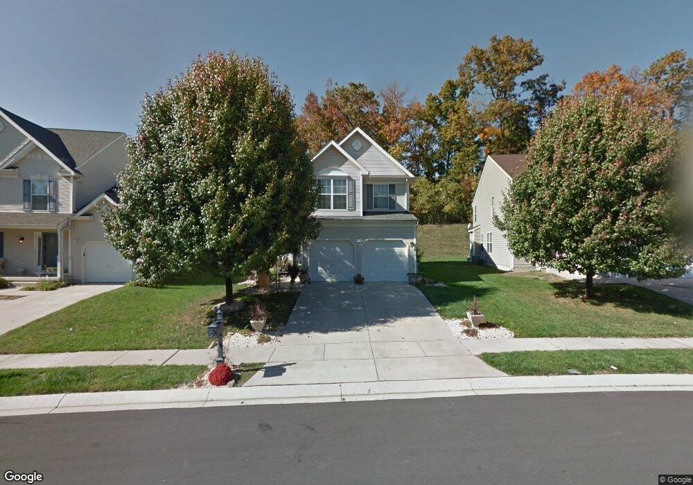
1011 W Viking Ct Abingdon, MD 21009
Long Bar Harbor NeighborhoodEstimated Value: $455,000 - $535,000
--
Bed
4
Baths
2,370
Sq Ft
$210/Sq Ft
Est. Value
About This Home
This home is located at 1011 W Viking Ct, Abingdon, MD 21009 and is currently estimated at $497,976, approximately $210 per square foot. 1011 W Viking Ct is a home located in Harford County with nearby schools including William Paca/Old Post Road Elementary School, Edgewood Middle School, and Edgewood High School.
Ownership History
Date
Name
Owned For
Owner Type
Purchase Details
Closed on
Mar 31, 2005
Sold by
Mckittrick Keith J
Bought by
Foulk Kristen and Buscemi Joseph
Current Estimated Value
Home Financials for this Owner
Home Financials are based on the most recent Mortgage that was taken out on this home.
Original Mortgage
$316,400
Outstanding Balance
$171,270
Interest Rate
6.75%
Mortgage Type
Adjustable Rate Mortgage/ARM
Estimated Equity
$326,706
Purchase Details
Closed on
Sep 5, 2002
Sold by
Barry Andrews Land Development Llc
Bought by
Mckittrick Keith J and Mc Kittrick Kimberly A
Create a Home Valuation Report for This Property
The Home Valuation Report is an in-depth analysis detailing your home's value as well as a comparison with similar homes in the area
Home Values in the Area
Average Home Value in this Area
Purchase History
| Date | Buyer | Sale Price | Title Company |
|---|---|---|---|
| Foulk Kristen | $395,500 | -- | |
| Mckittrick Keith J | $258,002 | -- | |
| Barry Andrews Land Development Llc | $127,600 | -- |
Source: Public Records
Mortgage History
| Date | Status | Borrower | Loan Amount |
|---|---|---|---|
| Open | Foulk Kristen | $316,400 | |
| Closed | Foulk Kristen | $79,100 | |
| Closed | Barry Andrews Land Development Llc | -- |
Source: Public Records
Tax History Compared to Growth
Tax History
| Year | Tax Paid | Tax Assessment Tax Assessment Total Assessment is a certain percentage of the fair market value that is determined by local assessors to be the total taxable value of land and additions on the property. | Land | Improvement |
|---|---|---|---|---|
| 2025 | $4,089 | $401,833 | $0 | $0 |
| 2024 | $4,089 | $375,167 | $0 | $0 |
| 2023 | $3,798 | $348,500 | $85,100 | $263,400 |
| 2022 | $3,655 | $335,333 | $0 | $0 |
| 2021 | $3,566 | $322,167 | $0 | $0 |
| 2020 | $3,566 | $309,000 | $85,100 | $223,900 |
| 2019 | $3,459 | $299,767 | $0 | $0 |
| 2018 | $3,322 | $290,533 | $0 | $0 |
| 2017 | $3,217 | $281,300 | $0 | $0 |
| 2016 | $140 | $281,300 | $0 | $0 |
| 2015 | $3,747 | $281,300 | $0 | $0 |
| 2014 | $3,747 | $284,500 | $0 | $0 |
Source: Public Records
Map
Nearby Homes
- 1032 Searay Ct
- 750 Harford Boat Club Rd
- 3620-3628 Sewell Rd
- 3622 Skylark Ct
- 4019 Abinrox Dr
- 3712 Trail Wood Ct
- 4032 Abingin Dr
- 4038 Smiths Landing Ct
- 3353 Shrewsbury Rd
- 4053 Abinrox Dr
- 3322 Shrewsbury Rd
- 1219 Abinchar Dr
- 1207 Alder Shot Ct
- 3812 Swift Run Dr
- 3314 Rosary Ct
- 515 Freys Rd
- 3921 E Baker Ave
- 1300 Amedoro Ct
- 4017 E Baker Ave
- 1405 Pomeroy Ave
- 1009 W Viking Ct
- 1013 W Viking Ct
- 1007 W Viking Ct
- 1015 W Viking Ct
- 1017 W Viking Ct
- 1008 W Viking Ct
- 1005 W Viking Ct
- 1012 W Viking Ct
- 1006 W Viking Ct
- 1026 Searay Ct
- 1028 Searay Ct
- 1014 W Viking Ct
- 1024 Searay Ct
- 1030 Searay Ct
- 1019 W Viking Ct
- 1020 Searay Ct
- 1004 W Viking Ct
- 1003 W Viking Ct
- 1006 Searay Ct
- 1004 Searay Ct