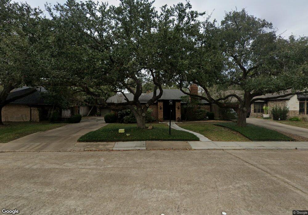
10110 Burgoyne Rd Houston, TX 77042
Briar Forest NeighborhoodEstimated Value: $663,504 - $969,000
4
Beds
3
Baths
2,268
Sq Ft
$349/Sq Ft
Est. Value
About This Home
This home is located at 10110 Burgoyne Rd, Houston, TX 77042 and is currently estimated at $792,126, approximately $349 per square foot. 10110 Burgoyne Rd is a home located in Harris County with nearby schools including Walnut Bend Elementary School, Paul Revere Middle School, and Westside High School.
Ownership History
Date
Name
Owned For
Owner Type
Purchase Details
Closed on
Feb 9, 2022
Sold by
Mcdonnell Gray Robert
Bought by
Gray Melinda Louise
Current Estimated Value
Purchase Details
Closed on
Nov 11, 2002
Sold by
Kersey Byron A and Stubblefield Kersey Pamela
Bought by
Gray Robert M and Gray Melinda L
Home Financials for this Owner
Home Financials are based on the most recent Mortgage that was taken out on this home.
Original Mortgage
$226,000
Interest Rate
6%
Purchase Details
Closed on
Apr 8, 1994
Sold by
Roller Michael S and Roller Debra A
Bought by
Kersey Byron A and Kersey Pamela Stubblefield
Purchase Details
Closed on
Oct 1, 1993
Sold by
Huddleston Michael and Lazarri Toni
Bought by
Roller Michael S and Linder Debra A
Create a Home Valuation Report for This Property
The Home Valuation Report is an in-depth analysis detailing your home's value as well as a comparison with similar homes in the area
Home Values in the Area
Average Home Value in this Area
Purchase History
| Date | Buyer | Sale Price | Title Company |
|---|---|---|---|
| Gray Melinda Louise | -- | None Listed On Document | |
| Gray Robert M | -- | Houston Title Co | |
| Kersey Byron A | -- | Stewart Title | |
| Roller Michael S | -- | -- |
Source: Public Records
Mortgage History
| Date | Status | Borrower | Loan Amount |
|---|---|---|---|
| Previous Owner | Gray Robert M | $226,000 | |
| Closed | Gray Robert M | $42,350 |
Source: Public Records
Tax History Compared to Growth
Tax History
| Year | Tax Paid | Tax Assessment Tax Assessment Total Assessment is a certain percentage of the fair market value that is determined by local assessors to be the total taxable value of land and additions on the property. | Land | Improvement |
|---|---|---|---|---|
| 2025 | $4,222 | $576,450 | $394,200 | $182,250 |
| 2024 | $4,222 | $525,746 | $394,200 | $131,546 |
| 2023 | $4,222 | $501,646 | $394,200 | $107,446 |
| 2022 | $11,020 | $544,000 | $394,200 | $149,800 |
| 2021 | $10,605 | $455,000 | $394,200 | $60,800 |
| 2020 | $11,611 | $479,480 | $394,200 | $85,280 |
| 2019 | $12,241 | $483,763 | $394,200 | $89,563 |
| 2018 | $8,907 | $452,633 | $227,760 | $224,873 |
| 2017 | $11,445 | $452,633 | $227,760 | $224,873 |
| 2016 | $10,510 | $452,633 | $227,760 | $224,873 |
| 2015 | $6,921 | $456,593 | $227,760 | $228,833 |
| 2014 | $6,921 | $383,600 | $192,720 | $190,880 |
Source: Public Records
Map
Nearby Homes
- 10203 Meadow Lake Ln
- 10206 Burgoyne Rd
- 10211 Olympia Dr
- 10218 Burgoyne Rd
- 2219 Briar Branch Dr
- 10010 Burgoyne Rd
- 10303 Chevy Chase Dr
- 2514 Briarbrook Dr
- 10315 Meadow Lake Ln
- 10031 Inwood Dr
- 10050 Locke Ln
- 10038 Locke Ln
- 10002 Wickersham Ln
- 1691 W Sam Houston Pkwy S
- 10118 Briar Rose Dr
- 2619 Briarpark Dr
- 1537 W Sam Houston Pkwy S
- 10042 Briar Forest Dr
- 10034 Briar Forest Dr
- 10317 Briar Forest Dr Unit 214
- 10106 Burgoyne Rd
- 10114 Burgoyne Rd
- 10111 Meadow Lake Ln
- 10115 Meadow Lake Ln
- 10107 Meadow Lake Ln
- 10102 Burgoyne Rd
- 10118 Burgoyne Rd
- 10107 Burgoyne Rd
- 10119 Meadow Lake Ln
- 10103 Meadow Lake Ln
- 10103 Burgoyne Rd
- 2210 Briarbrook Dr
- 10122 Burgoyne Rd
- 10123 Meadow Lake Ln
- 2206 Briarbrook Dr
- 10050 Burgoyne Rd
- 10114 Meadow Lake Ln
- 10110 Meadow Lake Ln
- 10118 Meadow Lake Ln
- 10051 Meadow Lake Ln