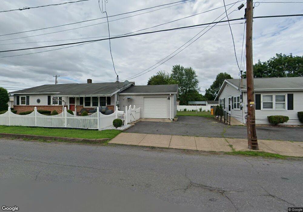
101103 N Poplar St Berwick, PA 18603
Estimated Value: $164,000 - $238,000
--
Bed
--
Bath
1,120
Sq Ft
$189/Sq Ft
Est. Value
About This Home
This home is located at 101103 N Poplar St, Berwick, PA 18603 and is currently estimated at $211,718, approximately $189 per square foot. 101103 N Poplar St is a home with nearby schools including Berwick Area High School, Holy Family Consolidated School, and New Story School.
Ownership History
Date
Name
Owned For
Owner Type
Purchase Details
Closed on
May 13, 2021
Sold by
Maset Robin A and Kennedy Shannon T
Bought by
Pena Stephanie
Current Estimated Value
Home Financials for this Owner
Home Financials are based on the most recent Mortgage that was taken out on this home.
Original Mortgage
$179,663
Interest Rate
2.9%
Mortgage Type
FHA
Purchase Details
Closed on
Dec 20, 2006
Sold by
Taranto Carol
Bought by
Kennedy Dennis J and Kennedy Dorothy A
Purchase Details
Closed on
Oct 14, 2005
Sold by
Taranto Sharon
Bought by
Taranto Carol
Create a Home Valuation Report for This Property
The Home Valuation Report is an in-depth analysis detailing your home's value as well as a comparison with similar homes in the area
Home Values in the Area
Average Home Value in this Area
Purchase History
| Date | Buyer | Sale Price | Title Company |
|---|---|---|---|
| Pena Stephanie | $182,978 | Red Maple Abstract | |
| Kennedy Dennis J | $170,000 | None Available | |
| Taranto Carol | $62,706 | None Available |
Source: Public Records
Mortgage History
| Date | Status | Borrower | Loan Amount |
|---|---|---|---|
| Previous Owner | Pena Stephanie | $179,663 |
Source: Public Records
Tax History Compared to Growth
Tax History
| Year | Tax Paid | Tax Assessment Tax Assessment Total Assessment is a certain percentage of the fair market value that is determined by local assessors to be the total taxable value of land and additions on the property. | Land | Improvement |
|---|---|---|---|---|
| 2025 | $3,797 | $42,360 | $0 | $0 |
| 2024 | $3,755 | $42,360 | $3,520 | $38,840 |
| 2023 | $3,501 | $42,360 | $3,520 | $38,840 |
| 2022 | $3,386 | $42,360 | $3,520 | $38,840 |
| 2021 | $3,311 | $42,360 | $3,520 | $38,840 |
| 2020 | $3,236 | $42,360 | $3,520 | $38,840 |
| 2019 | $3,185 | $42,360 | $3,520 | $38,840 |
| 2018 | $3,059 | $42,360 | $3,520 | $38,840 |
| 2017 | $3,070 | $42,360 | $3,520 | $38,840 |
| 2016 | -- | $42,360 | $3,520 | $38,840 |
| 2015 | -- | $42,360 | $3,520 | $38,840 |
| 2014 | -- | $42,360 | $3,520 | $38,840 |
Source: Public Records
Map
Nearby Homes
- 1510 Spring Garden Ave
- 0 Spring Garden Ave
- 405 N Mercer St
- 1239,1241 W Front St
- 1619 Brittain St
- 1638 Brittain St
- 1306 Orange St
- 1651 Brittain St
- 1522 1st Ave
- 120 Briarcliff Rd
- 108 110 Blair St
- 1185 Ferris Ave
- 1180 1st Ave
- 10041006 W Front St
- LOT #13 3rd Ave
- 825 N Mercer St
- 1932 Spring Garden Ave
- 228 Maple Rd
- 200 Iron St
- 1335 Freas Ave
- 101 N Poplar St
- 1507 W Front St
- 1453 W Front St
- 1509 W Front St
- 1515 W Front St
- 1449 W Front St
- 1445 W Front St
- 1500 Spring Garden Ave
- 1506 Spring Garden Ave
- 1454 Spring Garden Ave
- 1521 W Front St
- 1441 W Front St
- 1512 Spring Garden Ave
- 1448 Spring Garden Ave
- 1510 Spring Garden Ave
- 1518 Spring Garden Ave
- 1444 Spring Garden Ave
- 1437 W Front St
- 1525 W Front St
- 1520 Spring Garden Ave