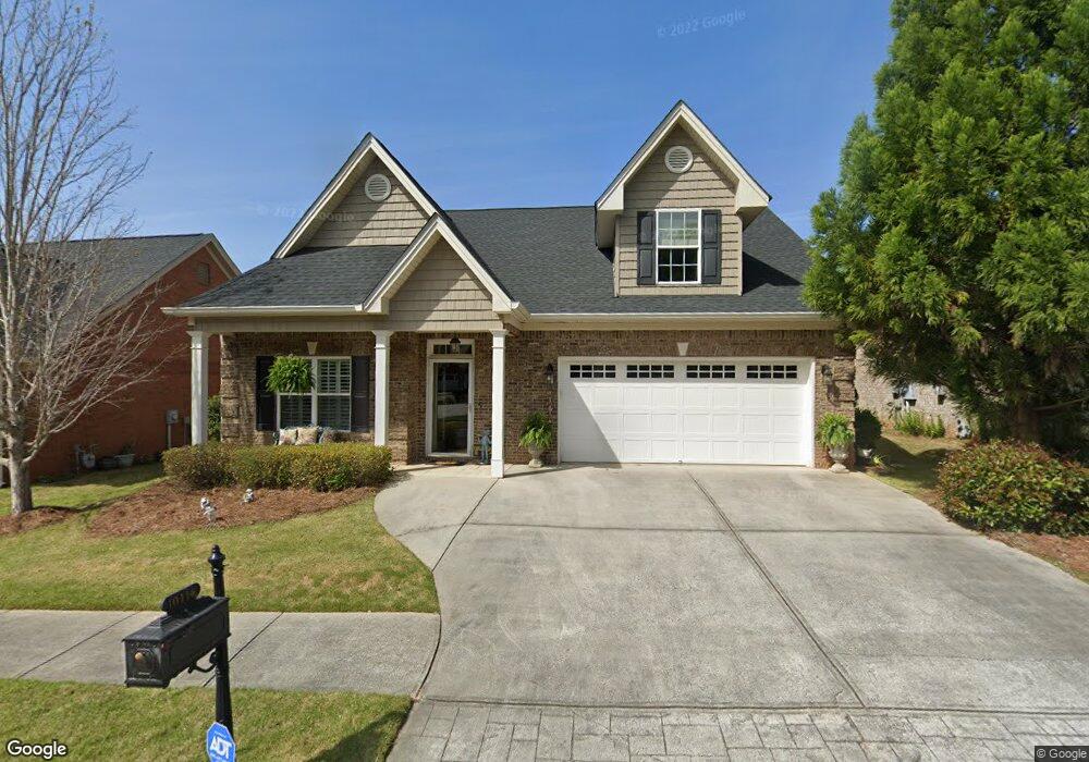
10114 Malcolm Dr Covington, GA 30014
Estimated Value: $344,000 - $397,000
2
Beds
2
Baths
2,204
Sq Ft
$166/Sq Ft
Est. Value
About This Home
This home is located at 10114 Malcolm Dr, Covington, GA 30014 and is currently estimated at $366,785, approximately $166 per square foot. 10114 Malcolm Dr is a home located in Newton County with nearby schools including Middle Ridge Elementary School, Cousins Middle School, and Eastside High School.
Ownership History
Date
Name
Owned For
Owner Type
Purchase Details
Closed on
Apr 18, 2018
Sold by
Davis Hugo M
Bought by
Martin Joan C
Current Estimated Value
Purchase Details
Closed on
Apr 15, 2011
Sold by
Laurita Norma
Bought by
Davis Hugo M and Davis Peggy M
Home Financials for this Owner
Home Financials are based on the most recent Mortgage that was taken out on this home.
Original Mortgage
$143,920
Interest Rate
4.83%
Mortgage Type
New Conventional
Purchase Details
Closed on
Apr 12, 2007
Sold by
T & T Const Inc
Bought by
Laurita Norma
Create a Home Valuation Report for This Property
The Home Valuation Report is an in-depth analysis detailing your home's value as well as a comparison with similar homes in the area
Home Values in the Area
Average Home Value in this Area
Purchase History
| Date | Buyer | Sale Price | Title Company |
|---|---|---|---|
| Martin Joan C | $230,000 | -- | |
| Davis Hugo M | $179,900 | -- | |
| Laurita Norma | $223,000 | -- |
Source: Public Records
Mortgage History
| Date | Status | Borrower | Loan Amount |
|---|---|---|---|
| Previous Owner | Davis Hugo M | $143,920 |
Source: Public Records
Tax History
| Year | Tax Paid | Tax Assessment Tax Assessment Total Assessment is a certain percentage of the fair market value that is determined by local assessors to be the total taxable value of land and additions on the property. | Land | Improvement |
|---|---|---|---|---|
| 2025 | $4,407 | $148,160 | $20,000 | $128,160 |
| 2024 | $4,311 | $142,760 | $20,000 | $122,760 |
| 2023 | $4,082 | $125,600 | $12,800 | $112,800 |
| 2022 | $3,580 | $110,160 | $12,800 | $97,360 |
| 2021 | $3,623 | $99,760 | $12,800 | $86,960 |
| 2020 | $3,520 | $88,240 | $12,800 | $75,440 |
| 2019 | $3,631 | $89,360 | $12,800 | $76,560 |
| 2018 | $3,779 | $91,960 | $12,800 | $79,160 |
| 2017 | $2,611 | $87,960 | $12,800 | $75,160 |
| 2016 | $1,887 | $70,320 | $9,600 | $60,720 |
| 2015 | $1,892 | $70,440 | $8,000 | $62,440 |
| 2014 | $1,743 | $66,840 | $0 | $0 |
Source: Public Records
Map
Nearby Homes
- 10110 Malcolm Ct
- 10155 Malcolm Dr
- 10184 Malcolm Dr
- 8193 Monticello St
- 85 Bellerive Ln SE
- 130 S Links Dr
- 8 Jackson Rd
- 7703 Fawn Cir
- 7713 Fawn Cir Unit 51
- 7762 Fawn Cir
- 8239 High Lake Terrace SE
- 9187 Plantation Cir
- 0 Petty St Unit 10547316
- 0 Petty St Unit 7640177
- 7155 Petty St SW
- 8151 Puckett St SW
- 7120 Chaney Dr SW
- 6195 Petty St SW
- 8112 Puckett St SW
- 6175 Petty St SW
- 10120 Malcolm Dr Unit 126
- 10120 Malcolm Dr
- 10108 Malcolm Dr Unit /47
- 10108 Malcolm Dr
- 10102 Malcolm Dr
- 10102 Malcolm Dr Unit 1
- 10126 Malcolm Dr
- 10119 Leverett Cir Unit LOT 54
- 10113 Leverett Cir
- 10105 Malcolm Ct
- 9102 Whispering Pines Cir
- 9216 Malcolm Dr
- 9210 Malcolm Dr
- 10111 Malcolm Ct
- 10104 Malcolm Ct
- 10138 Malcolm Dr Unit 57
- 10138 Malcolm Dr
- 9108 Whispering Pines Cir
- 9103 Whispering Pines Cir
- 9119 Leverett Cir
Your Personal Tour Guide
Ask me questions while you tour the home.