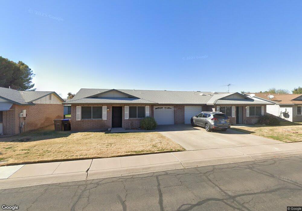
10114 N 95th Dr Unit A Peoria, AZ 85345
Estimated Value: $192,923 - $238,000
2
Beds
2
Baths
1,072
Sq Ft
$203/Sq Ft
Est. Value
About This Home
This home is located at 10114 N 95th Dr Unit A, Peoria, AZ 85345 and is currently estimated at $217,981, approximately $203 per square foot. 10114 N 95th Dr Unit A is a home located in Maricopa County with nearby schools including Sun Valley Elementary School, Raymond S. Kellis, and Ombudsman - Northwest Charter.
Ownership History
Date
Name
Owned For
Owner Type
Purchase Details
Closed on
May 8, 2003
Sold by
Lomonaco Kathleen Gail and Lomonaco Rosario Dominic
Bought by
Greener Sarah E
Current Estimated Value
Home Financials for this Owner
Home Financials are based on the most recent Mortgage that was taken out on this home.
Original Mortgage
$59,330
Outstanding Balance
$25,711
Interest Rate
5.75%
Mortgage Type
New Conventional
Estimated Equity
$192,270
Create a Home Valuation Report for This Property
The Home Valuation Report is an in-depth analysis detailing your home's value as well as a comparison with similar homes in the area
Home Values in the Area
Average Home Value in this Area
Purchase History
| Date | Buyer | Sale Price | Title Company |
|---|---|---|---|
| Greener Sarah E | $66,000 | Equity Title Agency Inc |
Source: Public Records
Mortgage History
| Date | Status | Borrower | Loan Amount |
|---|---|---|---|
| Open | Greener Sarah E | $59,330 |
Source: Public Records
Tax History Compared to Growth
Tax History
| Year | Tax Paid | Tax Assessment Tax Assessment Total Assessment is a certain percentage of the fair market value that is determined by local assessors to be the total taxable value of land and additions on the property. | Land | Improvement |
|---|---|---|---|---|
| 2025 | $476 | $6,114 | -- | -- |
| 2024 | $469 | $5,823 | -- | -- |
| 2023 | $469 | $16,510 | $3,300 | $13,210 |
| 2022 | $459 | $12,950 | $2,590 | $10,360 |
| 2021 | $491 | $11,260 | $2,250 | $9,010 |
| 2020 | $496 | $10,420 | $2,080 | $8,340 |
| 2019 | $480 | $9,110 | $1,820 | $7,290 |
| 2018 | $464 | $7,330 | $1,460 | $5,870 |
| 2017 | $464 | $6,120 | $1,220 | $4,900 |
| 2016 | $460 | $5,470 | $1,090 | $4,380 |
| 2015 | $429 | $5,560 | $1,110 | $4,450 |
Source: Public Records
Map
Nearby Homes
- 10127 N 95th Dr Unit A
- 10134 N 97th Ave Unit B
- 9616 W Mountain View Rd Unit A
- 9627 W North Ln Unit B
- 10018 N 97th Dr Unit A
- 10226 N 93rd Dr
- 10245 N 93rd Dr
- 9564 W Purdue Ave
- 9653 W Purdue Ave
- 10201 N 99th Ave Unit 32A
- 10201 N 99th Ave Unit 46
- 10201 N 99th Ave Unit 44
- 10201 N 99th Ave Unit 97
- 10201 N 99th Ave Unit 34
- 10201 N 99th Ave Unit 28A
- 10201 N 99th Ave Unit 49
- 10201 N 99th Ave Unit 129E
- 10201 N 99th Ave Unit 135F
- 10201 N 99th Ave Unit 3
- 10201 N 99th Ave Unit 160
- 10114 N 95th Dr
- 10114 N 95th Dr Unit B
- 10108 N 95th Dr Unit B
- 10120 N 95th Dr Unit A
- 10120 N 95th Dr Unit B
- 10113 N 96th Ave Unit B
- 10113 N 96th Ave Unit A
- 10119 N 96th Ave Unit A
- 10119 N 96th Ave Unit B
- 10119 N 95th Dr
- 10119 N 95th Dr Unit B
- 10119 N 95th Dr Unit A
- 10107 N 96th Ave Unit A
- 10107 N 96th Ave Unit B
- 10111 N 95th Dr Unit B
- 10111 N 95th Dr Unit A
- 10102 N 95th Dr Unit B
- 10102 N 95th Dr Unit A
- 10128 N 95th Dr Unit A
- 10128 N 95th Dr Unit B