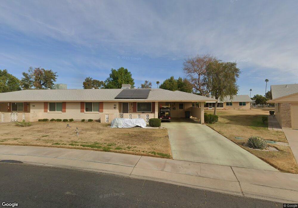
10114 W Forrester Dr Sun City, AZ 85351
Estimated Value: $183,000 - $223,000
2
Beds
2
Baths
1,125
Sq Ft
$181/Sq Ft
Est. Value
About This Home
This home is located at 10114 W Forrester Dr, Sun City, AZ 85351 and is currently estimated at $203,580, approximately $180 per square foot. 10114 W Forrester Dr is a home located in Maricopa County with nearby schools including Desert Mirage Elementary School, Ombudsman - Northwest Charter, and Arrowhead Montessori.
Ownership History
Date
Name
Owned For
Owner Type
Purchase Details
Closed on
Nov 28, 2011
Sold by
Glassman Wilson Esther M
Bought by
Wilson William R and William H Wilson Jr Revocable Trust
Current Estimated Value
Purchase Details
Closed on
Nov 22, 2011
Sold by
Wilson William R
Bought by
Tietge Dennis L and Tietge Mary Jo
Purchase Details
Closed on
Mar 11, 1994
Sold by
Fraser Ralph A and Fraser Jacqueline D
Bought by
Wilson William H and Wilson Elisa
Home Financials for this Owner
Home Financials are based on the most recent Mortgage that was taken out on this home.
Original Mortgage
$46,800
Interest Rate
7.59%
Mortgage Type
New Conventional
Create a Home Valuation Report for This Property
The Home Valuation Report is an in-depth analysis detailing your home's value as well as a comparison with similar homes in the area
Home Values in the Area
Average Home Value in this Area
Purchase History
| Date | Buyer | Sale Price | Title Company |
|---|---|---|---|
| Wilson William R | -- | First American Title Ins Co | |
| Tietge Dennis L | $54,000 | First American Title Ins Co | |
| Wilson William H | $66,900 | First Service Title Agency I |
Source: Public Records
Mortgage History
| Date | Status | Borrower | Loan Amount |
|---|---|---|---|
| Previous Owner | Wilson William H | $46,800 |
Source: Public Records
Tax History Compared to Growth
Tax History
| Year | Tax Paid | Tax Assessment Tax Assessment Total Assessment is a certain percentage of the fair market value that is determined by local assessors to be the total taxable value of land and additions on the property. | Land | Improvement |
|---|---|---|---|---|
| 2025 | $681 | $8,432 | -- | -- |
| 2024 | $614 | $8,031 | -- | -- |
| 2023 | $614 | $16,080 | $3,210 | $12,870 |
| 2022 | $578 | $13,660 | $2,730 | $10,930 |
| 2021 | $597 | $12,080 | $2,410 | $9,670 |
| 2020 | $581 | $10,570 | $2,110 | $8,460 |
| 2019 | $573 | $9,830 | $1,960 | $7,870 |
| 2018 | $552 | $8,520 | $1,700 | $6,820 |
| 2017 | $533 | $7,330 | $1,460 | $5,870 |
| 2016 | $499 | $5,970 | $1,190 | $4,780 |
| 2015 | $478 | $5,570 | $1,110 | $4,460 |
Source: Public Records
Map
Nearby Homes
- 10112 W Forrester Dr
- 13410 N Cedar Dr Unit 20
- 10127 W Forrester Dr
- 10114 W Candlewood Dr
- 13620 N Hawthorn Dr
- 13614 N Hawthorn Dr
- 10134 W Forrester Dr
- 10137 W Forrester Dr Unit 20
- 10114 W Royal Oak Rd Unit 20
- 13442 N Emberwood Dr
- 13606 N Redwood Dr Unit 209
- 13433 N Emberwood Dr
- 13636 N Redwood Dr Unit 203
- 13605 N Redwood Dr
- 10012 W Bolivar Dr
- 13420 N Emberwood Dr
- 10040 W Royal Oak Rd Unit B
- 10040 W Royal Oak Rd Unit H
- 13067 N 100th Dr
- 10030 W Royal Oak Rd Unit C
- 10116 W Forrester Dr
- 13636 N Emberwood Dr
- 13632 N Emberwood Dr Unit 172
- 10118 W Forrester Dr
- 10110 W Forrester Dr
- 10101 W Bolivar Dr
- 13626 N Emberwood Dr
- 10111 W Forrester Dr Unit 97
- 10120 W Forrester Dr Unit 112
- 13622 N Emberwood Dr Unit 20
- 10109 W Forrester Dr
- 10108 W Forrester Dr Unit 106
- 10113 W Bolivar Dr Unit 167
- 13616 N Emberwood Dr Unit 175
- 10122 W Forrester Dr Unit 113
- 13415 N Cedar Dr Unit 20
- 10107 W Forrester Dr
- 10106 W Forrester Dr
- 13413 N Cedar Dr Unit 95
- 13631 N Emberwood Dr Unit 185