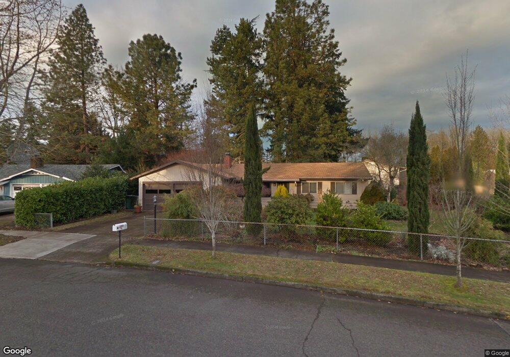
10115 SW Winter Ln Beaverton, OR 97008
Denney Whitford NeighborhoodEstimated Value: $503,000 - $530,000
3
Beds
2
Baths
1,248
Sq Ft
$413/Sq Ft
Est. Value
About This Home
This home is located at 10115 SW Winter Ln, Beaverton, OR 97008 and is currently estimated at $515,140, approximately $412 per square foot. 10115 SW Winter Ln is a home located in Washington County with nearby schools including McKay Elementary School, Whitford Middle School, and Southridge High School.
Ownership History
Date
Name
Owned For
Owner Type
Purchase Details
Closed on
Mar 8, 2006
Sold by
Carter Chitose
Bought by
Kitchel Barbara A
Current Estimated Value
Home Financials for this Owner
Home Financials are based on the most recent Mortgage that was taken out on this home.
Original Mortgage
$167,000
Outstanding Balance
$93,879
Interest Rate
6.08%
Mortgage Type
Fannie Mae Freddie Mac
Estimated Equity
$421,261
Purchase Details
Closed on
Mar 19, 2001
Sold by
Tollbom Bruce C and Tollbom Heather J
Bought by
Carter Chitose
Home Financials for this Owner
Home Financials are based on the most recent Mortgage that was taken out on this home.
Original Mortgage
$75,000
Interest Rate
11.25%
Create a Home Valuation Report for This Property
The Home Valuation Report is an in-depth analysis detailing your home's value as well as a comparison with similar homes in the area
Home Values in the Area
Average Home Value in this Area
Purchase History
| Date | Buyer | Sale Price | Title Company |
|---|---|---|---|
| Kitchel Barbara A | $235,000 | First American Title Insuran | |
| Carter Chitose | $152,000 | First American |
Source: Public Records
Mortgage History
| Date | Status | Borrower | Loan Amount |
|---|---|---|---|
| Open | Kitchel Barbara A | $167,000 | |
| Previous Owner | Carter Chitose | $75,000 |
Source: Public Records
Tax History Compared to Growth
Tax History
| Year | Tax Paid | Tax Assessment Tax Assessment Total Assessment is a certain percentage of the fair market value that is determined by local assessors to be the total taxable value of land and additions on the property. | Land | Improvement |
|---|---|---|---|---|
| 2025 | $4,885 | $231,550 | -- | -- |
| 2024 | $4,613 | $224,810 | -- | -- |
| 2023 | $4,613 | $218,270 | $0 | $0 |
| 2022 | $4,415 | $218,270 | $0 | $0 |
| 2021 | $4,260 | $205,750 | $0 | $0 |
| 2020 | $4,131 | $199,760 | $0 | $0 |
| 2019 | $4,000 | $193,950 | $0 | $0 |
| 2018 | $3,873 | $188,310 | $0 | $0 |
| 2017 | $3,728 | $182,830 | $0 | $0 |
| 2016 | $3,598 | $177,510 | $0 | $0 |
| 2015 | $3,465 | $172,340 | $0 | $0 |
| 2014 | $3,391 | $167,330 | $0 | $0 |
Source: Public Records
Map
Nearby Homes
- 10275 SW Winter Ln
- 10405 SW Denney Rd Unit 90
- 10440 SW Denney Rd
- 6745 SW Scholls Ferry Rd Unit 10
- 6745 SW Scholls Ferry Rd Unit 38
- 6325 SW Elm Ave
- 9845 SW Eagle Ln
- 6025 SW Spruce Ave
- 7640 SW Whitford Dr
- 6075 SW Arrow Wood Ln
- 10080 SW Crystal St
- 8050 SW 103rd Ave
- 6455 SW Scholls Ferry Rd
- 5805 SW Arrow Wood Ln
- 6820 SW Queen Ln
- 7720 SW Bel Aire Dr
- 6160 SW Alice Ln Unit 203B
- 5490 SW Elm Ave
- 6150 SW Alice Ln
- 6555 SW 86th Ave
- 6715 SW Oakwood Dr
- 10125 SW Winter Ln
- 6725 SW Rollingwood Dr
- 6825 SW Oakwood Dr
- 6695 SW Rollingwood Dr
- 6720 SW Oakwood Dr
- 6770 SW Oakwood Dr
- 10120 SW Winter Ln
- 10155 SW Winter Ln
- 6775 SW Rollingwood Dr
- 6820 SW Oakwood Dr
- 6675 SW Rollingwood Dr
- 6855 SW Oakwood Dr
- 6825 SW Rollingwood Dr
- 6850 SW Oakwood Dr
- 10175 SW Winter Ln
- 6855 SW Rollingwood Dr
- 6690 SW Rollingwood Dr
- 6700 SW Rollingwood Dr
- 6670 SW Pinecrest Ct