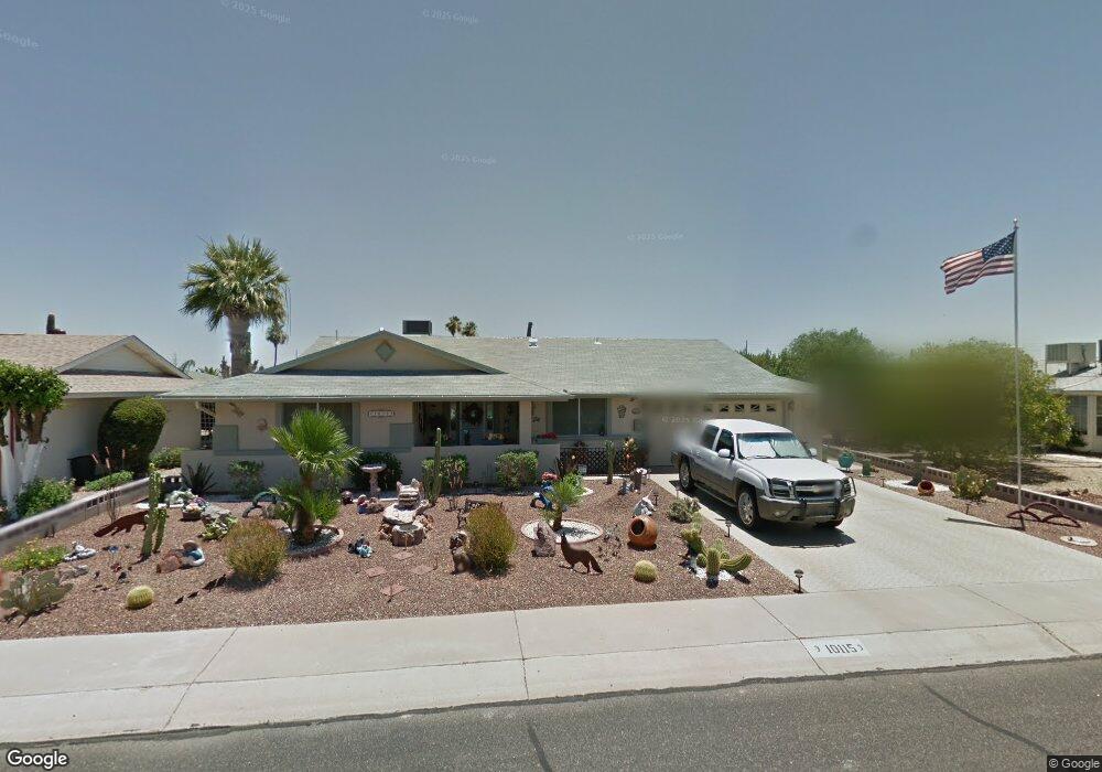
10115 W Kelso Dr Sun City, AZ 85351
Estimated Value: $239,724 - $305,000
3
Beds
2
Baths
1,768
Sq Ft
$159/Sq Ft
Est. Value
About This Home
This home is located at 10115 W Kelso Dr, Sun City, AZ 85351 and is currently estimated at $281,931, approximately $159 per square foot. 10115 W Kelso Dr is a home located in Maricopa County with nearby schools including Ombudsman - Northwest Charter and Peoria Accelerated High School.
Ownership History
Date
Name
Owned For
Owner Type
Purchase Details
Closed on
Dec 6, 2005
Sold by
Fry James
Bought by
Wittreich Charles E and Miller Patricia A
Current Estimated Value
Home Financials for this Owner
Home Financials are based on the most recent Mortgage that was taken out on this home.
Original Mortgage
$154,000
Outstanding Balance
$86,573
Interest Rate
6.37%
Mortgage Type
Purchase Money Mortgage
Estimated Equity
$195,358
Purchase Details
Closed on
May 11, 2001
Sold by
Fry James H and Fry Esther E
Bought by
Fry James H and Fry Esther E
Create a Home Valuation Report for This Property
The Home Valuation Report is an in-depth analysis detailing your home's value as well as a comparison with similar homes in the area
Home Values in the Area
Average Home Value in this Area
Purchase History
| Date | Buyer | Sale Price | Title Company |
|---|---|---|---|
| Wittreich Charles E | $192,500 | Ticor Title Agency Of Az Inc | |
| Fry James H | -- | -- |
Source: Public Records
Mortgage History
| Date | Status | Borrower | Loan Amount |
|---|---|---|---|
| Open | Wittreich Charles E | $154,000 |
Source: Public Records
Tax History Compared to Growth
Tax History
| Year | Tax Paid | Tax Assessment Tax Assessment Total Assessment is a certain percentage of the fair market value that is determined by local assessors to be the total taxable value of land and additions on the property. | Land | Improvement |
|---|---|---|---|---|
| 2025 | $987 | $12,143 | -- | -- |
| 2024 | $889 | $11,565 | -- | -- |
| 2023 | $889 | $21,280 | $4,250 | $17,030 |
| 2022 | $828 | $16,620 | $3,320 | $13,300 |
| 2021 | $855 | $15,500 | $3,100 | $12,400 |
| 2020 | $831 | $13,610 | $2,720 | $10,890 |
| 2019 | $829 | $12,680 | $2,530 | $10,150 |
| 2018 | $801 | $11,560 | $2,310 | $9,250 |
| 2017 | $770 | $10,280 | $2,050 | $8,230 |
| 2016 | $720 | $9,650 | $1,930 | $7,720 |
| 2015 | $689 | $8,700 | $1,740 | $6,960 |
Source: Public Records
Map
Nearby Homes
- 10001 W Caron Dr Unit 8
- 10201 W Caron Dr
- 10014 W Mission Ln
- 10109 W Mountain View Rd
- 10221 W Puget Ave
- 10022 W Mountain View Rd
- 10326 W Caron Dr
- 9925 W Mountain View Rd Unit 27
- 9915 W Mountain View Rd
- 9815 N 103rd Ave
- 10316 W Salem Dr Unit 6D
- 9834 N Balboa Dr
- 10166 W Cinnebar Ave
- 9158 N 98th Dr
- 10131 W Cheryl Dr Unit 6D
- 8601 N 103rd Ave Unit 313
- 8601 N 103rd Ave Unit 271
- 8601 N 103rd Ave Unit 58
- 8601 N 103rd Ave Unit 72
- 10302 W Cheryl Dr Unit D
- 10111 W Kelso Dr
- 9039 N 102nd Ave
- 9039 N 102nd Dr
- 9031 N 102nd Ave
- 10110 W Caron Dr
- 10101 W Kelso Dr
- 10018 W Caron Dr
- 10116 W Kelso Dr
- 10112 W Kelso Dr
- 10226 W Kelso Dr
- 10118 W Caron Dr
- 10019 W Kelso Dr
- 10102 W Kelso Dr
- 10202 W Kelso Dr
- 9040 N 102nd Ave
- 10101 W Caron Dr
- 10022 W Kelso Dr
- 10215 W Mission Ln
- 10124 W Caron Dr
- 10203 W Mission Ln