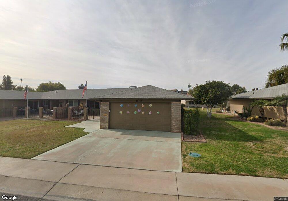
10117 W Candlewood Dr Unit 20 Sun City, AZ 85351
Estimated Value: $264,000 - $302,000
2
Beds
2
Baths
1,683
Sq Ft
$169/Sq Ft
Est. Value
About This Home
This home is located at 10117 W Candlewood Dr Unit 20, Sun City, AZ 85351 and is currently estimated at $284,619, approximately $169 per square foot. 10117 W Candlewood Dr Unit 20 is a home located in Maricopa County with nearby schools including Desert Mirage Elementary School, Ombudsman - Northwest Charter, and Peoria Accelerated High School.
Ownership History
Date
Name
Owned For
Owner Type
Purchase Details
Closed on
Aug 20, 2024
Sold by
Hall Family Living Trust and Hall John Robert
Bought by
Sutton Gary A and Sutton Kathleen M
Current Estimated Value
Purchase Details
Closed on
Apr 27, 2020
Sold by
Hall John Robert
Bought by
Hall John Robert and Hall Anna Teresa
Purchase Details
Closed on
Mar 23, 2020
Sold by
Hall John Robert and Hall Cynthia Agnes
Bought by
Hall John Robert
Purchase Details
Closed on
Sep 29, 2016
Sold by
King Denise E
Bought by
Hall John Robert and Hall Cynthia Agnes
Purchase Details
Closed on
Nov 9, 2011
Sold by
Oien Janice L
Bought by
Bilik Walter T and Bilik Margaret R
Purchase Details
Closed on
Oct 2, 2008
Sold by
Oien Douglas J and Oien Janice L
Bought by
Burson Harry F
Home Financials for this Owner
Home Financials are based on the most recent Mortgage that was taken out on this home.
Original Mortgage
$80,000
Interest Rate
6.31%
Mortgage Type
Purchase Money Mortgage
Purchase Details
Closed on
Sep 25, 2008
Sold by
Burson Phyllis M
Bought by
Burson Harry F
Home Financials for this Owner
Home Financials are based on the most recent Mortgage that was taken out on this home.
Original Mortgage
$80,000
Interest Rate
6.31%
Mortgage Type
Purchase Money Mortgage
Purchase Details
Closed on
Jun 14, 2007
Sold by
Kirkendall Alice J
Bought by
Oien Douglas J and Oien Janice L
Home Financials for this Owner
Home Financials are based on the most recent Mortgage that was taken out on this home.
Original Mortgage
$100,000
Interest Rate
6.21%
Mortgage Type
Purchase Money Mortgage
Purchase Details
Closed on
Oct 12, 2000
Sold by
Wilson W B and Wilson Helen M
Bought by
Kirkendall Alice J and Blackburn Jean R
Purchase Details
Closed on
Sep 4, 1997
Sold by
Wyatt David L and Wyatt Bonnie L
Bought by
Wilson W B and Wilson Helen M
Home Financials for this Owner
Home Financials are based on the most recent Mortgage that was taken out on this home.
Original Mortgage
$84,000
Interest Rate
6.12%
Create a Home Valuation Report for This Property
The Home Valuation Report is an in-depth analysis detailing your home's value as well as a comparison with similar homes in the area
Home Values in the Area
Average Home Value in this Area
Purchase History
| Date | Buyer | Sale Price | Title Company |
|---|---|---|---|
| Sutton Gary A | $300,000 | Equity Title Agency | |
| Hall John Robert | -- | None Available | |
| Hall John Robert | -- | None Available | |
| Hall John Robert | -- | None Available | |
| Bilik Walter T | $82,500 | Empire West Title Agency | |
| Burson Harry F | $163,000 | None Available | |
| Burson Harry F | -- | None Available | |
| Oien Douglas J | $149,500 | Security Title Agency Inc | |
| Kirkendall Alice J | $103,000 | First American Title | |
| Wilson W B | $105,000 | First American Title |
Source: Public Records
Mortgage History
| Date | Status | Borrower | Loan Amount |
|---|---|---|---|
| Previous Owner | Burson Harry F | $80,000 | |
| Previous Owner | Burson Harry F | $80,000 | |
| Previous Owner | Oien Douglas J | $100,000 | |
| Previous Owner | Wilson W B | $84,000 |
Source: Public Records
Tax History Compared to Growth
Tax History
| Year | Tax Paid | Tax Assessment Tax Assessment Total Assessment is a certain percentage of the fair market value that is determined by local assessors to be the total taxable value of land and additions on the property. | Land | Improvement |
|---|---|---|---|---|
| 2025 | $974 | $12,058 | -- | -- |
| 2024 | $878 | $11,484 | -- | -- |
| 2023 | $878 | $20,050 | $4,010 | $16,040 |
| 2022 | $827 | $17,450 | $3,490 | $13,960 |
| 2021 | $854 | $15,810 | $3,160 | $12,650 |
| 2020 | $831 | $14,100 | $2,820 | $11,280 |
| 2019 | $820 | $13,470 | $2,690 | $10,780 |
| 2018 | $789 | $11,930 | $2,380 | $9,550 |
| 2017 | $762 | $10,450 | $2,090 | $8,360 |
| 2016 | $367 | $8,600 | $1,720 | $6,880 |
| 2015 | $340 | $8,330 | $1,660 | $6,670 |
Source: Public Records
Map
Nearby Homes
- 10114 W Candlewood Dr
- 10114 W Royal Oak Rd Unit 20
- 13410 N Cedar Dr Unit 20
- 10127 W Forrester Dr
- 10137 W Forrester Dr Unit 20
- 10134 W Forrester Dr
- 10225 W Thunderbird Blvd
- 10112 W Forrester Dr
- 10040 W Royal Oak Rd Unit B
- 10040 W Royal Oak Rd Unit H
- 10030 W Royal Oak Rd Unit C
- 13620 N Hawthorn Dr
- 13614 N Hawthorn Dr
- 13442 N Emberwood Dr
- 10229 W Bolivar Dr
- 13067 N 100th Dr
- 13433 N Emberwood Dr
- 13071 N 100th Dr
- 13636 N Redwood Dr Unit 203
- 13606 N Redwood Dr Unit 209
- 10115 W Candlewood Dr
- 10121 W Candlewood Dr
- 10123 W Candlewood Dr
- 10112 W Royal Oak Rd Unit 20
- 10110 W Royal Oak Rd Unit 17
- 10116 W Royal Oak Rd
- 10116 W Royal Oak Rd Unit 20
- 10118 W Candlewood Dr
- 10116 W Candlewood Dr
- 10120 W Candlewood Dr
- 10109 W Candlewood Dr Unit 44
- 10125 W Candlewood Dr Unit 38
- 10122 W Candlewood Dr Unit 20
- 10108 W Royal Oak Rd
- 10112 W Candlewood Dr
- 10124 W Candlewood Dr
- 10118 W Royal Oak Rd
- 10107 W Candlewood Dr
- 10110 W Candlewood Dr
- 10106 W Royal Oak Rd Unit 20