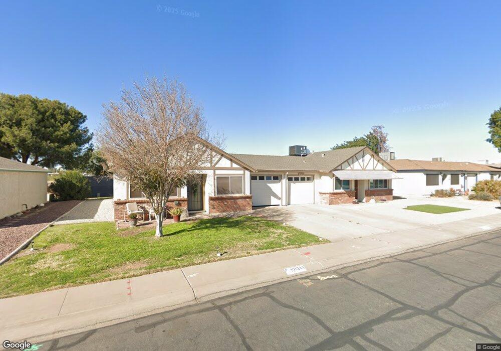
10118 N 97th Dr Unit A Peoria, AZ 85345
Estimated Value: $179,382 - $237,000
--
Bed
2
Baths
1,025
Sq Ft
$207/Sq Ft
Est. Value
About This Home
This home is located at 10118 N 97th Dr Unit A, Peoria, AZ 85345 and is currently estimated at $212,596, approximately $207 per square foot. 10118 N 97th Dr Unit A is a home located in Maricopa County with nearby schools including Sun Valley Elementary School, Raymond S. Kellis, and Ombudsman - Northwest Charter.
Ownership History
Date
Name
Owned For
Owner Type
Purchase Details
Closed on
Oct 4, 2002
Sold by
Hillman Ronald W and Estate Of Richard F Hillman
Bought by
Mason Raphaelia
Current Estimated Value
Home Financials for this Owner
Home Financials are based on the most recent Mortgage that was taken out on this home.
Original Mortgage
$64,020
Outstanding Balance
$26,467
Interest Rate
5.97%
Mortgage Type
FHA
Estimated Equity
$186,129
Purchase Details
Closed on
Mar 14, 2001
Sold by
Richardson Mary E
Bought by
Hillman Richard F
Purchase Details
Closed on
Apr 8, 1996
Sold by
Gross Willard
Bought by
Richardson Mary E
Home Financials for this Owner
Home Financials are based on the most recent Mortgage that was taken out on this home.
Original Mortgage
$53,200
Interest Rate
7.84%
Mortgage Type
New Conventional
Create a Home Valuation Report for This Property
The Home Valuation Report is an in-depth analysis detailing your home's value as well as a comparison with similar homes in the area
Home Values in the Area
Average Home Value in this Area
Purchase History
| Date | Buyer | Sale Price | Title Company |
|---|---|---|---|
| Mason Raphaelia | $66,000 | Capital Title Agency Inc | |
| Hillman Richard F | $58,000 | Security Title Agency | |
| Richardson Mary E | $56,000 | First American Title |
Source: Public Records
Mortgage History
| Date | Status | Borrower | Loan Amount |
|---|---|---|---|
| Open | Mason Raphaelia | $64,020 | |
| Previous Owner | Richardson Mary E | $53,200 |
Source: Public Records
Tax History Compared to Growth
Tax History
| Year | Tax Paid | Tax Assessment Tax Assessment Total Assessment is a certain percentage of the fair market value that is determined by local assessors to be the total taxable value of land and additions on the property. | Land | Improvement |
|---|---|---|---|---|
| 2025 | $439 | $5,644 | -- | -- |
| 2024 | $433 | $5,375 | -- | -- |
| 2023 | $433 | $16,030 | $3,200 | $12,830 |
| 2022 | $424 | $12,280 | $2,450 | $9,830 |
| 2021 | $454 | $10,670 | $2,130 | $8,540 |
| 2020 | $458 | $9,870 | $1,970 | $7,900 |
| 2019 | $422 | $8,730 | $1,740 | $6,990 |
| 2018 | $343 | $10,150 | $2,030 | $8,120 |
| 2017 | $329 | $5,730 | $1,140 | $4,590 |
| 2016 | $322 | $10,150 | $2,030 | $8,120 |
| 2015 | $290 | $10,150 | $2,030 | $8,120 |
Source: Public Records
Map
Nearby Homes
- 10134 N 97th Ave Unit B
- 9616 W Mountain View Rd Unit A
- 10127 N 95th Dr Unit A
- 10201 N 99th Ave Unit 32A
- 10201 N 99th Ave Unit 46
- 10201 N 99th Ave Unit 44
- 10201 N 99th Ave Unit 97
- 10201 N 99th Ave Unit 34
- 10201 N 99th Ave Unit 28A
- 10201 N 99th Ave Unit 49
- 10201 N 99th Ave Unit 129E
- 10201 N 99th Ave Unit 135F
- 10201 N 99th Ave Unit 3
- 10201 N 99th Ave Unit 160
- 10201 N 99th Ave Unit 149
- 10201 N 99th Ave Unit 2
- 10201 N 99th Ave Unit 33
- 10201 N 99th Ave Unit 152
- 10201 N 99th Ave Unit 21
- 10201 N 99th Ave Unit 96
- 10118 N 97th Dr Unit B
- 10110 N 97th Dr Unit B
- 10110 N 97th Dr Unit A
- 10126 N 97th Dr Unit B
- 10126 N 97th Dr Unit A
- 10126 N 97th Dr
- 10109 N 97th Dr Unit B
- 10109 N 97th Dr Unit A
- 10101 N 97th Dr
- 10101 N 97th Dr Unit B
- 10101 N 97th Dr Unit A
- 10101 N 97th Dr Unit B
- 10101 N 97th Dr Unit A
- 10117 N 97th Dr Unit B
- 10117 N 97th Dr Unit A
- 10102 N 97th Dr Unit B
- 10102 N 97th Dr Unit A
- 10023 N 97th Dr Unit B
- 10023 N 97th Dr Unit A
- 10132 N 97th Dr Unit B