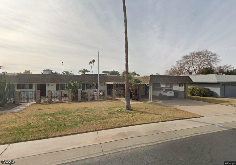
10119 W Bolivar Dr Sun City, AZ 85351
Estimated Value: $254,000 - $291,000
2
Beds
2
Baths
1,683
Sq Ft
$164/Sq Ft
Est. Value
About This Home
This home is located at 10119 W Bolivar Dr, Sun City, AZ 85351 and is currently estimated at $276,000, approximately $163 per square foot. 10119 W Bolivar Dr is a home located in Maricopa County with nearby schools including Desert Mirage Elementary School, Ombudsman - Northwest Charter, and Peoria Accelerated High School.
Ownership History
Date
Name
Owned For
Owner Type
Purchase Details
Closed on
Sep 27, 2019
Sold by
Grow Investments Llc
Bought by
Uriarte Properties Llc
Current Estimated Value
Home Financials for this Owner
Home Financials are based on the most recent Mortgage that was taken out on this home.
Original Mortgage
$120,000
Outstanding Balance
$104,661
Interest Rate
3.5%
Mortgage Type
Commercial
Estimated Equity
$171,339
Purchase Details
Closed on
Jun 10, 2015
Sold by
Evans Paula R and Estate Of Darwin O Fee
Bought by
Evans Paula R
Purchase Details
Closed on
Dec 9, 2011
Sold by
Evans Paula R
Bought by
Fee Darwin O
Purchase Details
Closed on
Jul 29, 2010
Sold by
Evans Steven A
Bought by
Evans Paula R
Purchase Details
Closed on
Sep 7, 2007
Sold by
Evans Paula R
Bought by
Evans Paula R and Evans Steven A
Create a Home Valuation Report for This Property
The Home Valuation Report is an in-depth analysis detailing your home's value as well as a comparison with similar homes in the area
Home Values in the Area
Average Home Value in this Area
Purchase History
| Date | Buyer | Sale Price | Title Company |
|---|---|---|---|
| Uriarte Properties Llc | $164,000 | Pioneer Title Agency Inc | |
| Evans Paula R | -- | None Available | |
| Fee Darwin O | -- | None Available | |
| Evans Paula R | -- | None Available | |
| Evans Paula R | -- | None Available |
Source: Public Records
Mortgage History
| Date | Status | Borrower | Loan Amount |
|---|---|---|---|
| Open | Uriarte Properties Llc | $120,000 |
Source: Public Records
Tax History Compared to Growth
Tax History
| Year | Tax Paid | Tax Assessment Tax Assessment Total Assessment is a certain percentage of the fair market value that is determined by local assessors to be the total taxable value of land and additions on the property. | Land | Improvement |
|---|---|---|---|---|
| 2025 | $297 | $8,423 | -- | -- |
| 2024 | $325 | -- | -- | -- |
| 2023 | $325 | $11,780 | $2,350 | $9,430 |
| 2022 | $336 | $11,780 | $2,350 | $9,430 |
| 2021 | $371 | $15,710 | $3,140 | $12,570 |
| 2020 | $385 | $14,000 | $2,800 | $11,200 |
| 2019 | $406 | $13,320 | $2,660 | $10,660 |
| 2018 | $417 | $11,780 | $2,350 | $9,430 |
| 2017 | $391 | $10,270 | $2,050 | $8,220 |
| 2016 | $354 | $8,420 | $1,680 | $6,740 |
| 2015 | $672 | $8,110 | $1,620 | $6,490 |
Source: Public Records
Map
Nearby Homes
- 10134 W Forrester Dr
- 10112 W Forrester Dr
- 10127 W Forrester Dr
- 13620 N Hawthorn Dr
- 10137 W Forrester Dr Unit 20
- 13614 N Hawthorn Dr
- 13636 N Redwood Dr Unit 203
- 13410 N Cedar Dr Unit 20
- 10114 W Candlewood Dr
- 10012 W Bolivar Dr
- 13606 N Redwood Dr Unit 209
- 10114 W Royal Oak Rd Unit 20
- 13605 N Redwood Dr
- 13832 N Crown Point
- 10229 W Bolivar Dr
- 13433 N Emberwood Dr
- 13442 N Emberwood Dr
- 13828 N Whispering Lake Dr
- 9935 W Thunderbird Blvd
- 10309 W Floriade Dr Unit 18
- 10117 W Bolivar Dr
- 10121 W Bolivar Dr
- 10124 W Forrester Dr
- 10113 W Bolivar Dr Unit 167
- 10125 W Bolivar Dr
- 10122 W Forrester Dr Unit 113
- 10126 W Forrester Dr Unit 20
- 10128 W Forrester Dr
- 10120 W Forrester Dr Unit 112
- 10127 W Bolivar Dr Unit 162
- 10124 W Bolivar Dr Unit 392
- 10118 W Forrester Dr
- 10130 W Forrester Dr Unit 117
- 10112 W Bolivar Dr Unit 20
- 10128 W Bolivar Dr
- 10131 W Bolivar Dr Unit 161
- 10132 W Forrester Dr
- 10116 W Forrester Dr
- 10106 W Bolivar Dr Unit 388
- 10125 W Forrester Dr