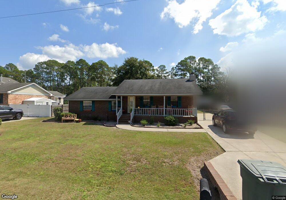
1012 Bacon Rd Hinesville, GA 31313
Estimated Value: $196,513 - $220,000
3
Beds
2
Baths
1,456
Sq Ft
$144/Sq Ft
Est. Value
About This Home
This home is located at 1012 Bacon Rd, Hinesville, GA 31313 and is currently estimated at $209,628, approximately $143 per square foot. 1012 Bacon Rd is a home located in Liberty County with nearby schools including Button Gwinnett Elementary School, Snelson-Golden Middle School, and Bradwell Institute.
Ownership History
Date
Name
Owned For
Owner Type
Purchase Details
Closed on
Nov 22, 2002
Sold by
Hardison Brian K and Hardison S
Bought by
Edwards Beverly
Current Estimated Value
Purchase Details
Closed on
Mar 29, 1996
Sold by
Arnold William
Bought by
Hardison Brian K and Hardison S
Purchase Details
Closed on
Aug 24, 1992
Bought by
Arnold William
Purchase Details
Closed on
Dec 27, 1989
Bought by
Caraviello Harold E and Caraviello Wanda D
Purchase Details
Closed on
Jul 10, 1985
Bought by
Nickerson Thomas E and Nickerson Phyllis P
Purchase Details
Closed on
Aug 20, 1984
Bought by
Liberty Home Builders Inc
Create a Home Valuation Report for This Property
The Home Valuation Report is an in-depth analysis detailing your home's value as well as a comparison with similar homes in the area
Home Values in the Area
Average Home Value in this Area
Purchase History
| Date | Buyer | Sale Price | Title Company |
|---|---|---|---|
| Edwards Beverly | $61,500 | -- | |
| Hardison Brian K | $72,900 | -- | |
| Arnold William | $63,700 | -- | |
| Caraviello Harold E | $64,200 | -- | |
| Nickerson Thomas E | $58,500 | -- | |
| Liberty Home Builders Inc | $9,000 | -- |
Source: Public Records
Tax History Compared to Growth
Tax History
| Year | Tax Paid | Tax Assessment Tax Assessment Total Assessment is a certain percentage of the fair market value that is determined by local assessors to be the total taxable value of land and additions on the property. | Land | Improvement |
|---|---|---|---|---|
| 2024 | $1,694 | $57,077 | $11,795 | $45,282 |
| 2023 | $1,694 | $57,077 | $12,000 | $45,077 |
| 2022 | $1,944 | $46,794 | $10,000 | $36,794 |
| 2021 | $1,666 | $38,825 | $8,800 | $30,025 |
| 2020 | $1,681 | $38,830 | $8,800 | $30,030 |
| 2019 | $1,688 | $39,245 | $8,800 | $30,445 |
| 2018 | $1,680 | $39,250 | $8,800 | $30,450 |
| 2017 | $1,306 | $39,665 | $8,800 | $30,865 |
| 2016 | $1,622 | $39,670 | $8,800 | $30,870 |
| 2015 | $1,644 | $39,670 | $8,800 | $30,870 |
| 2014 | $1,644 | $41,417 | $8,800 | $32,617 |
| 2013 | -- | $40,639 | $10,000 | $30,639 |
Source: Public Records
Map
Nearby Homes
- 1021 Bacon Rd
- 910 Brett Dr
- 130 Pointe Dr S
- 920 Greenbriar Rd
- 1015 White Cir
- 927 Charles C Frasier Blvd
- 648 Honey Ridge Ln
- 649 Honey Ridge Ln
- 985 Pineland Ave
- 700 Kadi Ln
- 940 Fox Haven Ct
- 234 Deerwood Dr
- 936 Pineland Ave
- 992 Pineland Ave
- 929 Pineland Ave
- 970 Whippoorwill Way
- 679 Mcdowell Rd
- 214 Whitetail Cir
- 661 Mahoney Rd
- 253 Glenn Bryant Rd
- 1010 Bacon Rd
- 1014 Bacon Rd
- 1016 Bacon Rd
- 1011 Bacon Rd
- 1009 Bacon Rd
- 1013 Bacon Rd
- 1007 Bacon Rd
- 1006 Bacon Rd Unit n/a
- 1006 Bacon Rd
- 1018 Bacon Rd
- 1015 Bacon Rd
- 907 Brett Dr Unit C
- 907 Brett Dr Unit A
- 907 Brett Dr Unit E
- 907 Brett Dr Unit 907 B
- 907 Brett Dr Unit A
- 907 Brett Dr Unit B
- 907 Brett Dr
- 907 Brett Dr Unit C
- 1005 Bacon Rd