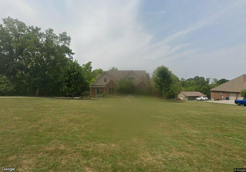
1012 Bunker Hill Dr Lawrenceburg, KY 40342
Estimated Value: $343,000 - $641,884
--
Bed
--
Bath
2,281
Sq Ft
$216/Sq Ft
Est. Value
About This Home
This home is located at 1012 Bunker Hill Dr, Lawrenceburg, KY 40342 and is currently estimated at $491,971, approximately $215 per square foot. 1012 Bunker Hill Dr is a home with nearby schools including Saffell Street Elementary School, Anderson County Middle School, and Anderson County High School.
Ownership History
Date
Name
Owned For
Owner Type
Purchase Details
Closed on
Dec 28, 2016
Sold by
Morgan Joshua and Morgan Gina
Bought by
Hatfield Lucas E and Hatfield Nicole C
Current Estimated Value
Home Financials for this Owner
Home Financials are based on the most recent Mortgage that was taken out on this home.
Original Mortgage
$346,750
Outstanding Balance
$285,427
Interest Rate
4.08%
Mortgage Type
New Conventional
Estimated Equity
$206,544
Purchase Details
Closed on
Jan 27, 2014
Sold by
Joshua Joshua and Morgan Gina
Bought by
Smith Thomas H and Smith Gayle
Create a Home Valuation Report for This Property
The Home Valuation Report is an in-depth analysis detailing your home's value as well as a comparison with similar homes in the area
Home Values in the Area
Average Home Value in this Area
Purchase History
| Date | Buyer | Sale Price | Title Company |
|---|---|---|---|
| Hatfield Lucas E | $365,000 | None Available | |
| Smith Thomas H | $50,000 | -- |
Source: Public Records
Mortgage History
| Date | Status | Borrower | Loan Amount |
|---|---|---|---|
| Open | Hatfield Lucas E | $346,750 |
Source: Public Records
Tax History Compared to Growth
Tax History
| Year | Tax Paid | Tax Assessment Tax Assessment Total Assessment is a certain percentage of the fair market value that is determined by local assessors to be the total taxable value of land and additions on the property. | Land | Improvement |
|---|---|---|---|---|
| 2024 | $3,962 | $0 | $0 | $0 |
| 2023 | $3,807 | $0 | $0 | $0 |
| 2022 | $3,887 | $0 | $0 | $0 |
| 2021 | $3,979 | $0 | $0 | $0 |
| 2020 | $4,073 | $0 | $0 | $0 |
| 2019 | $4,135 | $365,000 | $50,000 | $315,000 |
| 2018 | $4,098 | $365,000 | $50,000 | $315,000 |
| 2017 | $3,978 | $365,000 | $50,000 | $315,000 |
| 2016 | $2,862 | $270,000 | $50,000 | $220,000 |
| 2015 | $2,795 | $270,000 | $50,000 | $220,000 |
| 2014 | $516 | $50,000 | $50,000 | $0 |
| 2013 | $549 | $54,000 | $54,000 | $0 |
Source: Public Records
Map
Nearby Homes
- 1022 Forest Hill Dr
- 111 Carlton Dr
- 551 S Main St
- 121 Plantation Dr
- 129 Plantation Dr
- 14 Coleman Dr
- 538 Lincoln St
- 540 Lincoln St
- 502 S Main St
- 507 E Court St
- 1013 Silver Leaf Dr
- 1060 Butler Dr
- 1408 Harrodsburg Rd
- 207 S Gatewood St
- 101 Carlton Dr Unit 115
- 1313 Bonnie Blue Loop
- 324 Highland Ave
- 2020 Thorntree Ln
- 3017 Briar Creek Rd
- 249 1/2 E Court St
- 1008 Bunker Hill Dr
- 1006 Bunker Hill Dr
- 1009 Bunker Hill Dr
- 1002 Bunker Hill Dr
- 1011 Bunker Hill Dr
- 1003 Bunker Hill Dr
- 1001 Bunker Hill Dr
- 1007 Bunker Hill Dr
- 0 Bunker Hill Dr
- 1000 Bunker Hill Dr
- 32 Bunker Hill Dr
- 1004 Bunker Hill Dr
- 1005 Bunker Hill Dr
- 1013 Bunker Hill Dr
- 7 Forest Hill Dr
- 1024 Forrest Hill Dr
- 1008 Forrest Hill Dr
- 1013 Forrest Hill Dr
- 1006 Forrest Hill Dr
- 1010 Forrest Hill Dr